

मुझे मेरी सफलताओं से न आंकों, मुझे मापो मेरे प्रयासों से
बेशक शोहरते काबिल है वो जो चढ़ गया हिमालय आसानी से
पर जो तूफानी रात से लड़ कर हारा, एक पंक्ति तो प्रेरित हो उसके भी विश्वासों से
जीते जिन्होंने पदक, नाम सिर्फ़ वही याद रखे दुनिया ने
पर जो पदक की उम्मीद बिना भागा, सीखो कुछ उनके भी एहसासों से
मैं हारी जरूर हूँ, पर हताश नहीं हूं मैं
मैंने तो बस यही सुना, अपनी थकी हुईं सांसों से
मुझे मेरी सफलताओं से न आंकों, मुझे मापो मेरे प्रयासों से
Rough Translation:
Do not measure me by my successes, judge me by my efforts.
Sure, the one who scaled Everest with ease deserves the fame,
But the one who battled a stormy night and fell short – let at least one line be inspired by his flame.
The world remembers only those who won medals and stood tall
But learn from the one who ran without hope of reward, yet gave it his all.
Yes, I may have stumbled, but I did not despair,
For I heard a voice in my breathless fight – “You still dare”
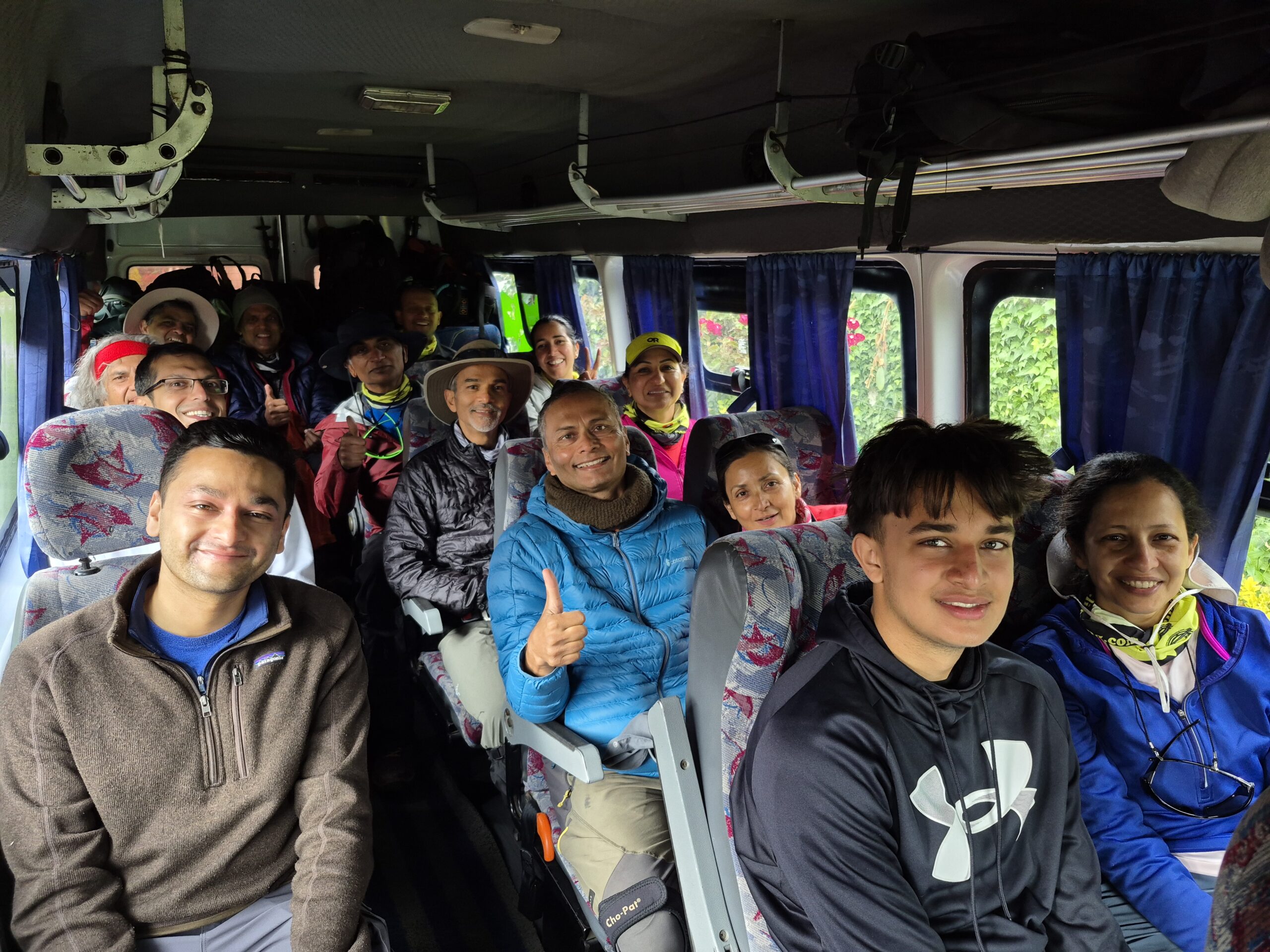
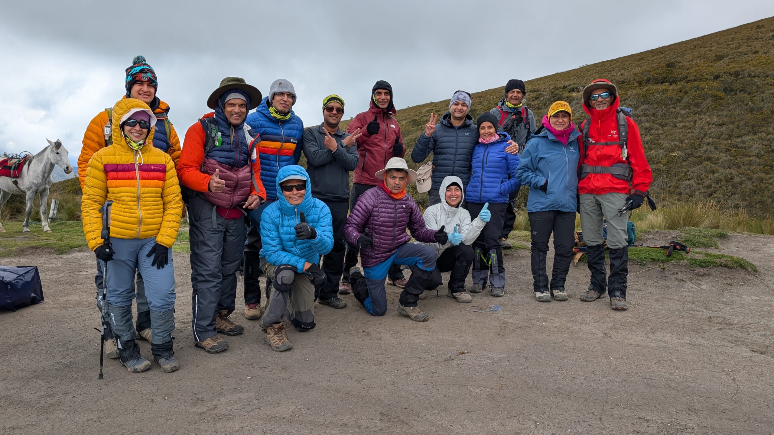
This is a photo blog of my Ecuador trip where we ambitiously attempted to climb 6 peaks in just 13 days. As you can probably guess from the poem I wrote above, we were not really successful in our mission. We did give it our best shot though.
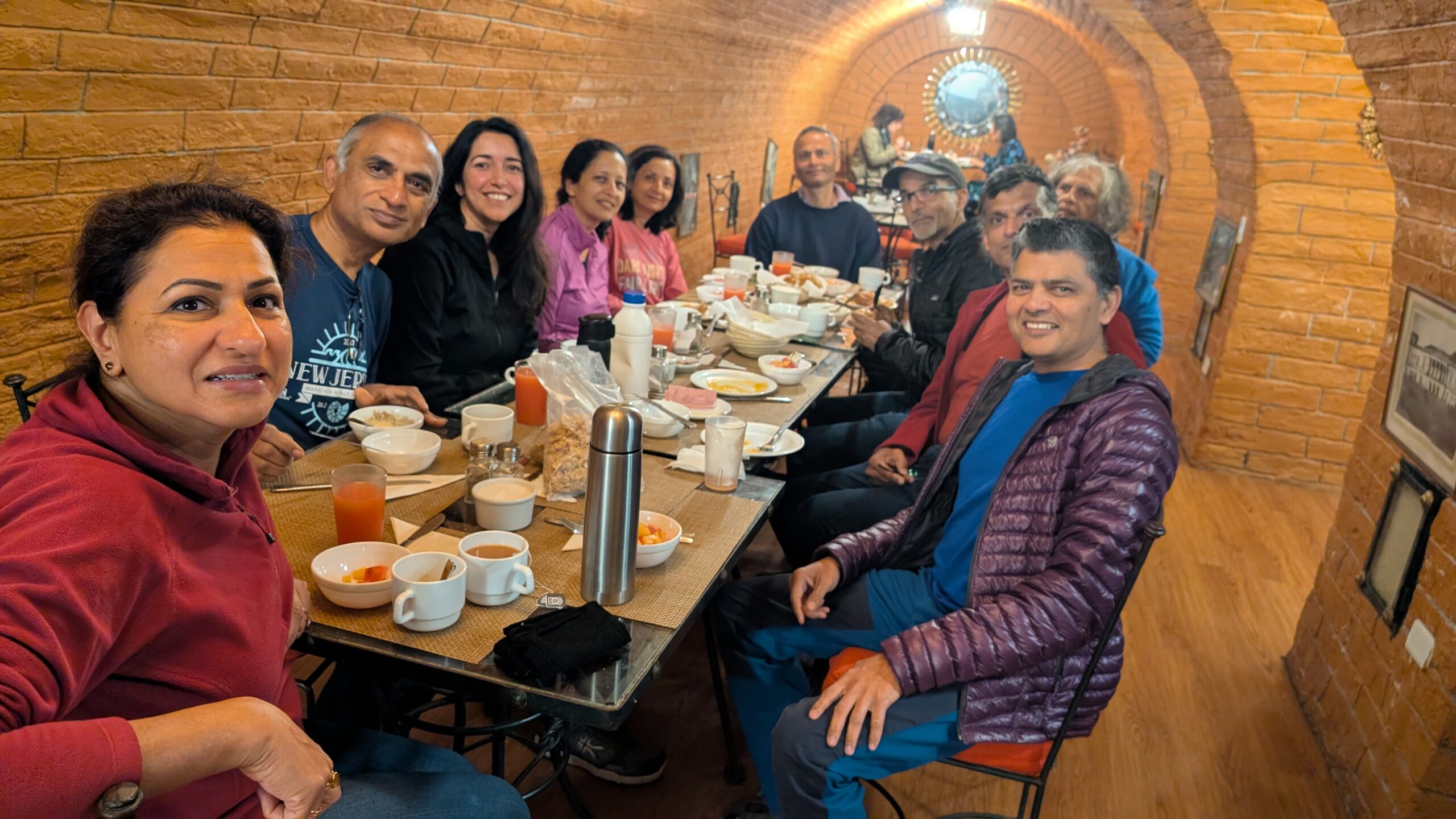
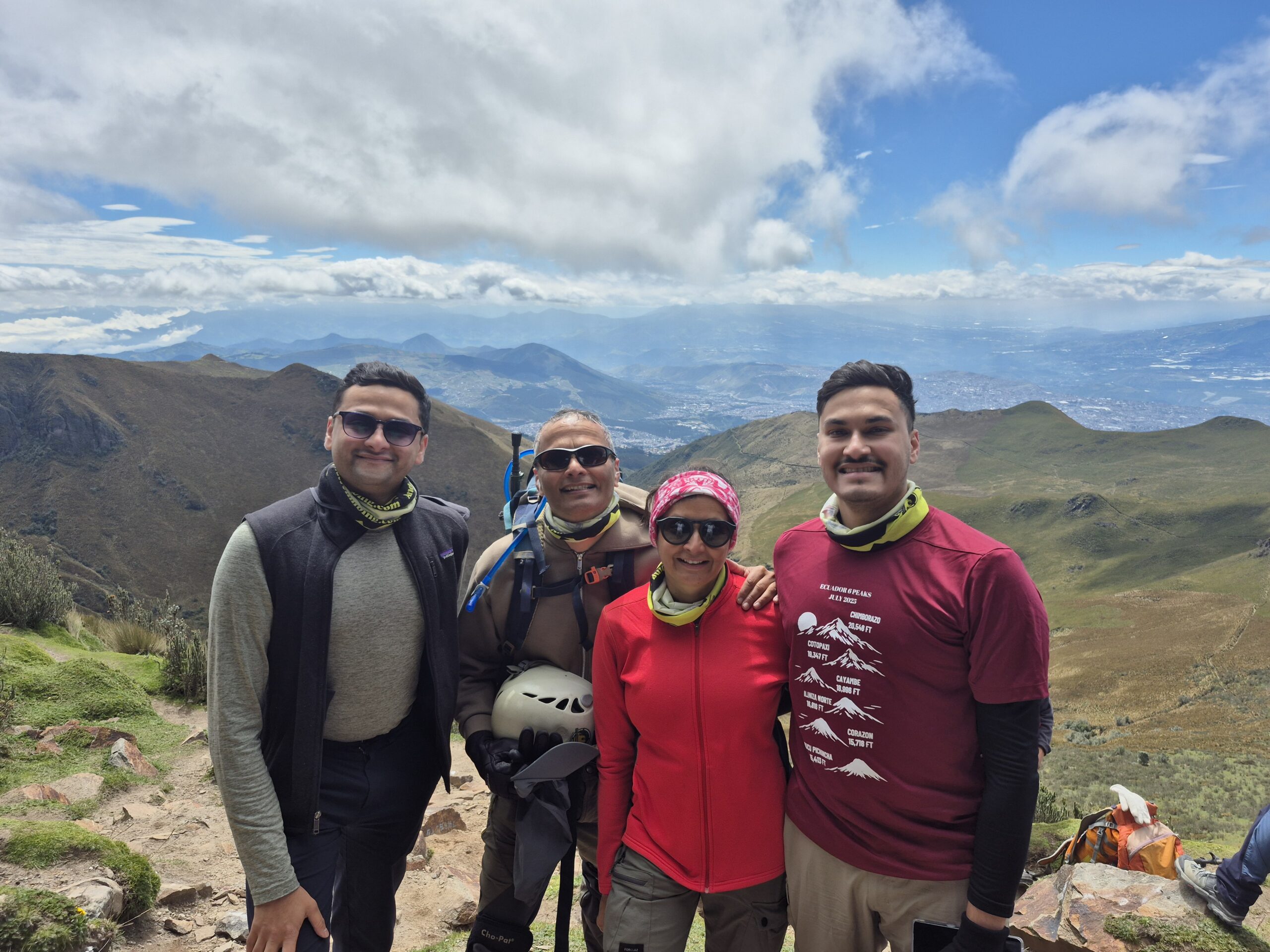
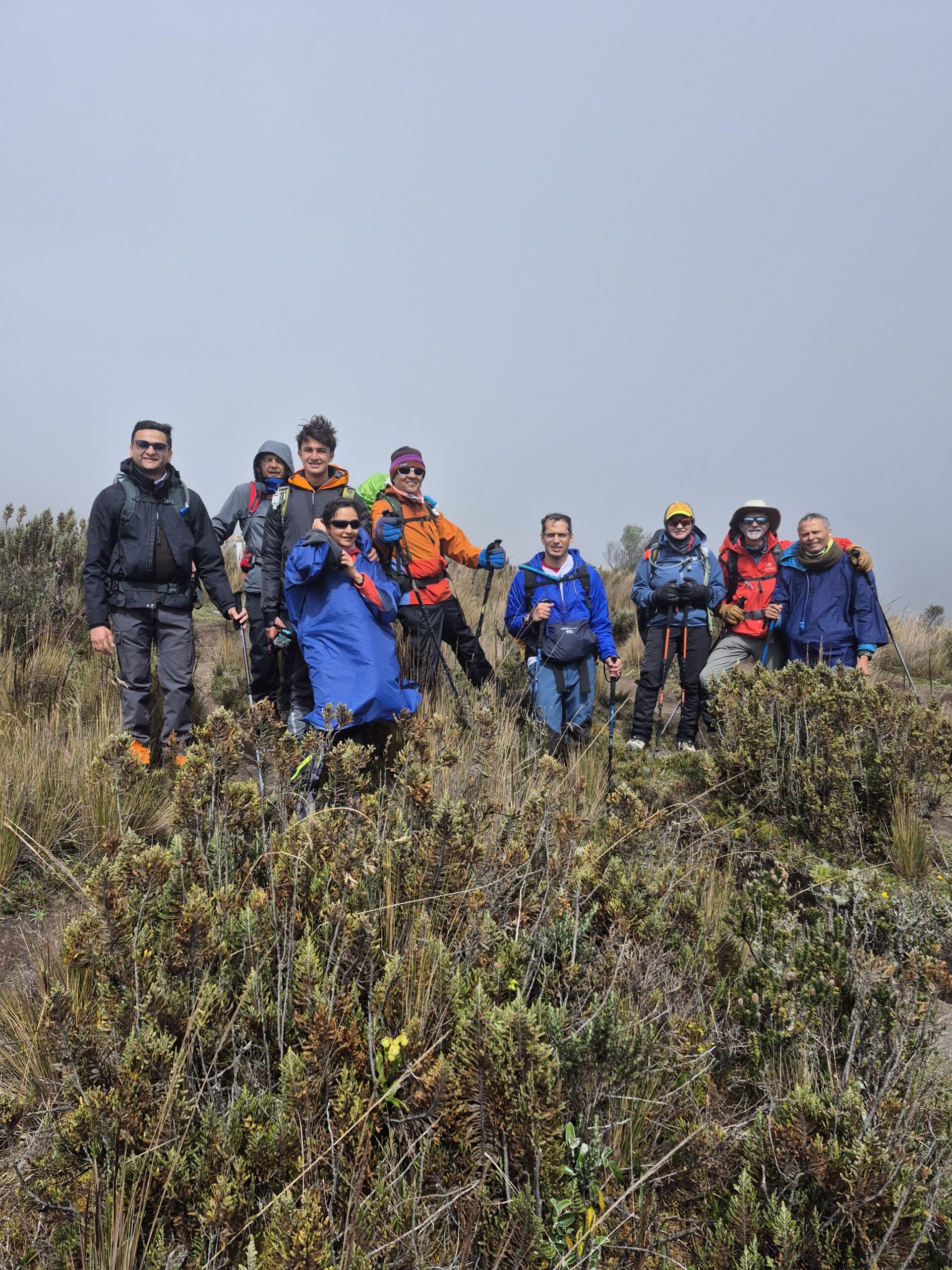
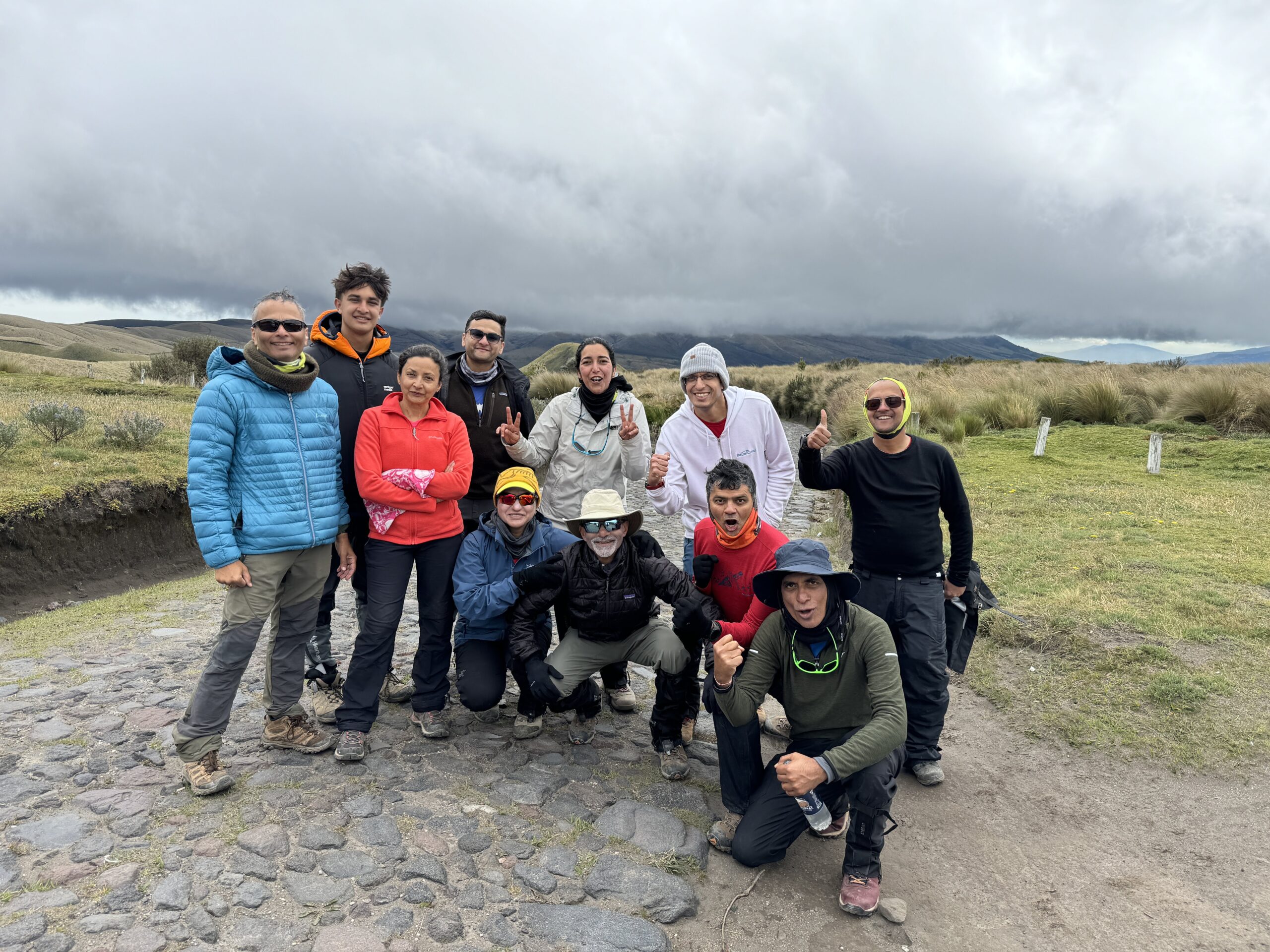
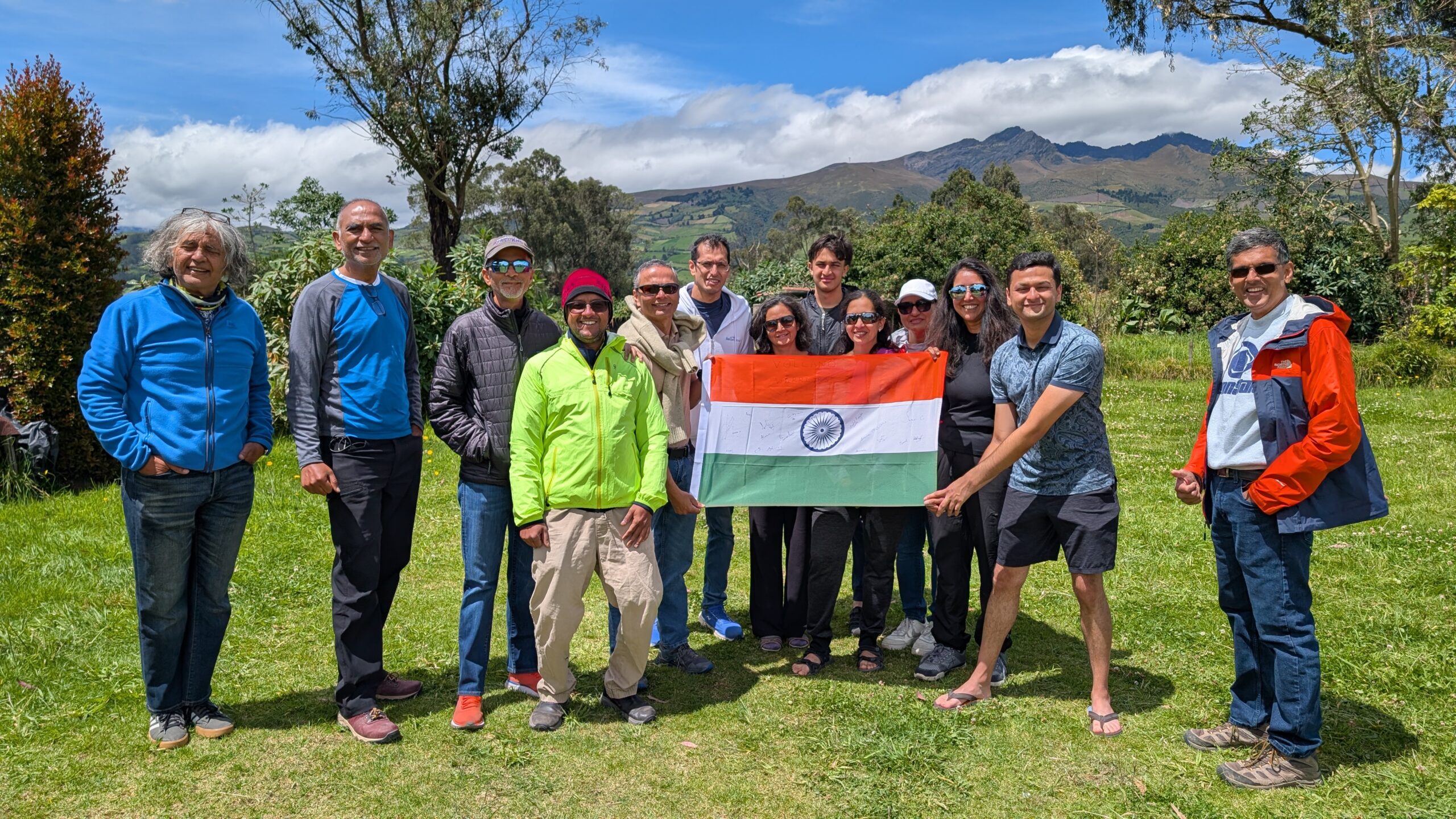
There were 15 of us in the group. Meet the team Volcano Warriors:
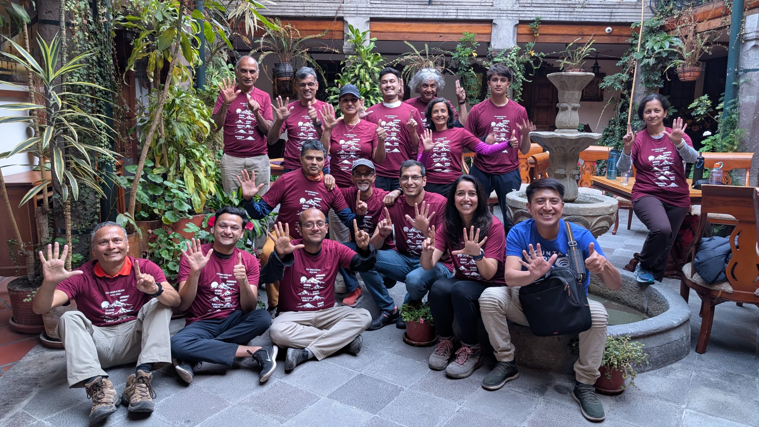
From left to right (standing): Sri, Sushil, Priti, Sahil, Gautam, Anu, Neel, and Meenal
We are all wearing our custom T-shirts designed by Neel and printed by Divya. We are holding up six fingers to represent the six peaks we planned to climb.
Let me introduce them:
- Samir Palnitkar (Pune, India): My best friend who is more like family to me. We have done a number of treks together and we have been co-founders for three different startups. Samir took the lead in organizing this trip and did everything to make it smooth for all of us.
- Aditya Palnitkar (Washington DC): Samir’s elder son. He is very level-headed, motivated and always ready to help. I have a truly special affection for him 🙂
- Jai Rawat (Bay Area, CA): That’s me! I was still recovering from my left ankle surgery earlier in the year and didn’t really get a chance to train for this trek.
- Ashutosh Chauhan (Bay Area, CA): One of the most disciplined guys I have met – from training to execution. He and Nidhi are both avid hikers. They have two little kids at home but still manage to maintain this active lifestyle.
- Arun Kumar (Seattle, WA): Fit as a fiddle. We have done several treks together over the years. He is getting fitter with every passing year! There’s always something to learn when you spend time with him.
- Sagar Chivate (Washington DC): This was my second time trekking with Sagar. Quietly determined with the ability to slip in some really funny comments. Great company.
- Divya Yerraguntla (Bay Area, CA): We are on the board of IITK Foundation together currently but this was the first time we trekked together. She finds a way to stay positive regardless of the situation – uplifting everyone around her. She is also an amazing singer.
- Diego (Ecuador): He was our trek organizer who took care of all the logistics including booking the stays, getting the permits, finding the guides and renting the equipment. Unfortunately we had a poor experience with his organization (Andes Climbing) and I would not recommend going with them.
- Srikanth Nandyala (Bay Area, CA): Truly one of the nicest human beings I have met. Always eager to help everyone and also has the uncanny ability to find humor in every situation.
- Sushil Ranjan (North Carolina): Great mental strength and physical stamina. Claims to follow a healthy, vegan diet but seems to be dislike to all sorts of fruits and vegetables. He ate mostly non-veg during the trip!
- Priti Gairola (Seattle, WA): Arun’s better half. This was my second time trekking with her. She is a no-nonsense, mentally strong person. Looking forward to many more treks with her.
- Sahil Palnitkar (Dallas, TX): Samir’s younger son. He was still recovering from his ACL surgery and had to abandon the trek after the first climb. I missed him dearly as we get along really well.
- Gautam Vasisht (Los Angeles, CA): Like a true astrophysicist, he seemed to be in his own world most of the time :). However, he was definitely one of the strongest hikers in the group.
- Anu Palnitkar (Pune, India): Samir’s better half who is like a little sister to me. Never a dull moment around her – always fighting with me 🙂 She tackles steep slopes with ease, walking with folded hands!
- Neel Patwardhan (Washington DC): Youngest member of the group. He had fractured his right wrist recently and his cast came out the day before his flight! Amazing that he could do some of the climbs which were hard for even fully abled adults.
- Meenal Patwardhan (Washington DC): She is grittiness personified. Never complaining or demanding – just doing whatever it takes to complete the trek. Her gentle demeanor beguiles her internal strength.
Trek Overview
We signed up with Andes Climbing for our trek. They had great reviews and were also reasonably priced. Unfortunately, our experience with them was absolutely terrible, and I would NOT recommend them. Our planned itinerary was as follows:
- Acclimatization days (June 26-28): Acclimatize in Quito which is at 9,350ft
- Day 1 (June 29): Summit Rucu Pichincha (15,413 ft)
- Day 2 (June 30): Summit Corazon (15,720 ft)
- Day 3 (July 1): Climb to Nuevos Horizontes Hut (15,583 ft)
- Day 4 (July 2): Summit Illiniza Norte (16,818 ft)
- Day 5 (July 3): Rest day
- Day 6 (July 4): Climb to Cotopaxi refuge (15,958 ft)
- Day 7 (July 5): Summit Cotopaxi (19,347 ft)
- Day 8 (July 6): Rest day
- Day 9 (July 7): Climb to Cayambe Refuge (15,092 ft)
- Day 10 (July 8): Summit Cayambe (18,996 ft)
- Day 11 (July 9): Rest day
- Day 12 (July 10): Chimborazo high camp (17,552 ft)
- Day 13 (July 11): Summit Chimborazo (20,702 ft)
It was definitely an ambitious plan but with many years of hiking and climbing experience under our belt, we felt that we were ready for this challenge.
Preparation
I had been battling a painful left ankle for several years. Finally I decided to get a surgery done in January of this year (2025). The podiatrist who did the surgery promised a full recovery in 6-8 weeks. However, 5 months later I still had swelling and residual pain. That meant that instead of the usual 2-3 months of rigorous training, I did some moderate training for 2-3 weeks before the trek. I was also wearing an ankle brace the entire time to protect the ankle.
I was hoping that I would be able to pull through but I was proven wrong. For the first time ever, I was not able to summit. Poor weather and bad, unhelpful guides were also a factor but I believe that my lack of preparation was also a significant factor in my failure to summit.
June 26-28: Acclimatization and sight seeing in Quito
For any high altitude trek, proper acclimatization is critical. Quito, our starting point, is located at 9,350 ft. We decided to arrive three days prior to the start of the trek to make sure that our bodies had enough time to adjust to the high altitude.
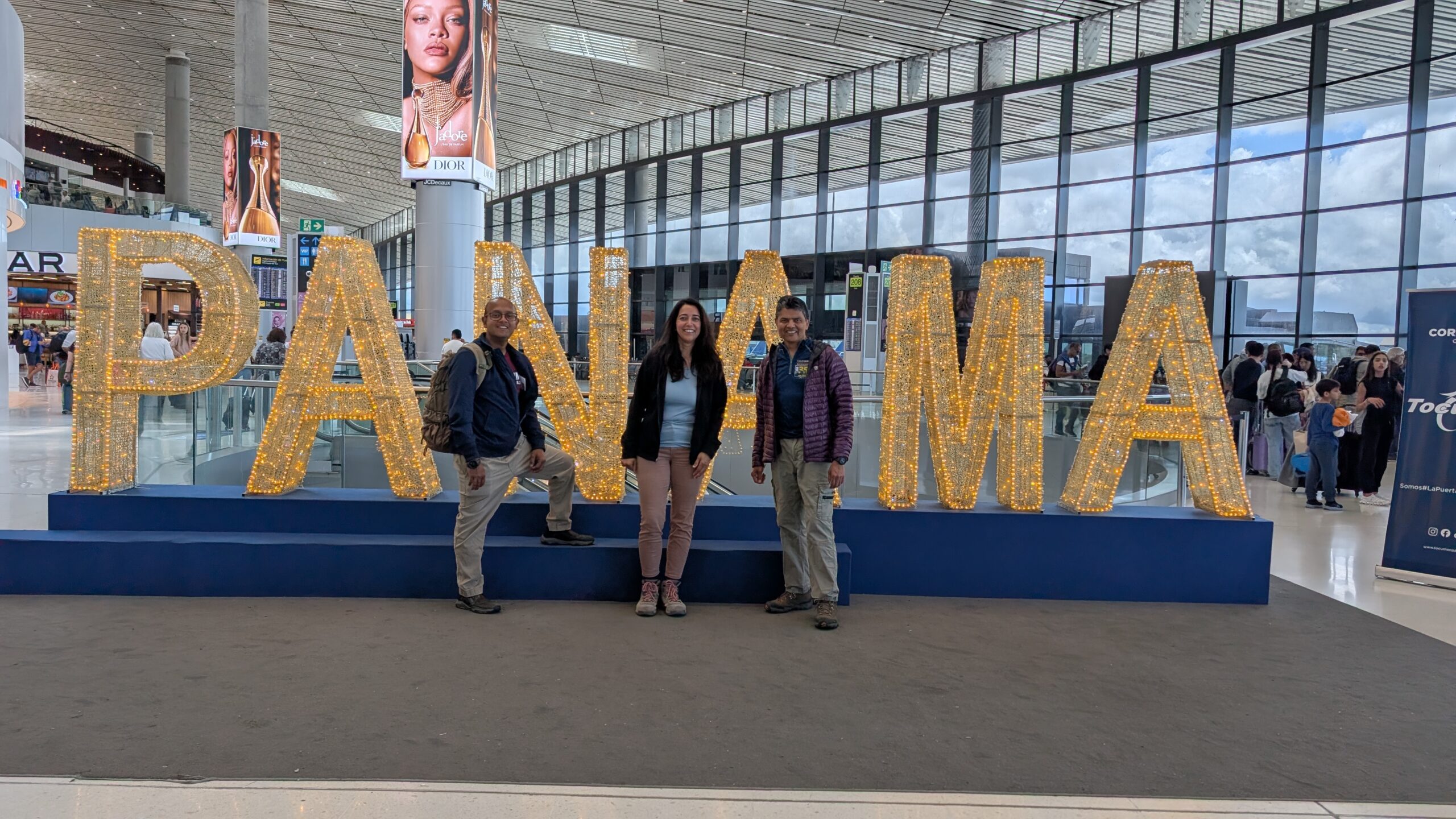
We were all arriving from different parts of the country on different flights. Divya, Ashutosh and I were on the same flight from SFO.
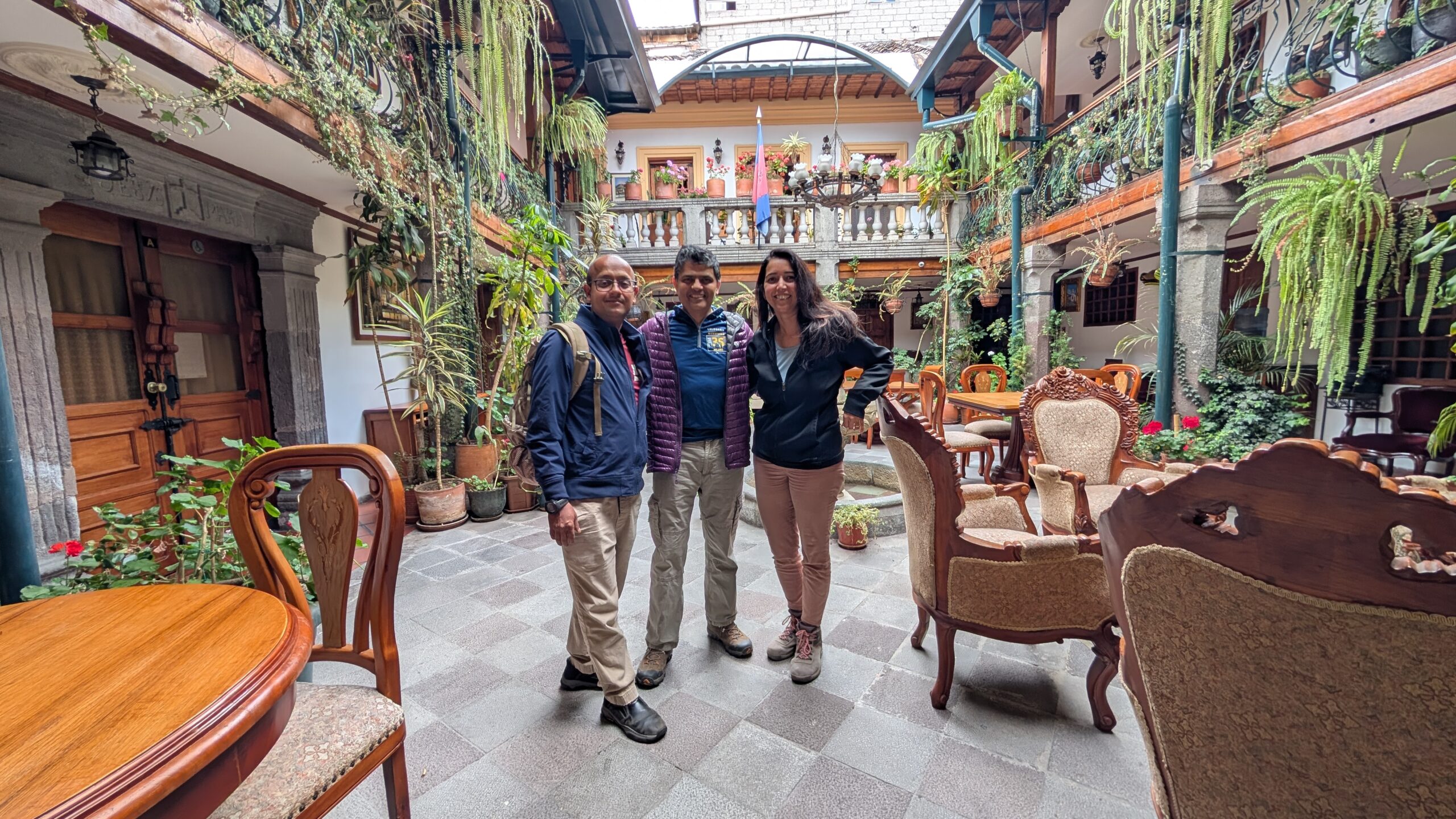
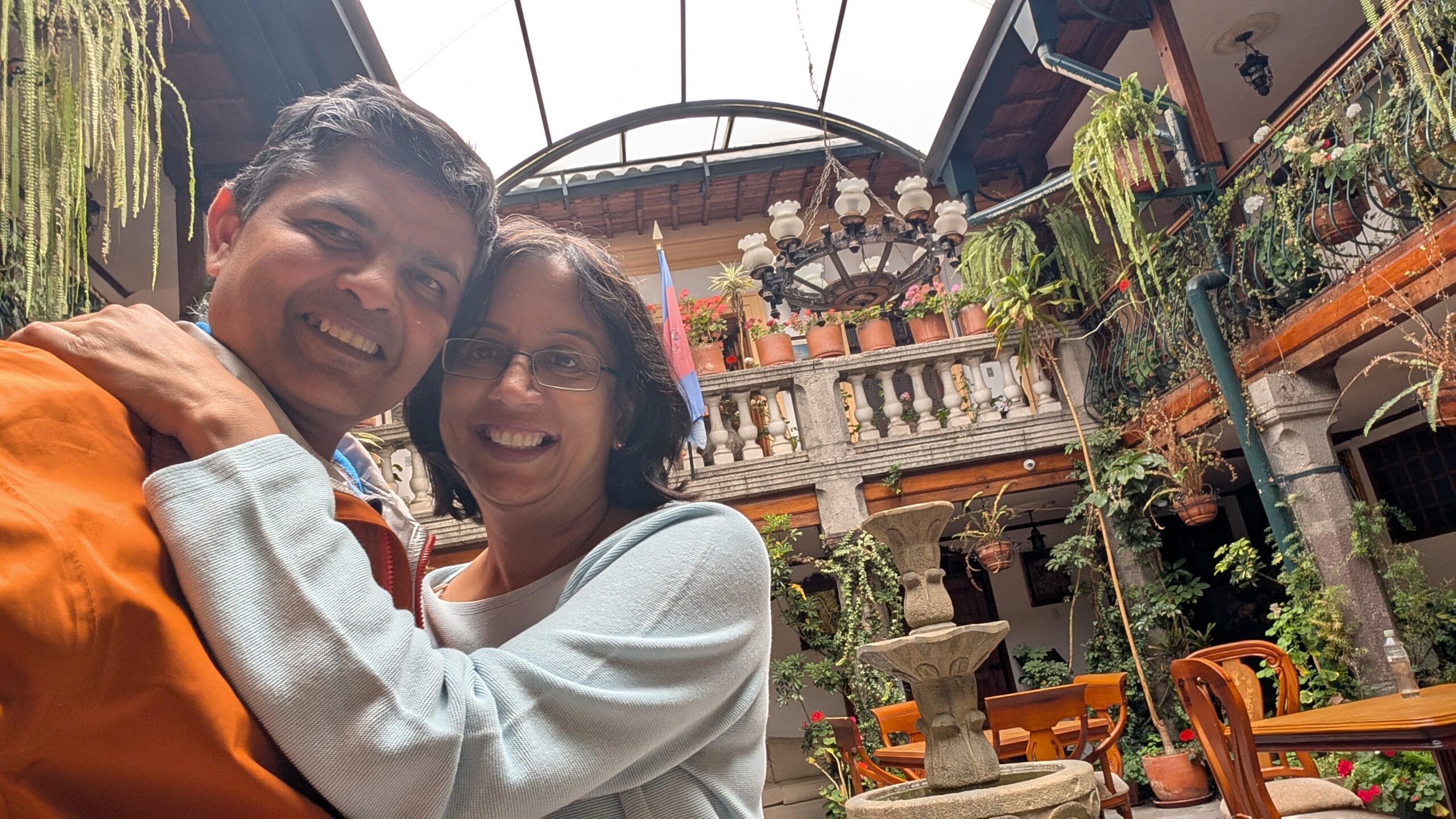
Our hotel was in the heart of the old city. The hotel itself is claimed to the 5th oldest building in Quito, built in 1690. Rooms were a bit dated but clean. The hotel decor was very pretty.
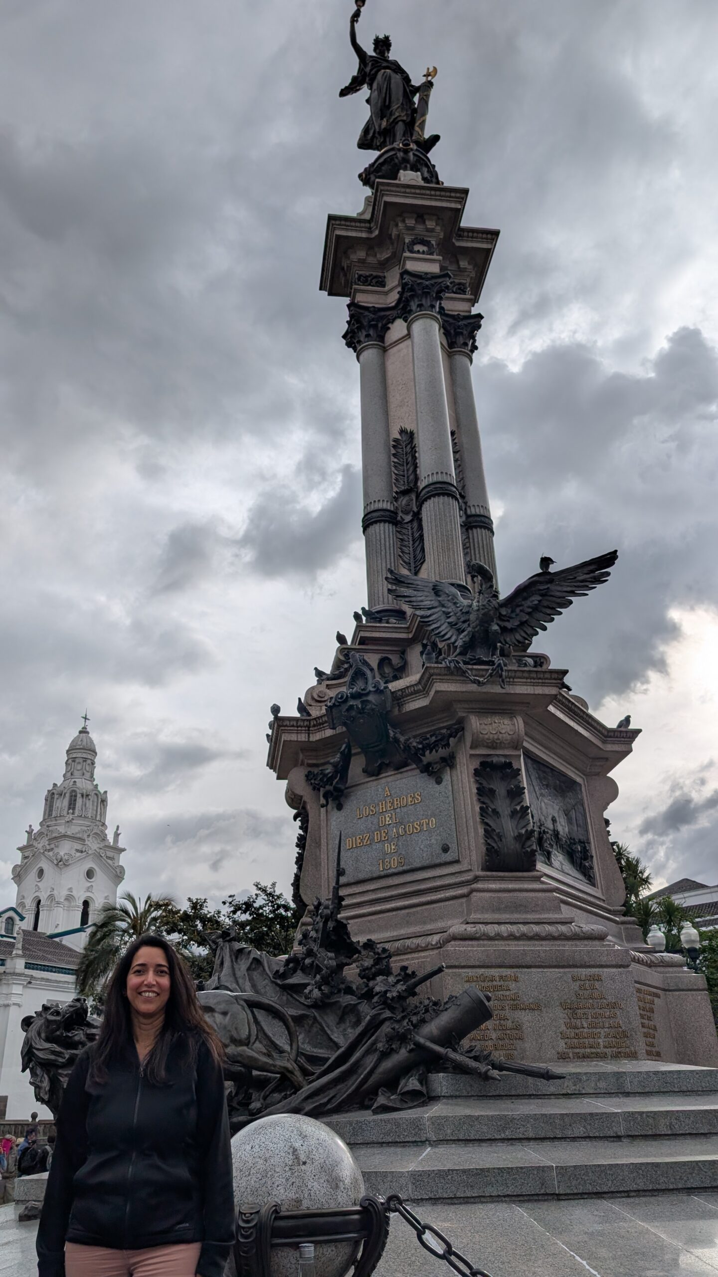
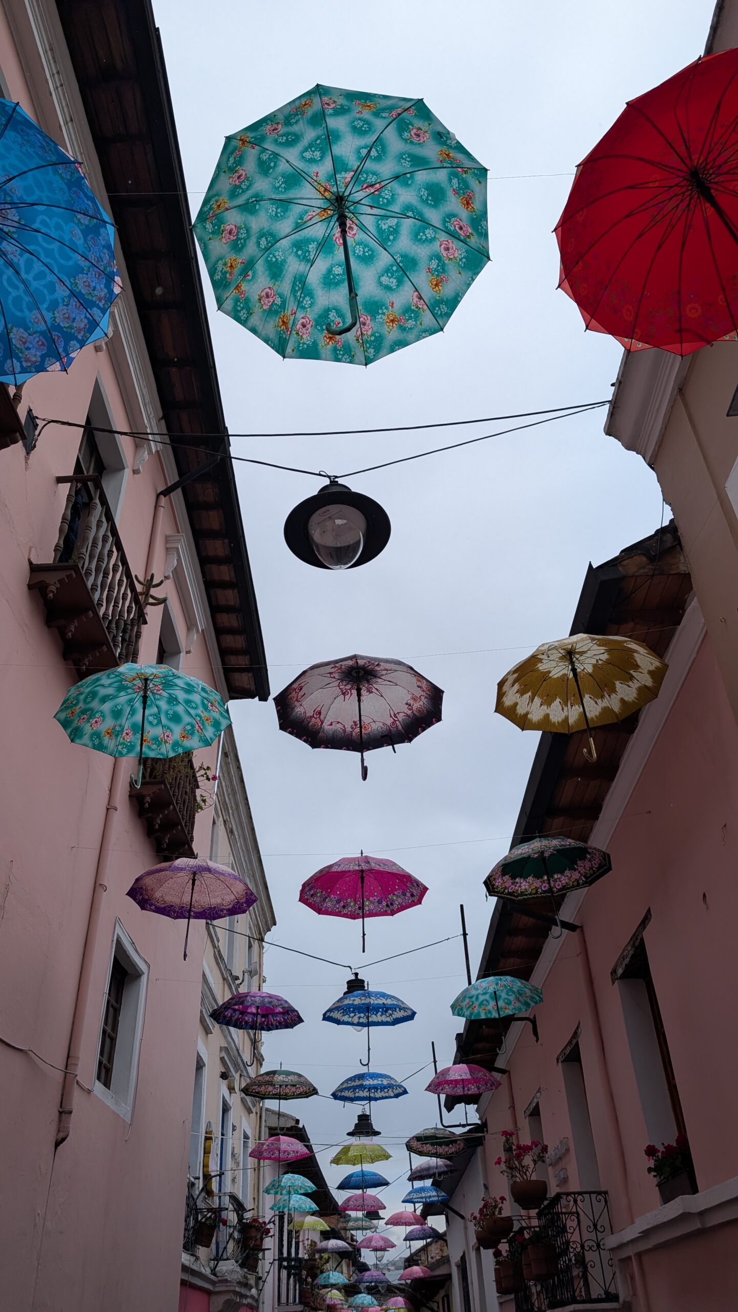
Since we had 2.5 days in Quito, we decided to use the time for some sightseeing. Quito is the capital city of Ecuador. It is located just south of the equator. It was the first city in the world to be declared as a UNESCO World Heritage Site in 1978.
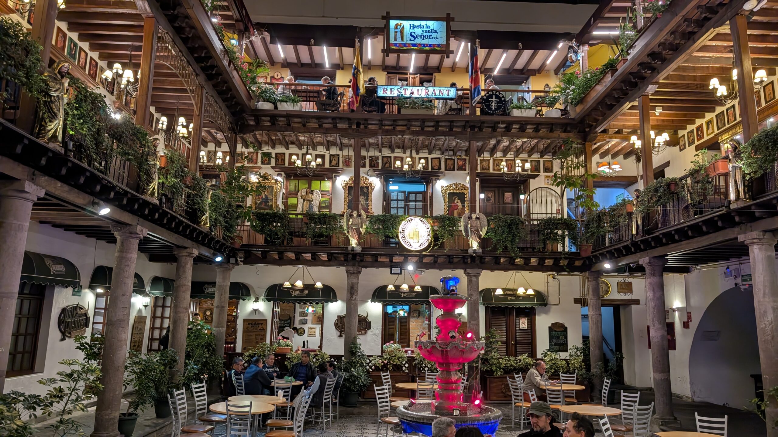
We had dinner in the Palacio Arzobispal at the famous “Hasta La Vuelta Señor” restaurant. The name comes from a local legend about a priest who was sent away in disgrace and said ““Hasta La Vuelta Señor” (Until I return, Lord) as he left. The restaurant serves local dishes in a nice setting. We tried the potato soup and empanadas which were quite good.
fsa
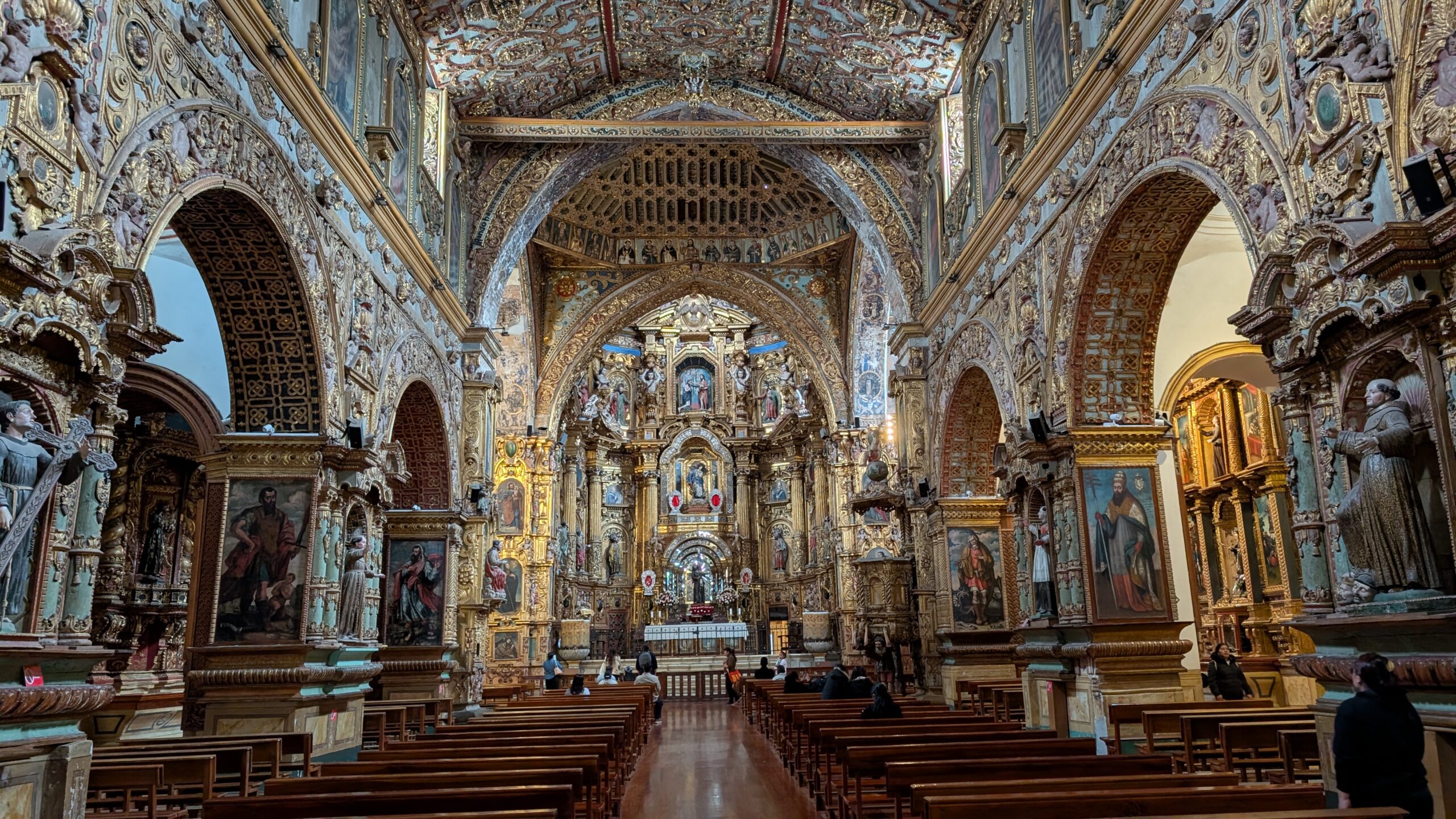
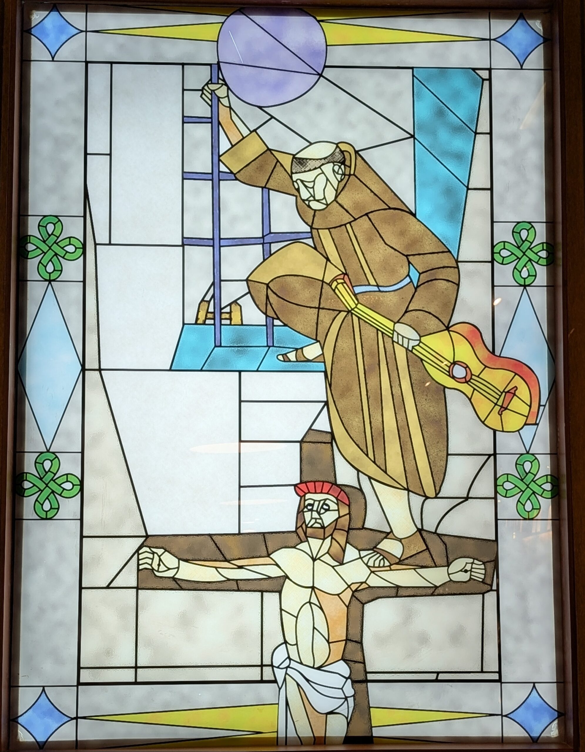
This basilica (and many other monuments in Quito) exhibits a blend of European techniques and Indigenous craftsmanship. Indigenous artists incorporated many local motifs such as plants, native birds, faces etc., these were often hidden or camouflaged as Christian iconography. It was very interesting to discover some of these with the help of our guide.
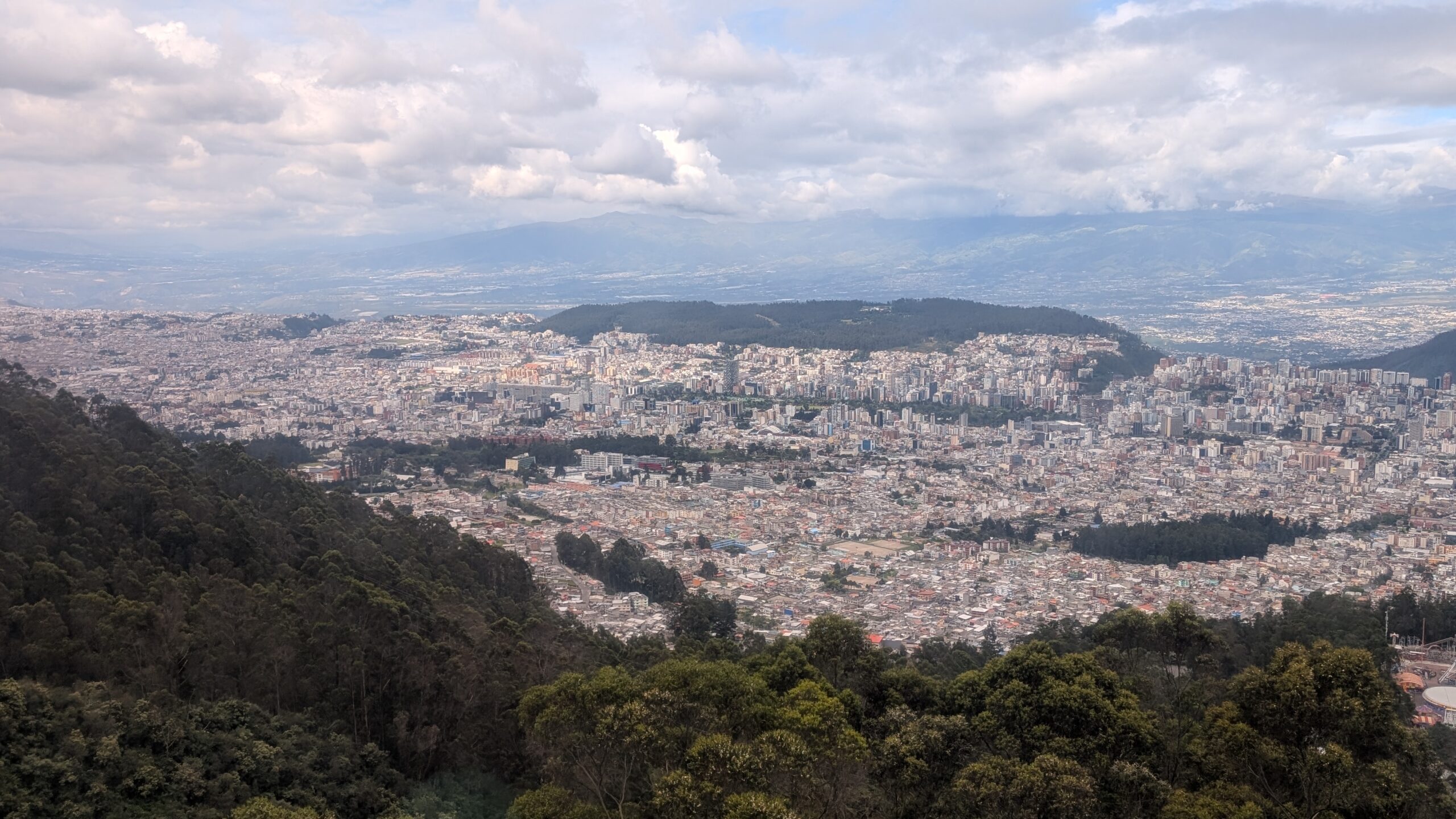
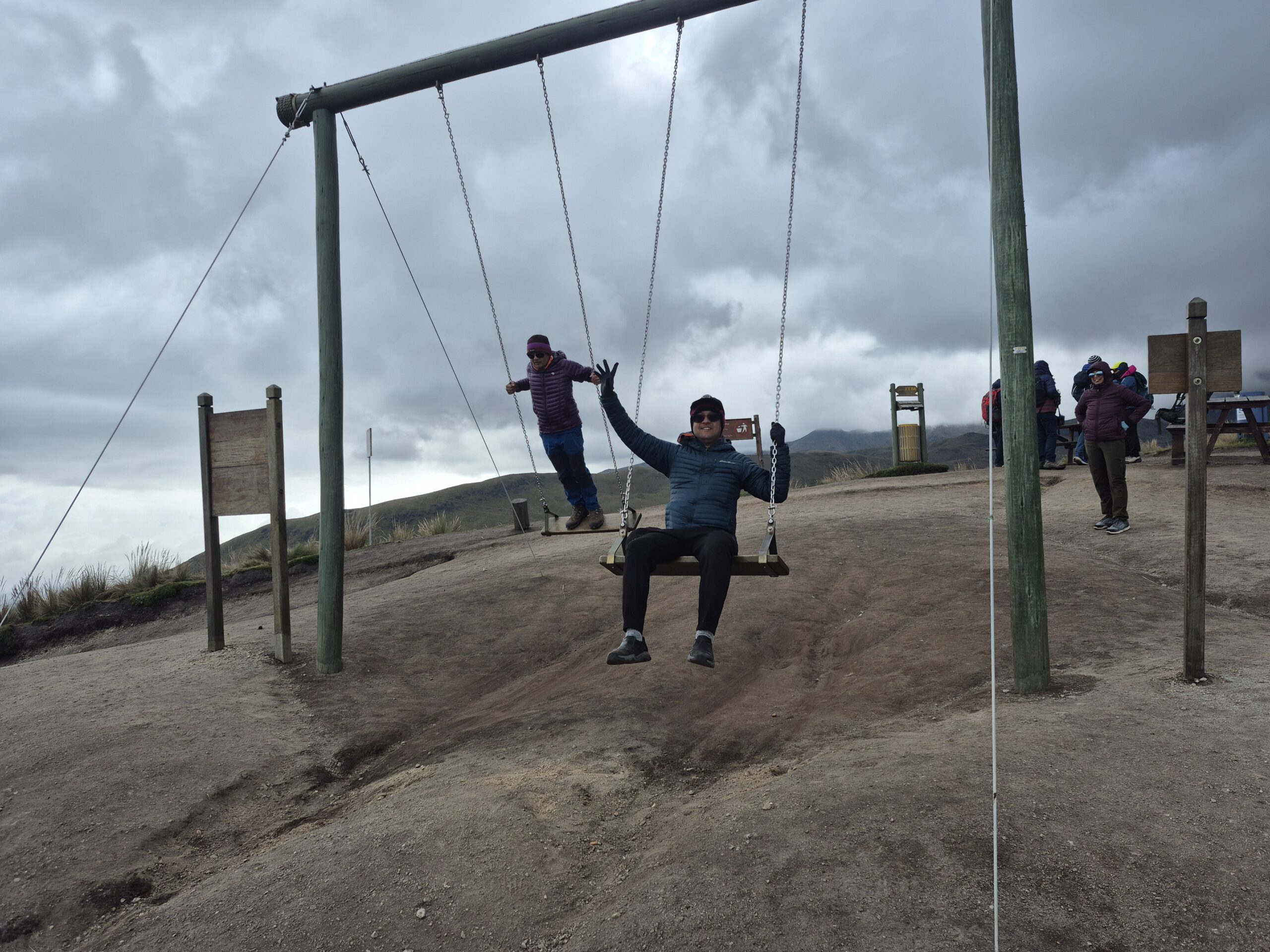
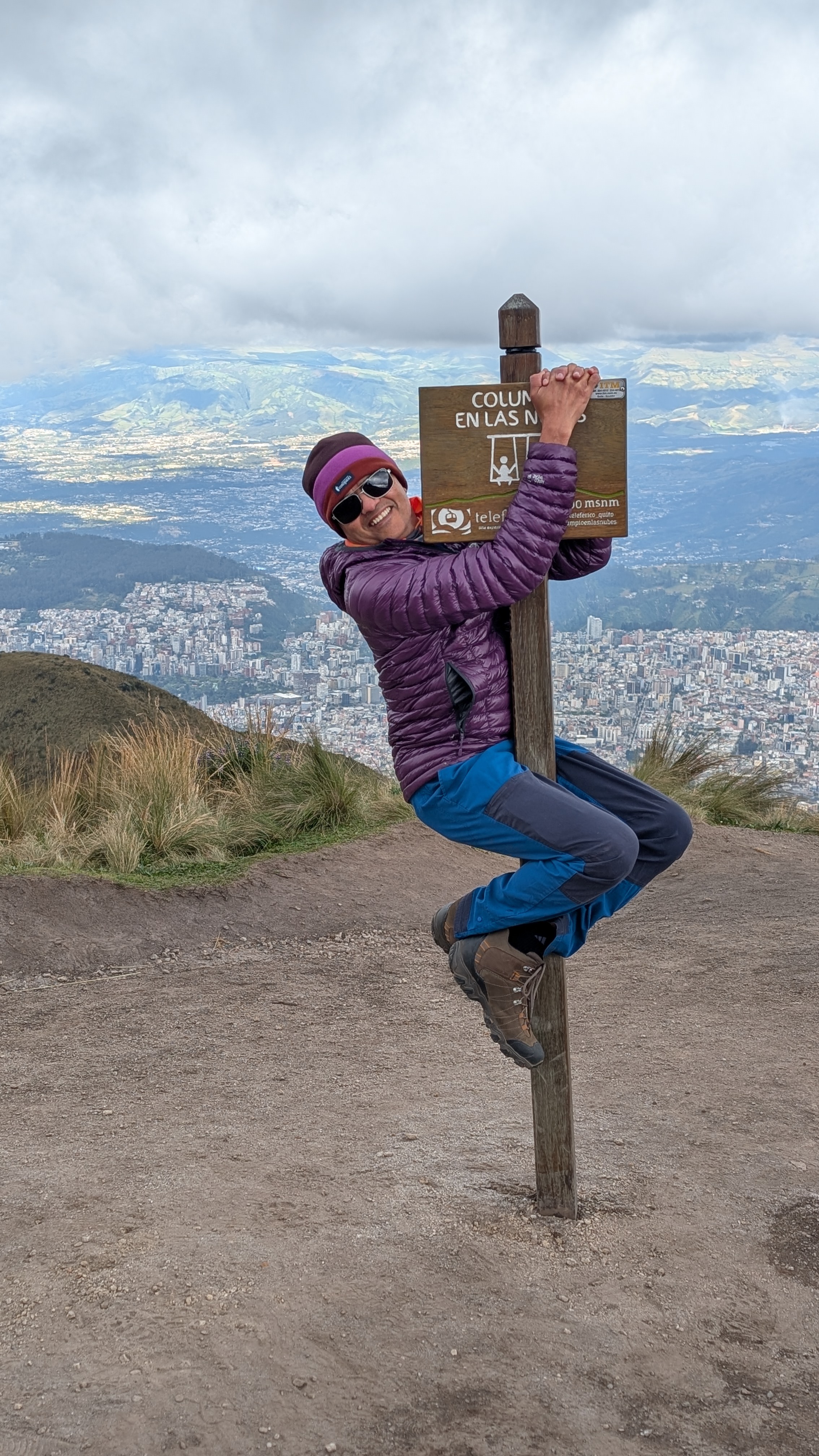
Cruz Loma is not only a popular tourist destination, for us it also served as an acclimatization day. We climbed another 200 ft, enjoyed the swings and spent a few hours at a high altitude.
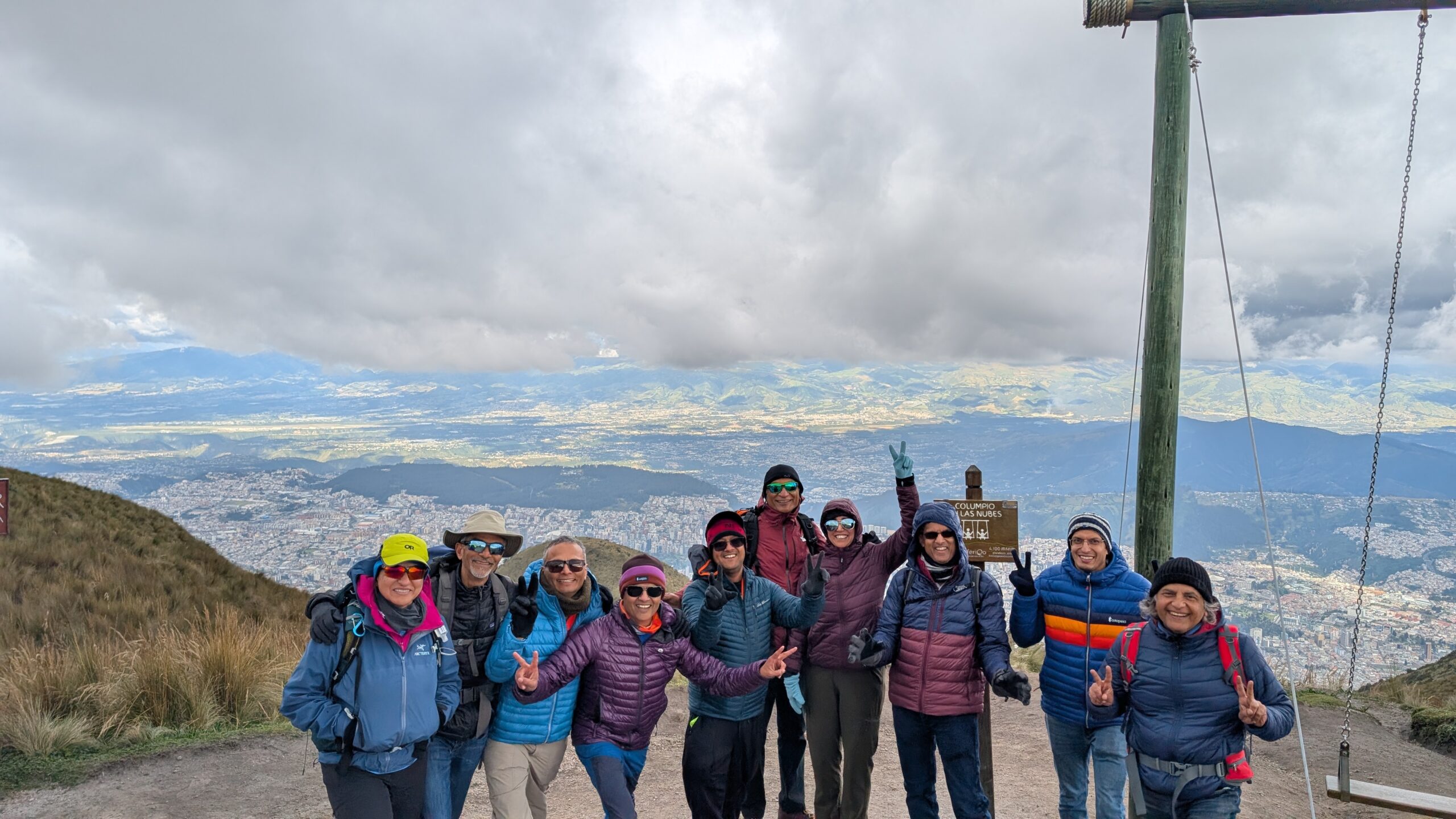
At 13,500 ft, for some people in the group, it was already their highest altitude. Fortunately everyone was feeling fine so far.
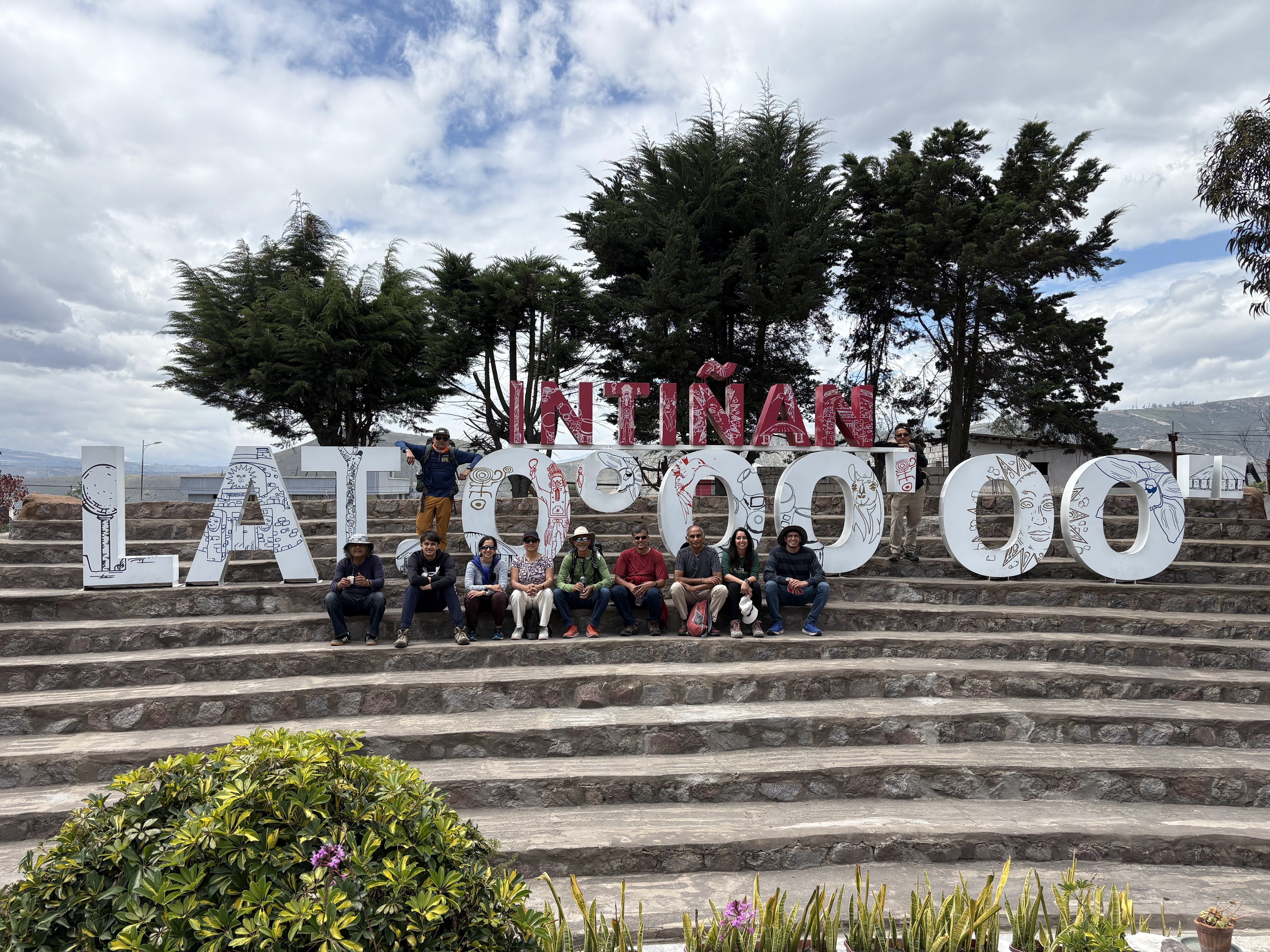
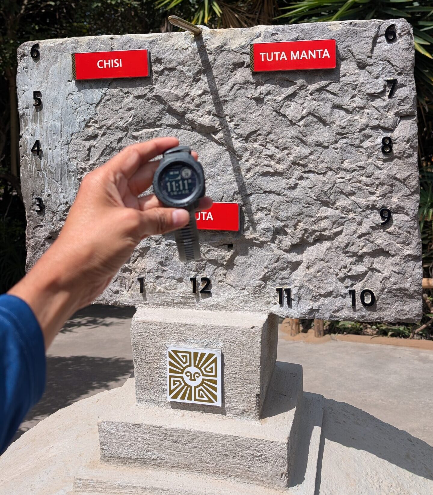
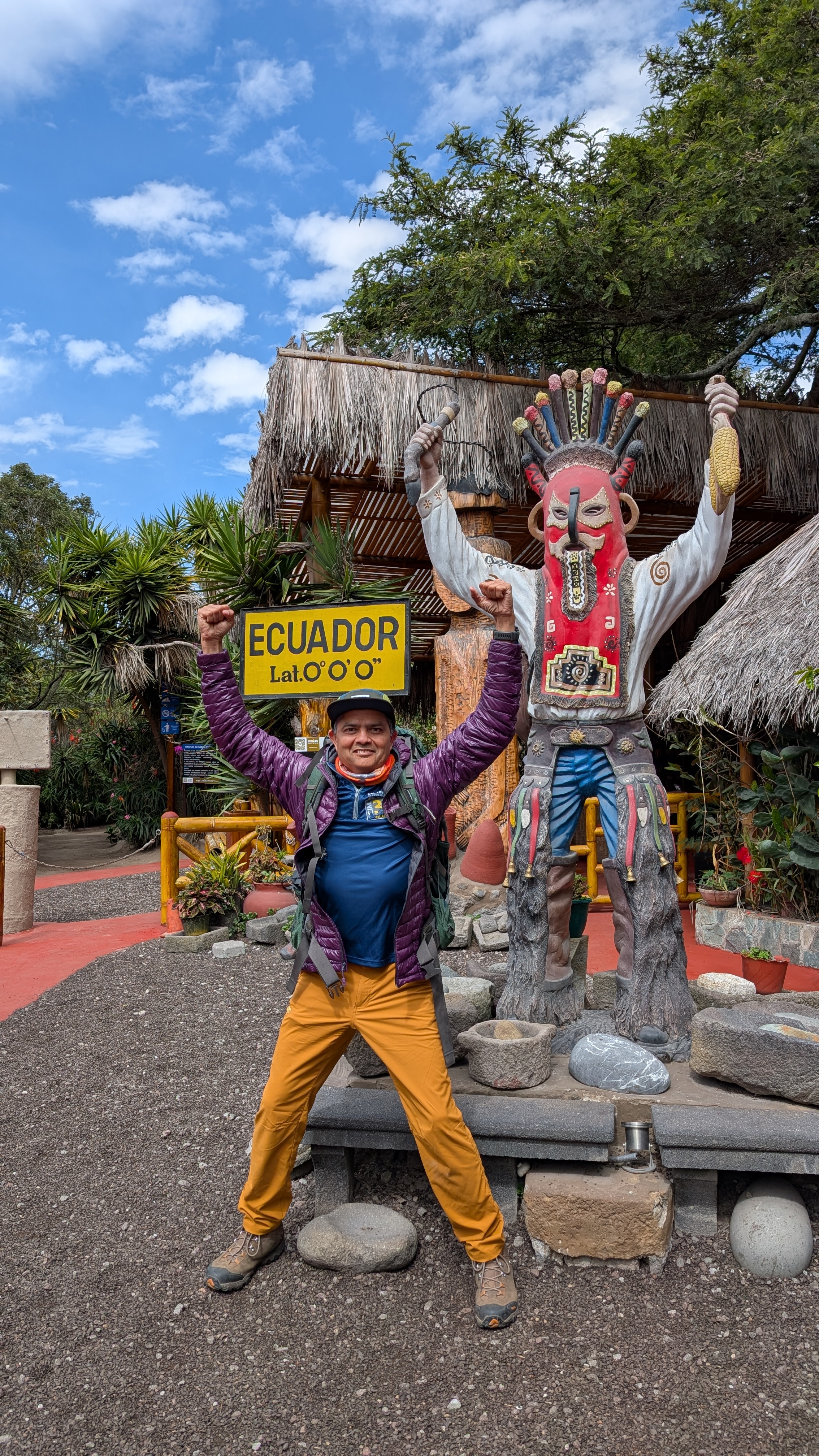
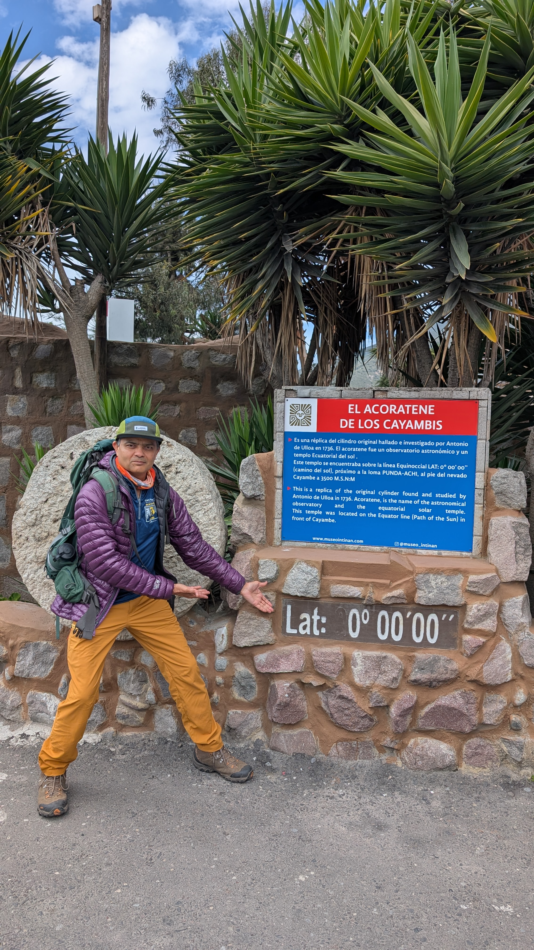
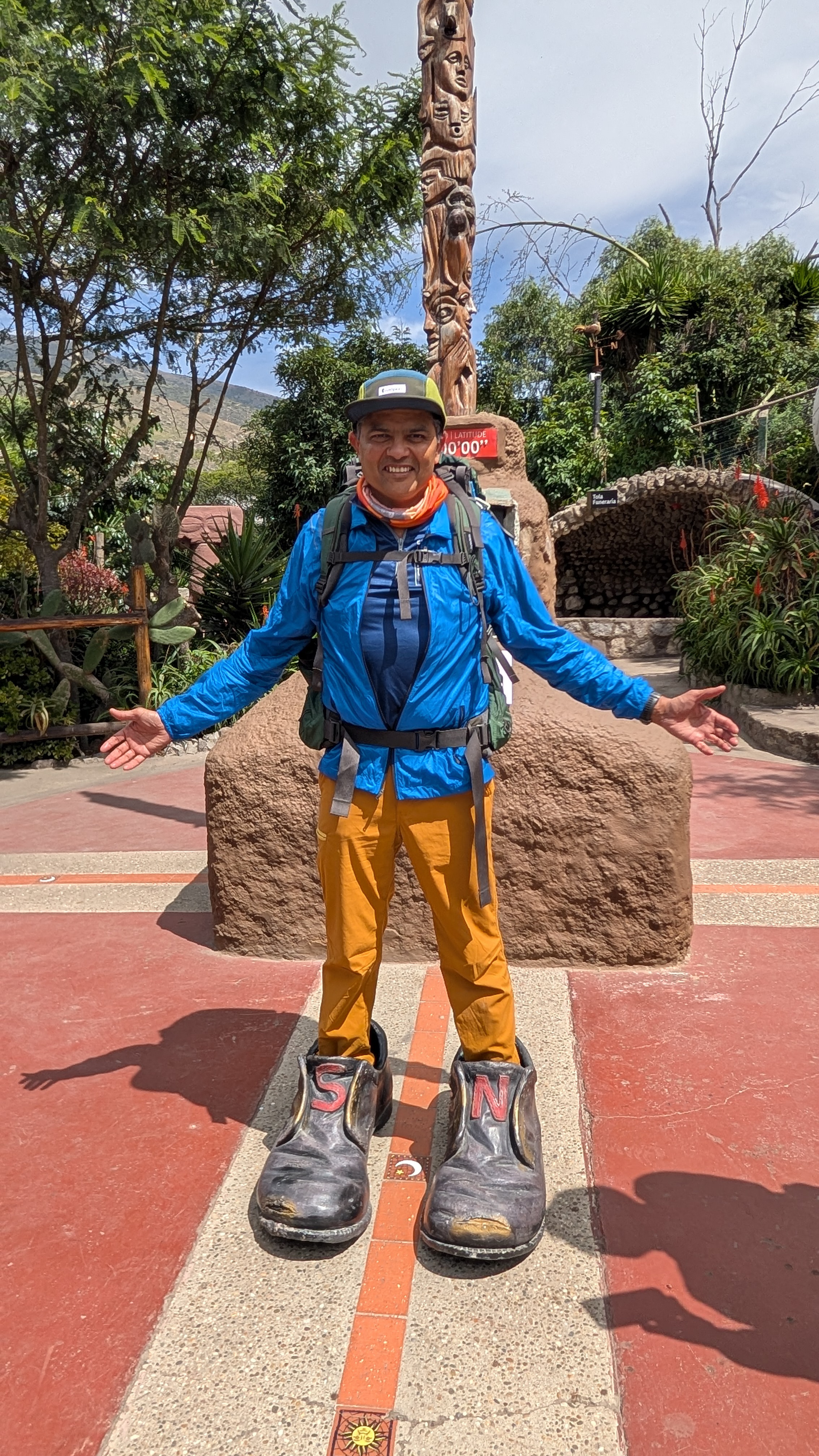
We visited the Intinan museum which is located very close to the equator (probably within 50-100 meters). It was a really fun visit. They have many interactive “equator” demonstrations that are scientifically debated but very entertaining and somewhat mind-bending nevertheless. For example:
- Water drains in different directions (swirls clockwise vs. counterclockwise) on either side of the equator (Coriolis effect). On the equator it does not swirl at all.
- Balancing an egg on a nail on the equator
- Trying to walk in a straight line
- Sundial clock
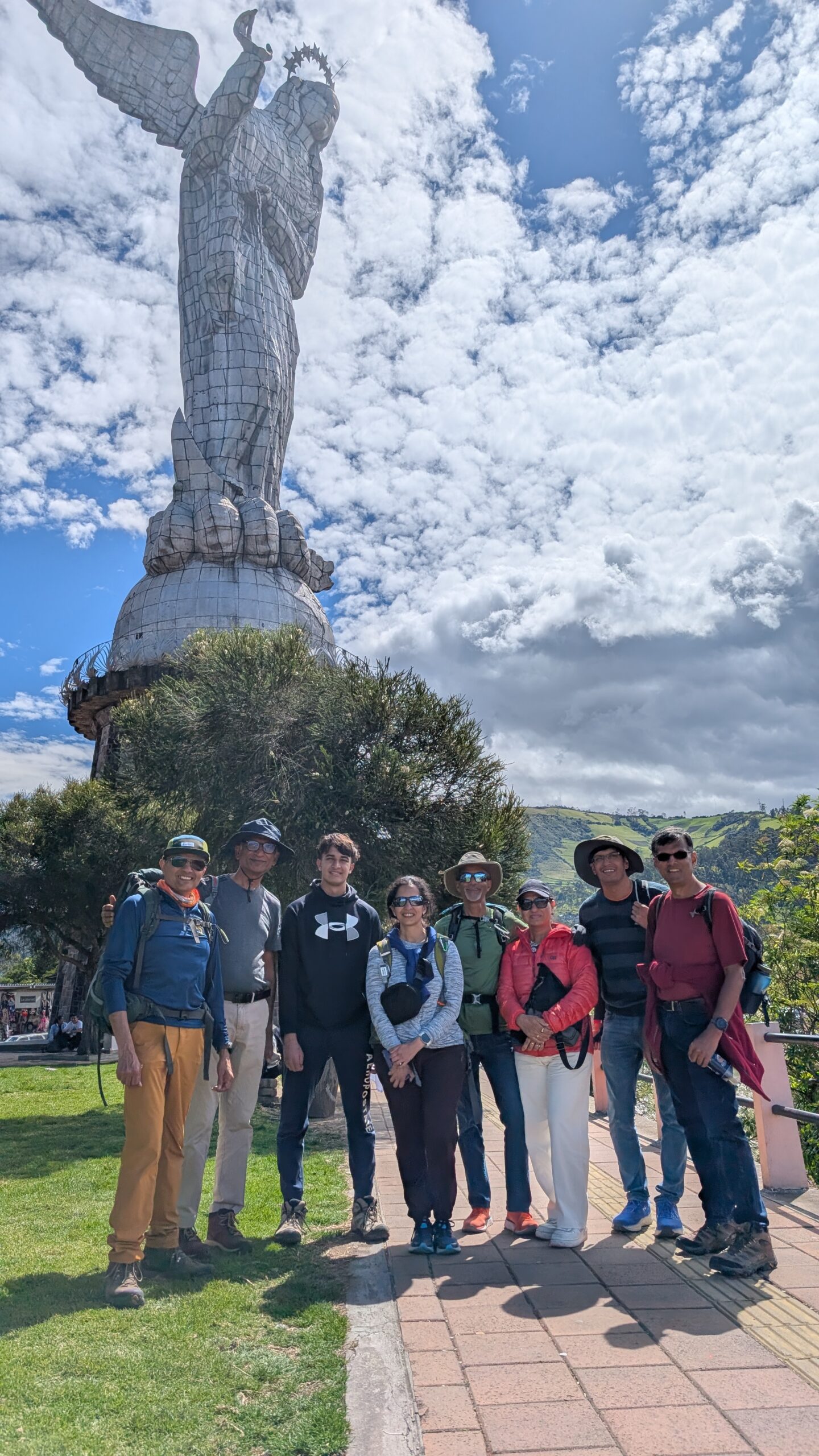
We also visited the Virgen de El Panecillo (Virgin of Quito) monument. The statue is 135 ft tall and is located on top of the El Panecillo hill making it easily visible from pretty much anywhere in the city. It is made of thousands of aluminum panels which were assembled like a giant puzzle.
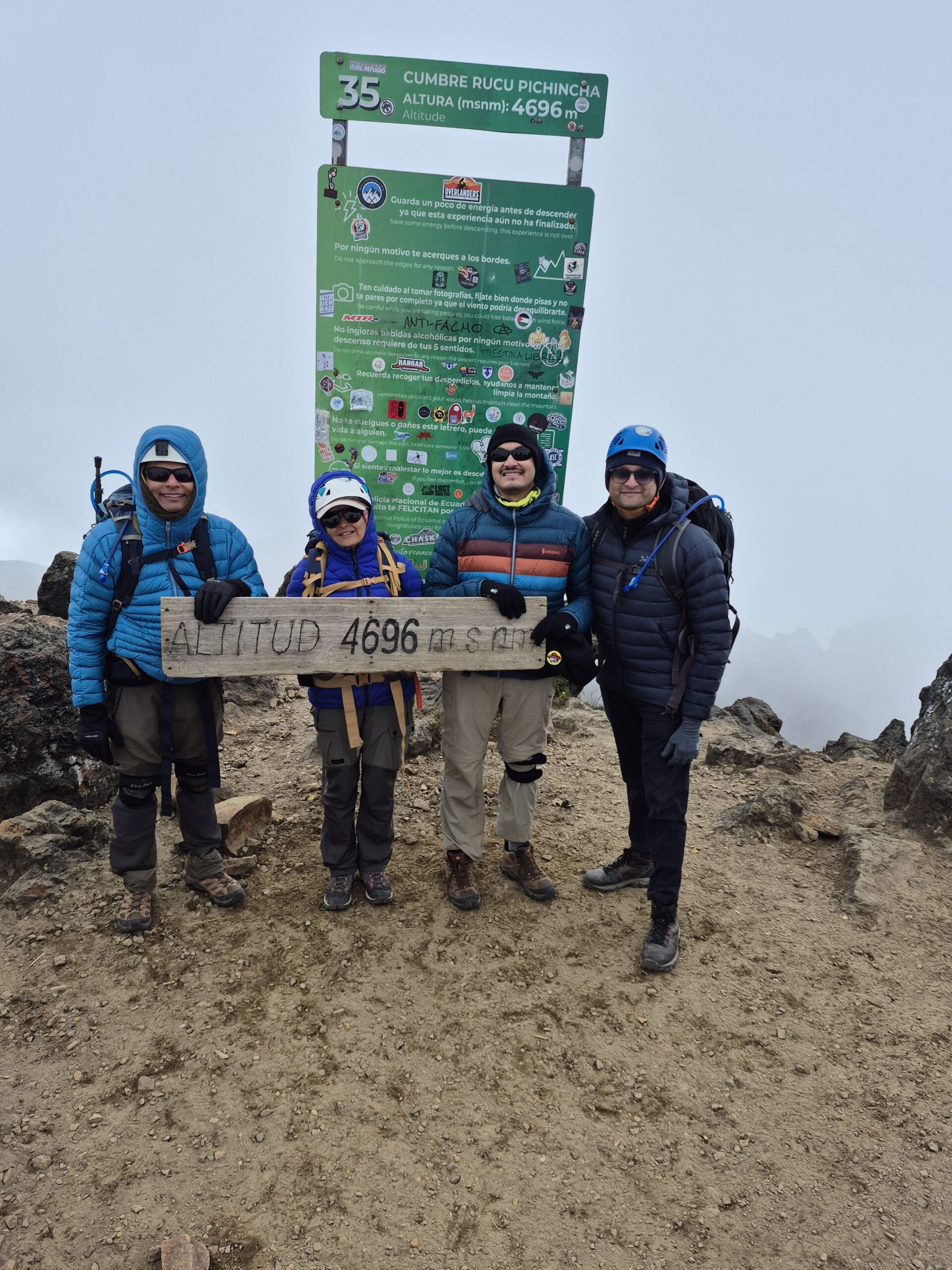
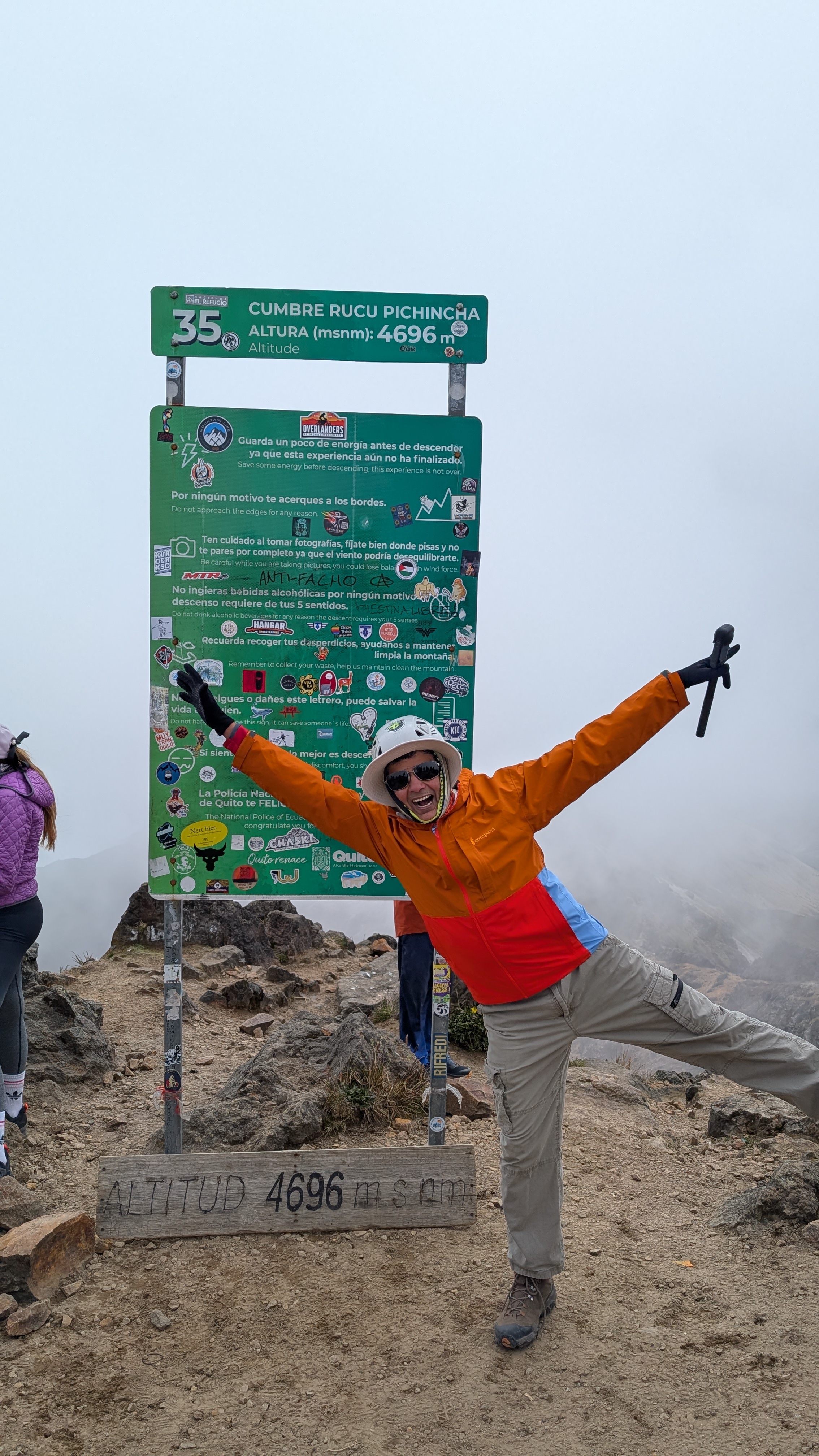
Day 1 (June 29)
Scheduled target: Summit Rucu Pichincha (15,413 ft)
What we did: Summited Rucu Pichincha
Start Elevation: 12,943 ft
Ascent: 2,400 ft
Start Time/Time to Summit: 9:00am / 4 hrs (1:00pm)
Time to Descend: 1:45 hrs (3:30pm)
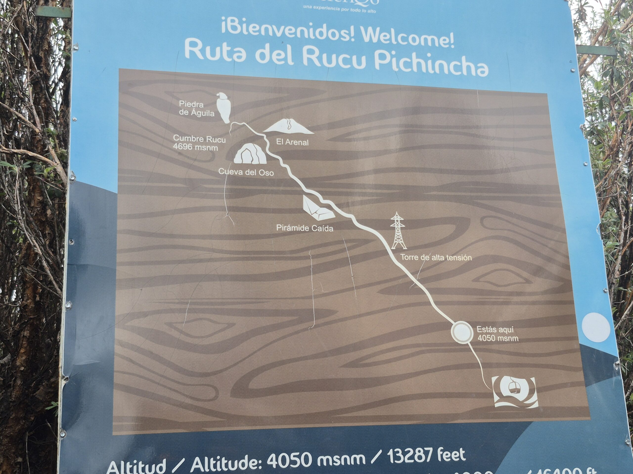
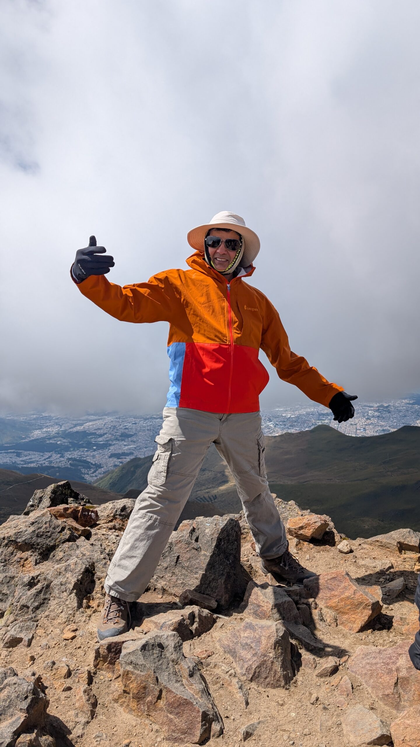
Highly anticipated first day of climbing! We were picked up from our hotel at around 7:30am in a bus. We drove to the base of the teleferico where our guides had already bought the cable car tickets. Rucu Pichincha climb starts from the top of teleferico which is at an altitude of 12,943 ft. “Rucu” in Kichwa (Quechua) language means “old” and Pichincha is the name of the mountain range.
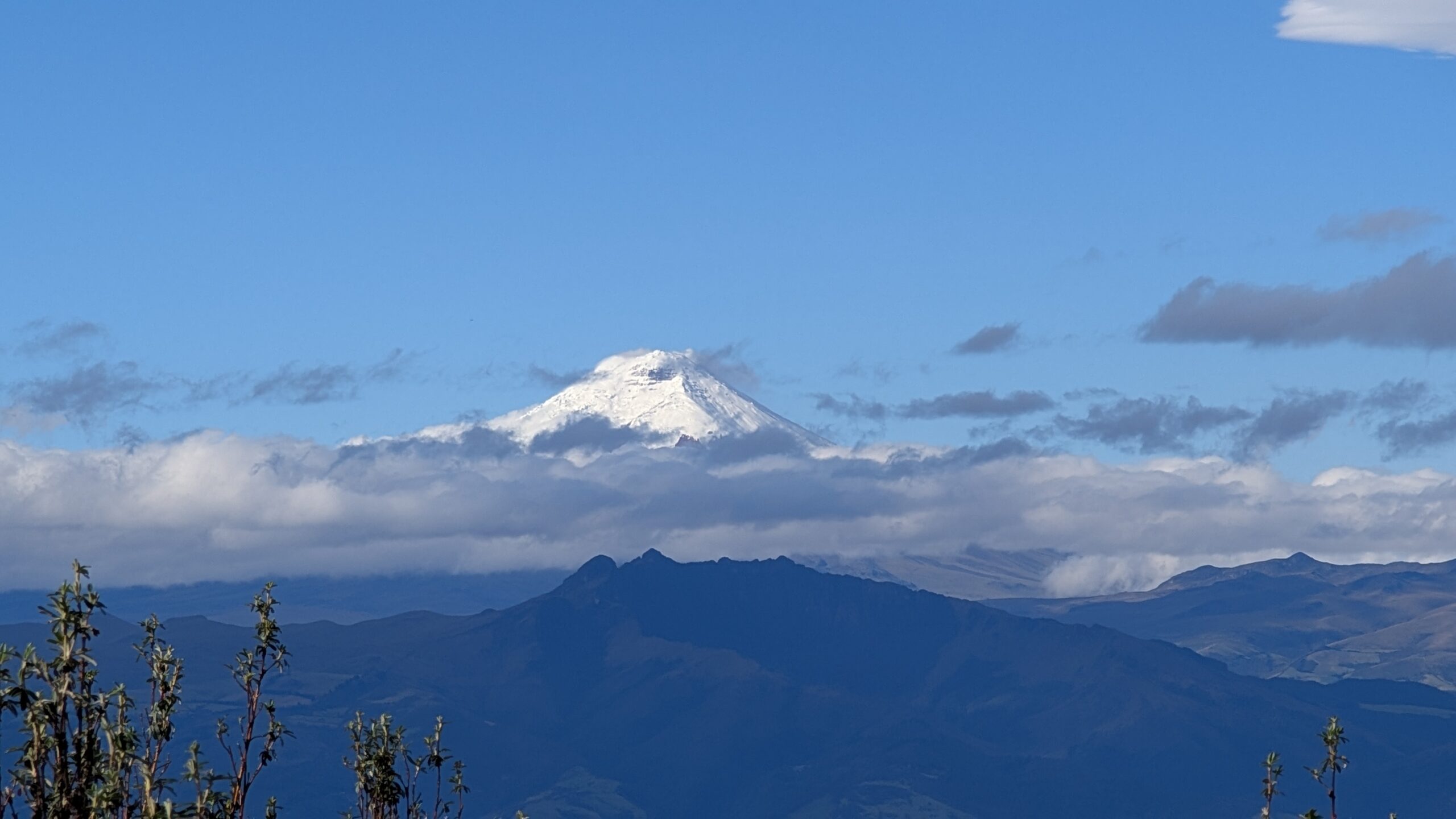
We started our climb at around 9am and were immediately greeted with a great view of the Cotopaxi volcano. It looked both scary and inviting to climb. We will have our shot at that in just a few days!
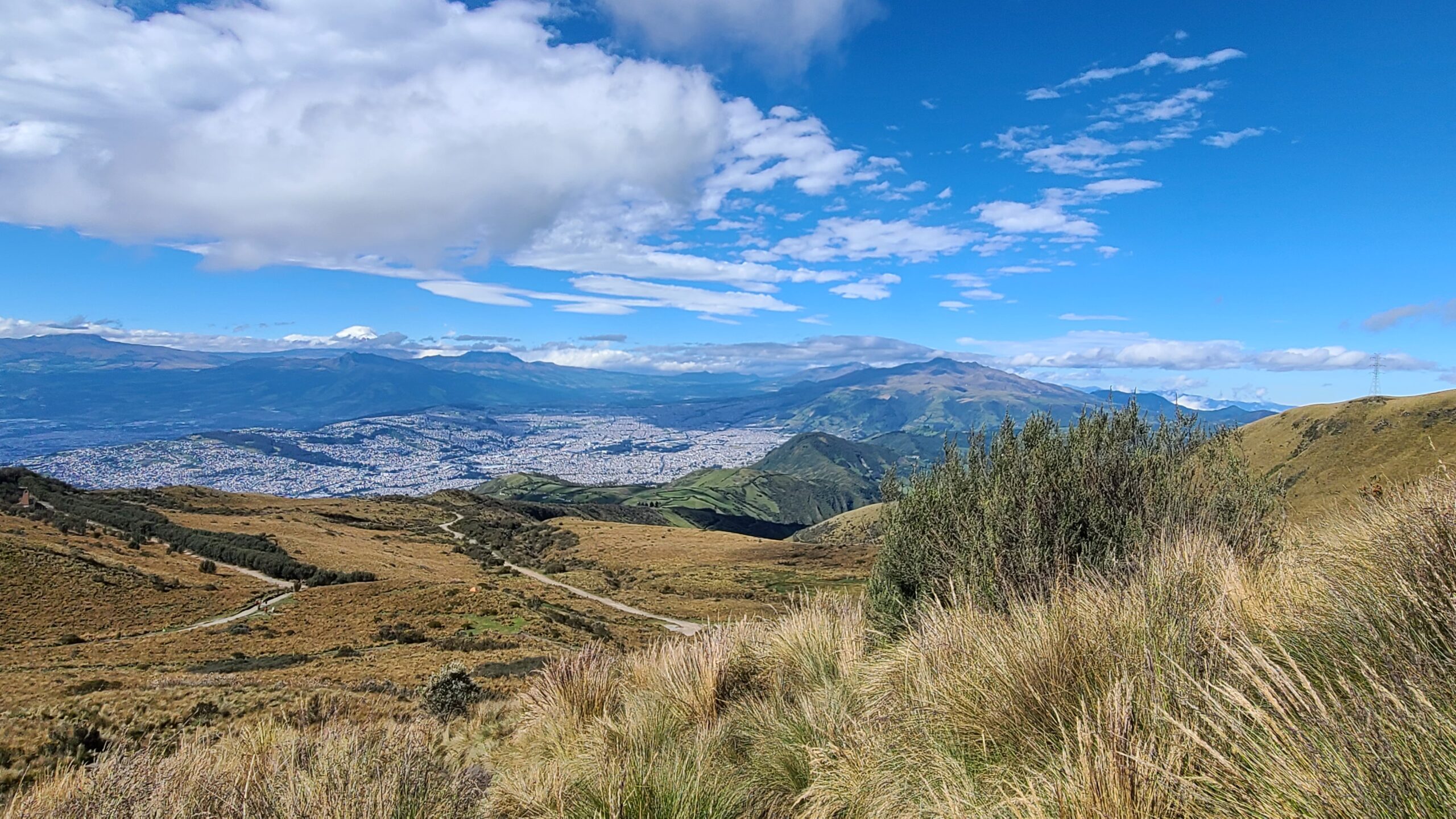
Weather was good and we saw sweeping views of the city and the surrounding mountains.
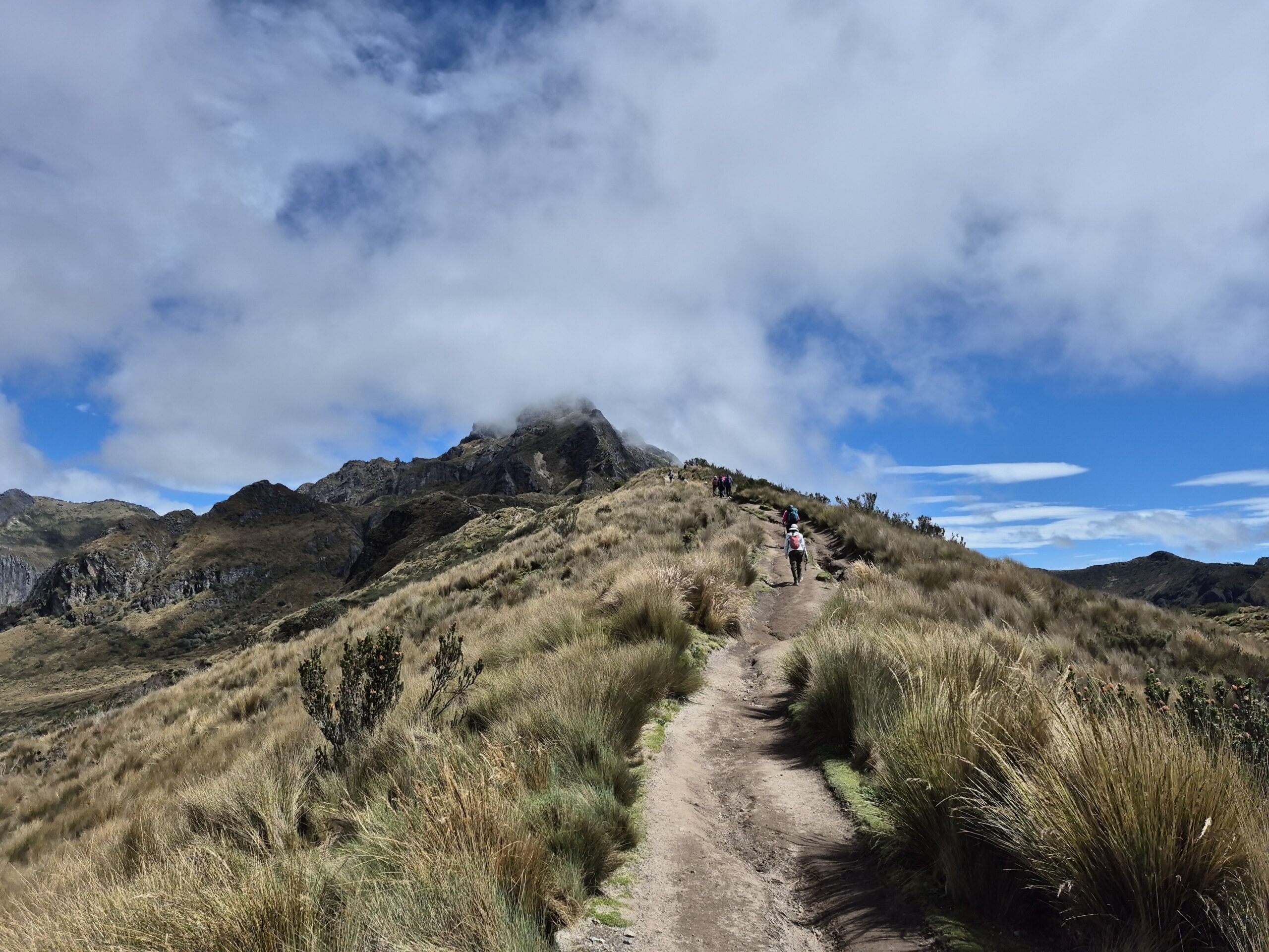
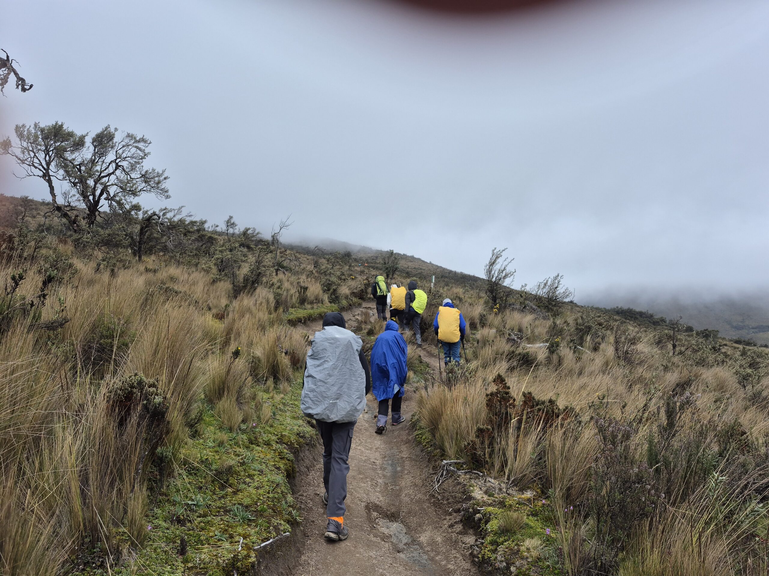
The trail started out as a broad, well paved path. We took frequent breaks to allow everyone in the group to sync up and to eat and hydrate.
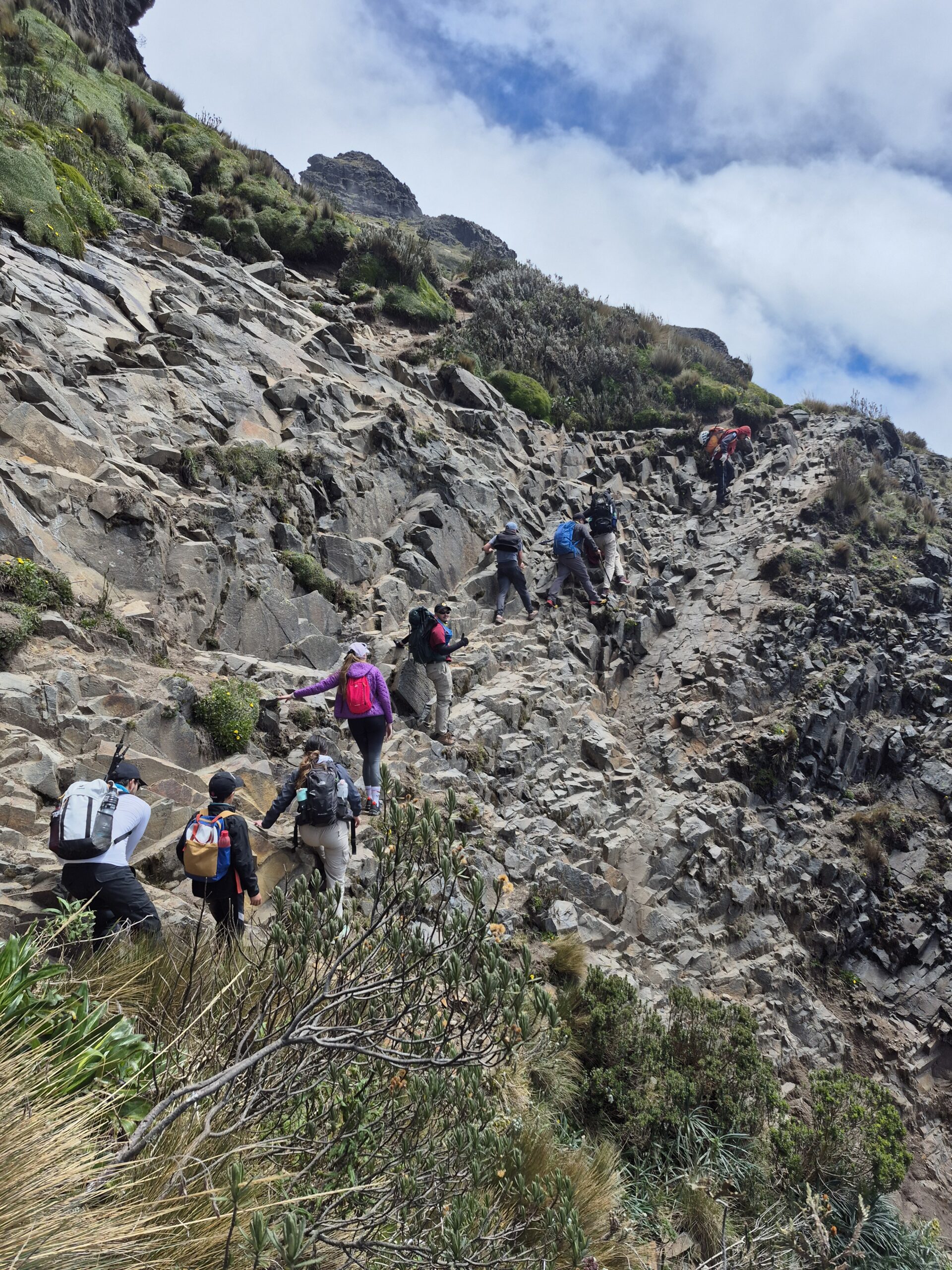
About two hours into the climb, the well paved trail disappeared and we found ourselves scrambling on a rocky path. Some sections had very narrow footing with steep drops. Other sections required us to use four wheel drive (use all fours!). It was fun but also challenging and occasionally scary. We had to wear helmets for safety against falling rocks.
The video shows the final six minutes of climb compressed in 1min. You can see the rock scrambling, how the fog is rolling in, and the overall terrain and difficulty. I was holding my camera in one hand making it even harder to navigate this section!
Finally around 1pm Arun, Divya, Priti and I made it to the summit. We took a lot of pictures there and waited for the rest of the group to arrive. Anu, Samir, Aditya, Sagar, Neel and Gautam arrived shortly after.
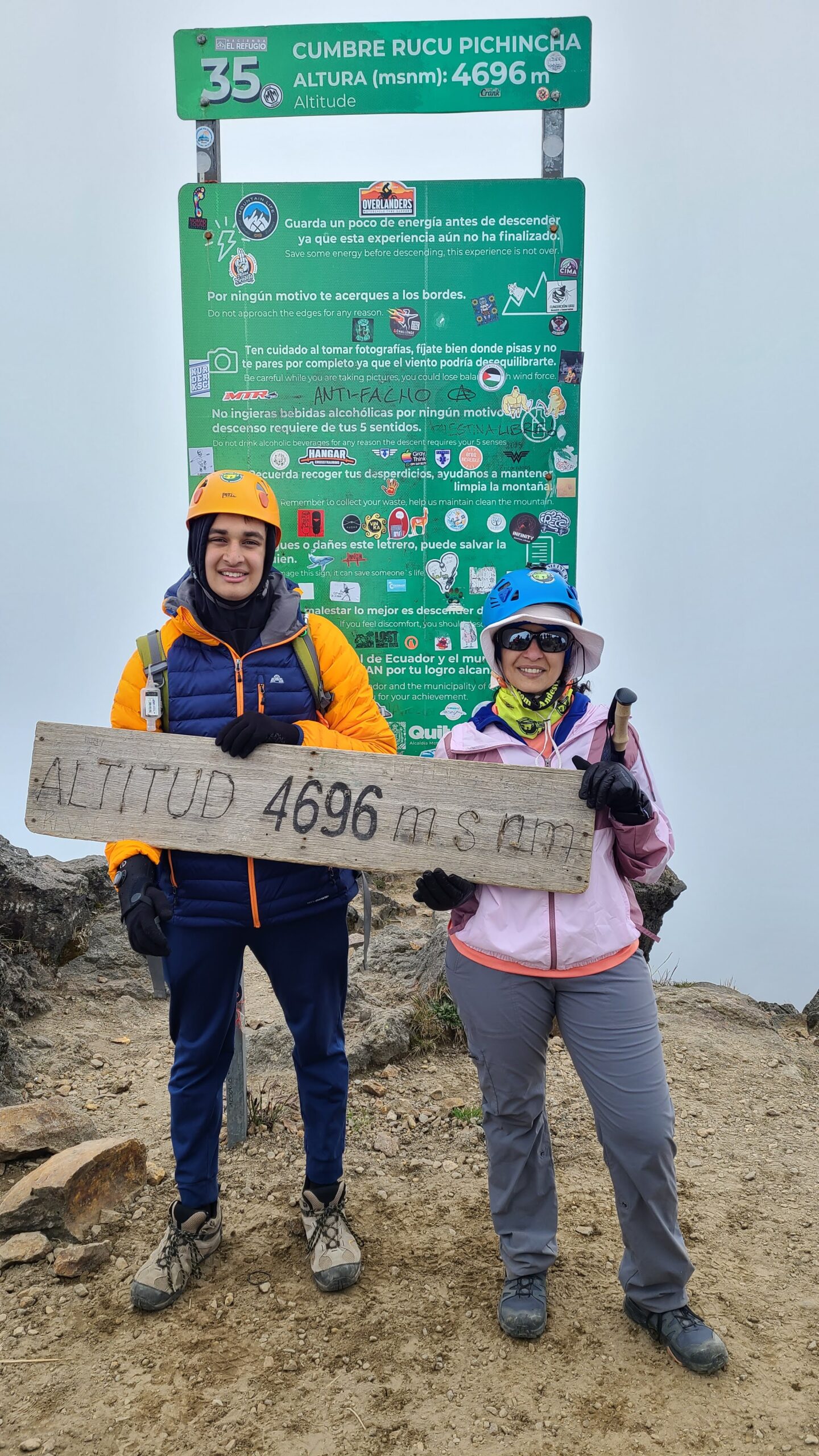
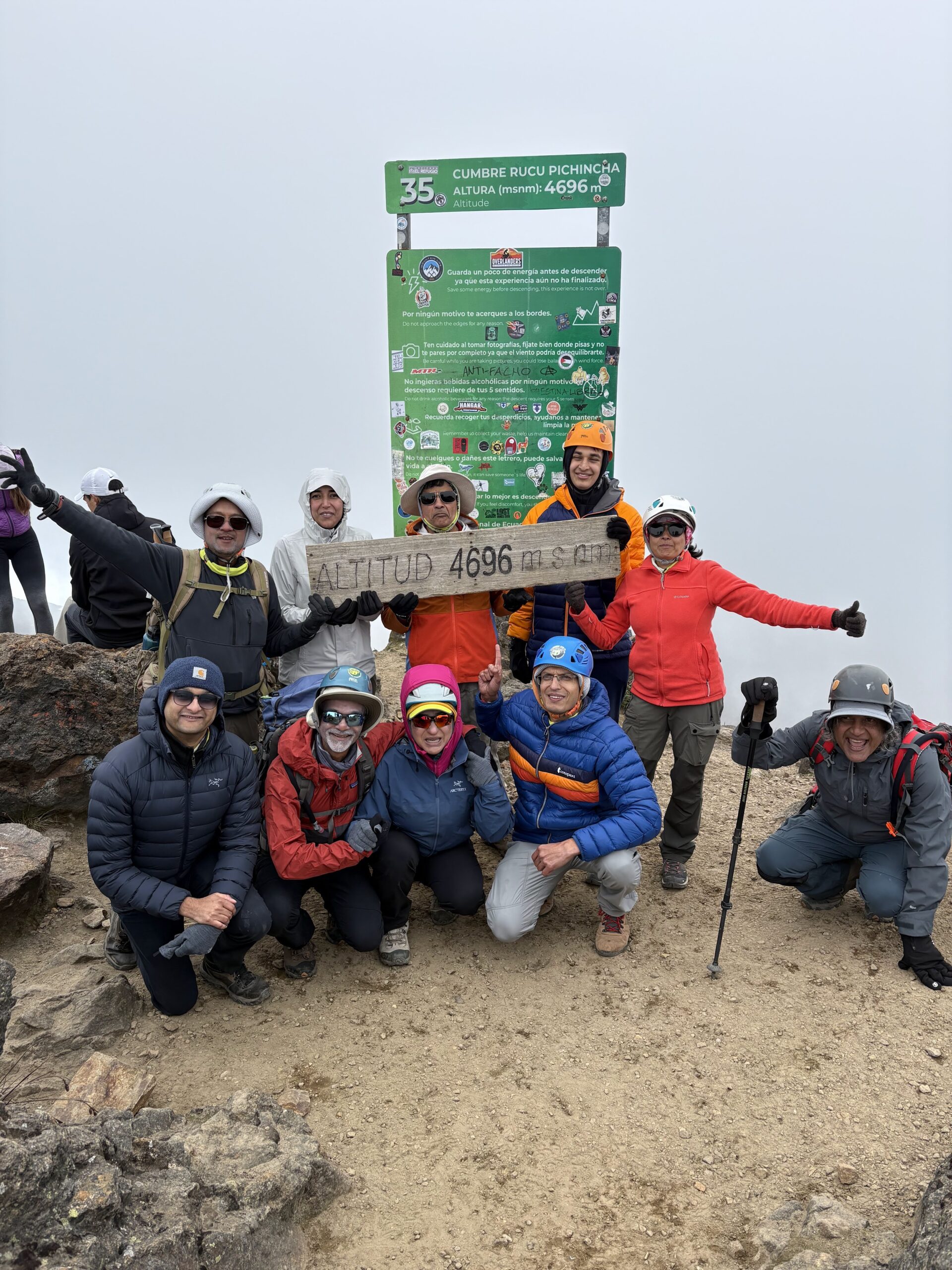
As you can see in the video, the fog was rolling in very fast and by the time we reached the top, it was completely foggy. Most of our photos have a white background instead of the breathtaking scenery we were hoping for 🙁
After spending about 30-45 minutes at the top, we decided to head down. Some of team members were still on their way up but it was getting cold and windy at the top and the guide suggested that we should start heading back.
We started hiking down at around 1:45pm
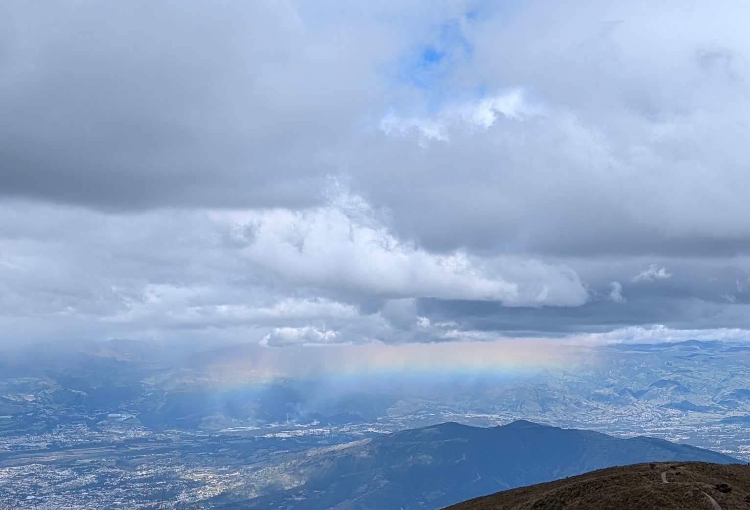
Fog seemed to start clearing up as we continued down. We saw this amazing rainbow which stretched for miles, forming a horizontal arc! I have never seen such a rainbow. It was quite a sight.
It took us about 2 hours to get down. I had a large mocha which really hit the spot. We waited for the rest of the team to join us and then took the teleferico down. Sushil got impacted by altitude sickness and vomited. Apparently the same thing happened to him last year when he climbed Kilimanjaro. After the initial altitude sickness, his body adjusted quickly. Therefore we were not worried. Sure enough, his body adjusted quickly in the subsequent climbs.
Sahil, who had a recent ACL surgery, felt a lot of pain in his knee. A screw that was inserted during the surgery started bothering him tremendously. He completed this climb but decided that it was not possible (and unwise) to continue trekking with the bum knee. He decided to fly back to Dallas and scheduled another surgery to get his knee fixed. It was really disappointing but it was the right decision.
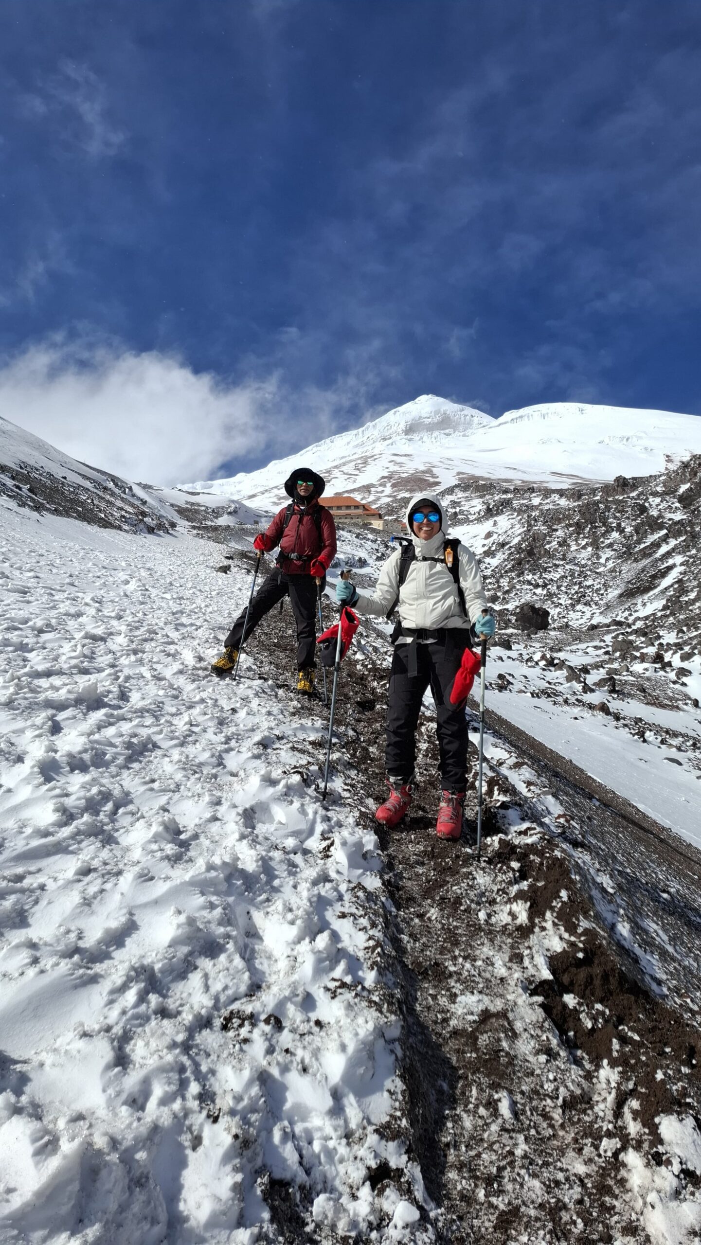
We got back in our bus and drove to the town of Machachi. This will be our base for the rest of the trek. We stayed in our guide’s hotel – Casa del Montanero (CDM). It was a basic but comfortable accommodation.
Day 2 (June 30)
Scheduled target: Summit Corazon (15,720 ft)
What we did: Summited Rumiñahui (15,489 ft)
Start Elevation: 12,880 ft
Ascent: 2,600 ft
Start Time/Time to Summit: 9:30am / 3:20 hrs (12:50pm)
Time to Descend: 2:15 hrs (3:30pm)
We left our lodge (CDM) at 6:20am hoping to start our climb early. We arrived at the village of El Chaupi after about 1hr of driving. Unfortunately it was raining heavily and our guide said we cannot possibly hike in that weather even with the rain gear. The trail will be slippery and foggy with very low visibility. We did not want to waste the day. Samir insisted that they find another mountain for us to climb. After some discussion the guide decided to take a chance on Ruminahui. It is located in the Cotopaxi national park and while not quite as tall as Corazon, it is pretty close.
We crossed our fingers and drove another hour or so to Ruminahui. Runinahui is named after a revered Inca warrior who led resistance against the Spanish conquistadors. Fortunately the rain here was not very strong. We donned our rain gear and got ready. It was nearly 9:30am by the time we started our climb – so much for the early start! But at least we were able to save the day.
We walked for about half-a-mile when Aditya handed me a glove that had dropped out of my pocket. I looked around and could not find the other one. Assuming that I had dropped the other glove as well, I walked all the way back to the car but couldn’t find it. Disappointed, I rushed back to join the team which had covered quite a distance already by then. Sometime later, I found the other glove inside my pants, close to my right ankle! My rain pants have a full zipper and also have zippered pockets. I had accidentally used the wrong zipper, sending the glove down the leg of my pants instead of into the pocket 🙂 I was happy but also annoyed at my carelessness which costed me almost an extra mile of walking.
The hike was really pretty with a lot of wildflowers. It started out easy but got very tricky at times. There were sections of loose sands which were really slippery, rock scrambles with steep drops, and often no clear trail to follow.
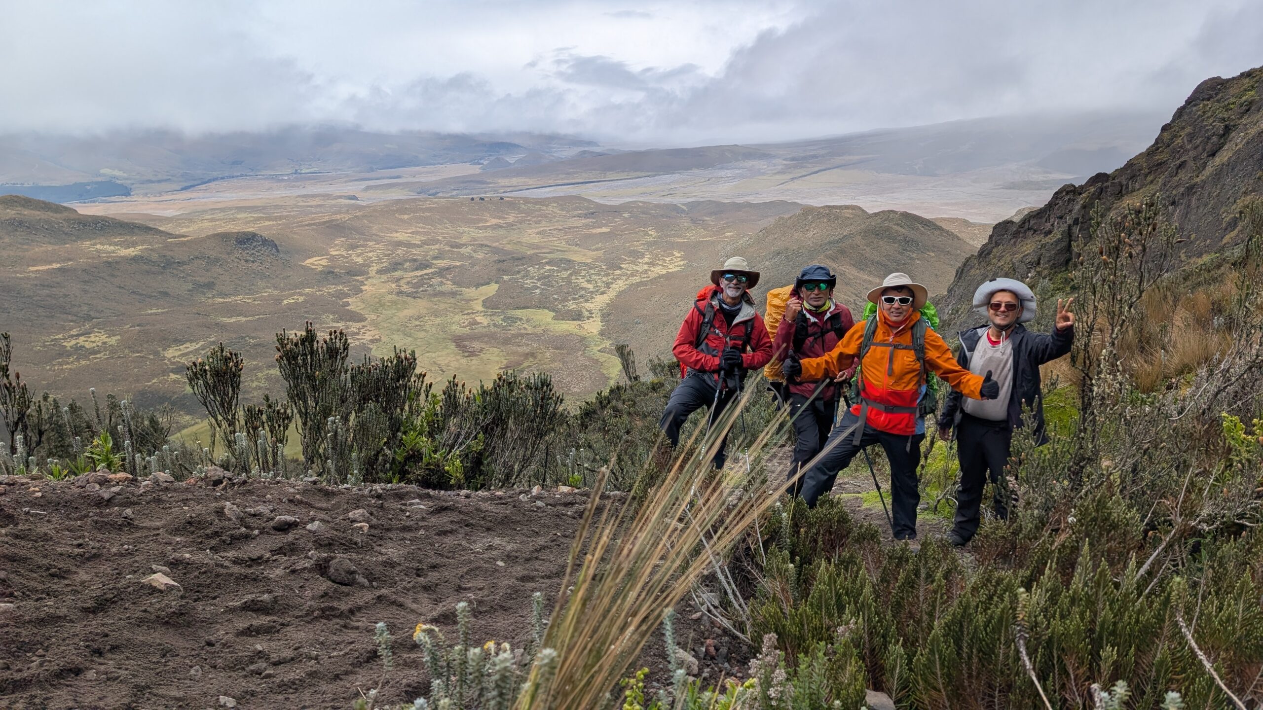
You can see the sandy section in the photo above. This section wasn’t particularly steep though. It does add a lot more friction and therefore makes it more tiring to walk on loose sand.
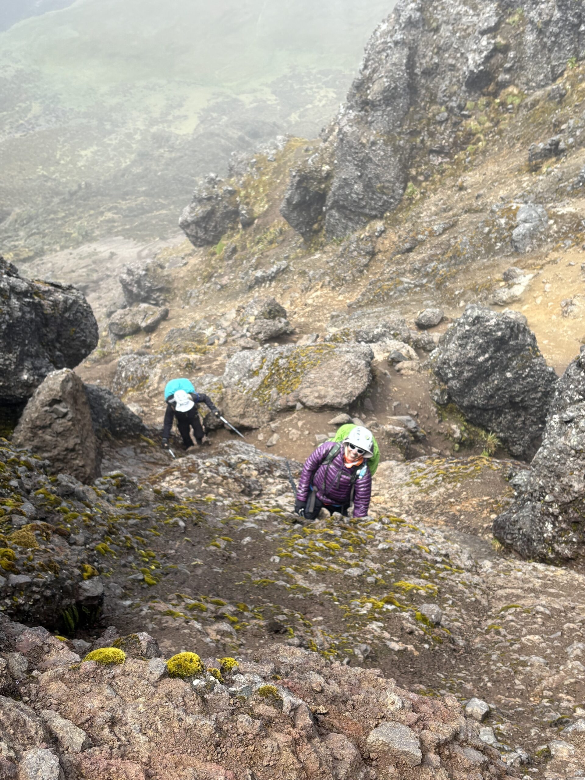
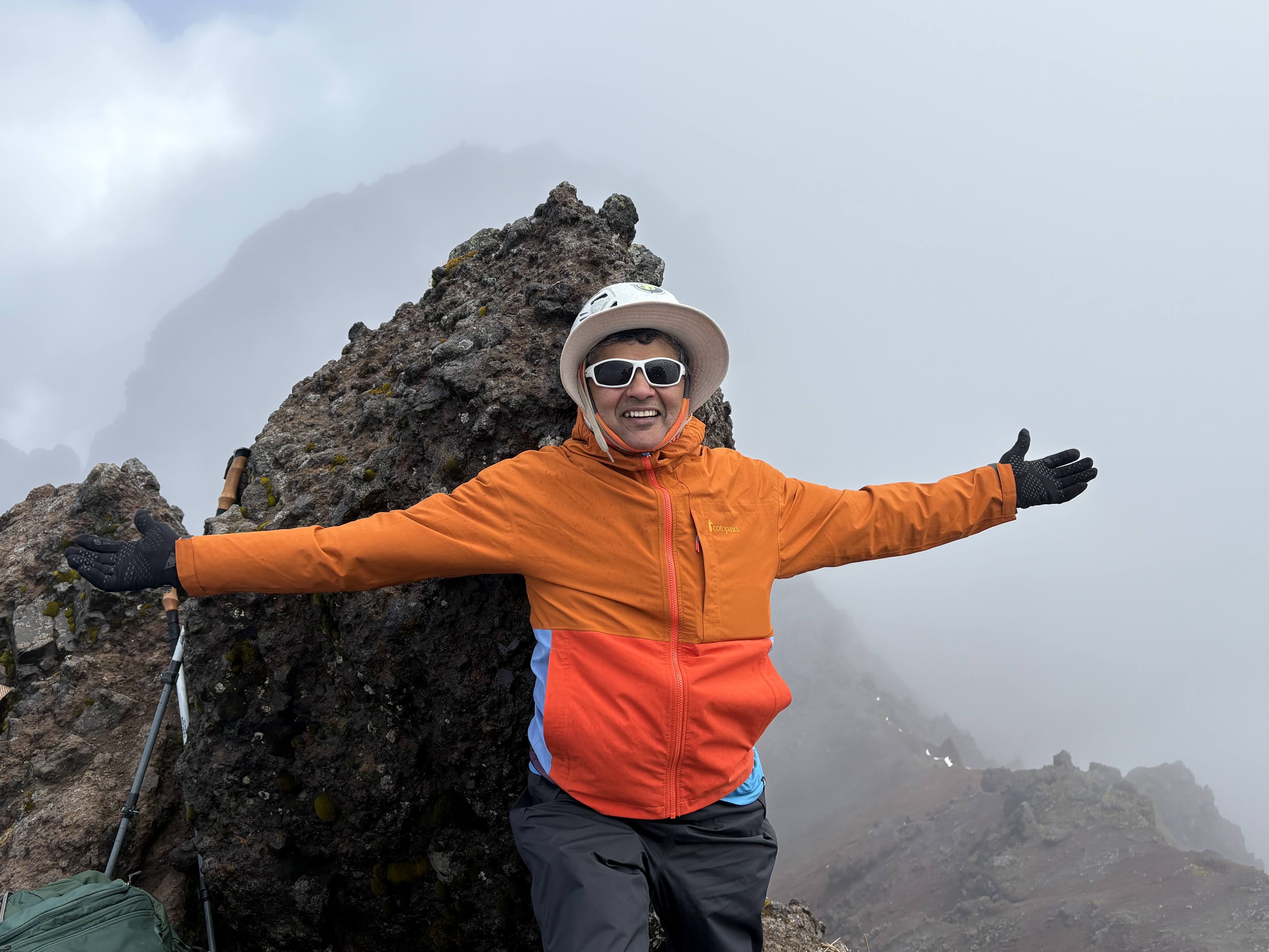
Last section of the climb was really treacherous at times. The final section to the summit was near vertical. See the picture below. We had to have our helmets on for the last hour of the climb to protect against falling rocks and to protect our heads in case of a slip.
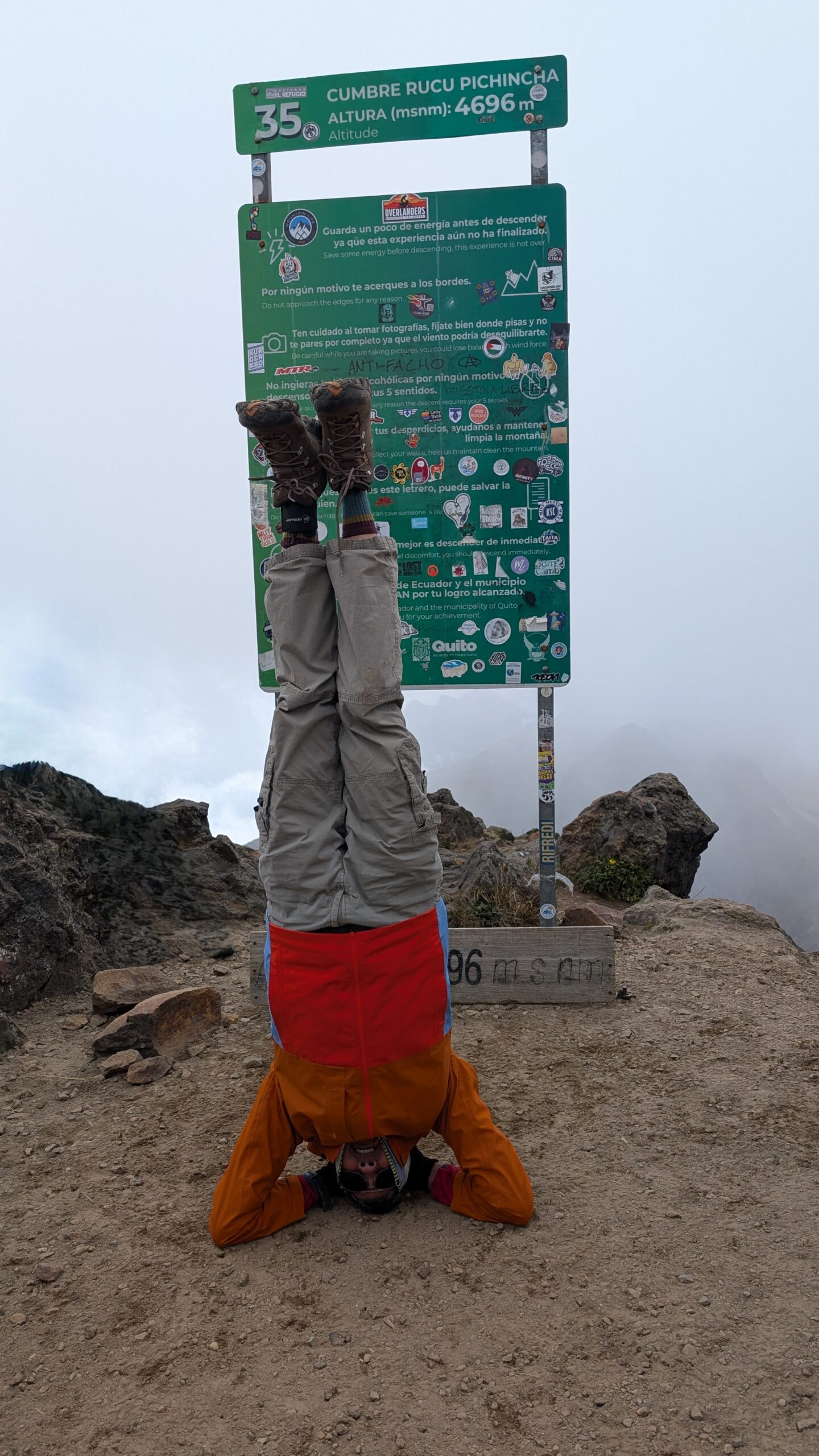
Unlike most summits, the top of Ruminahui is very jagged. There was barely any area to sit, let alone a flat surface for me to do my headstand 🙂
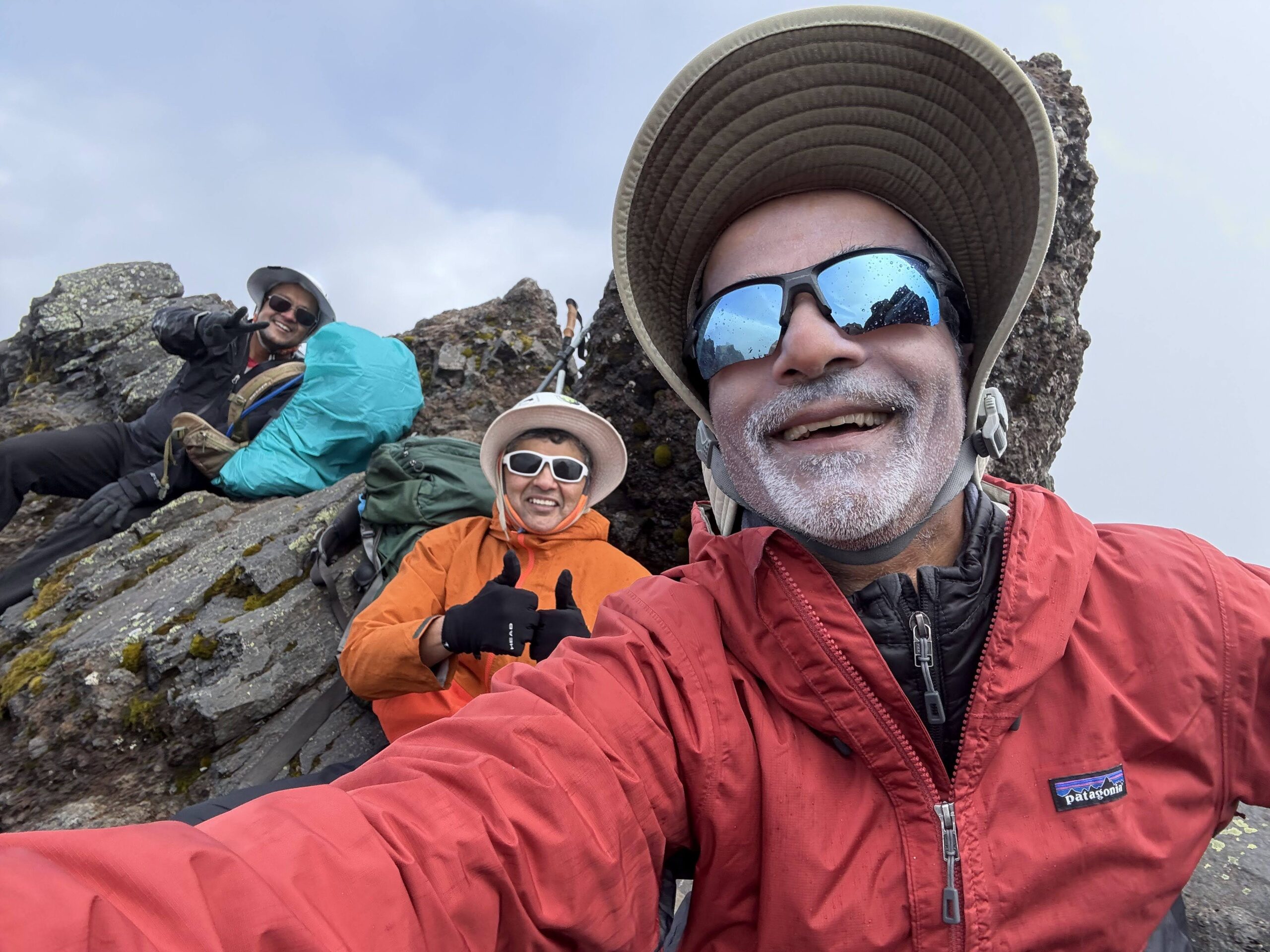
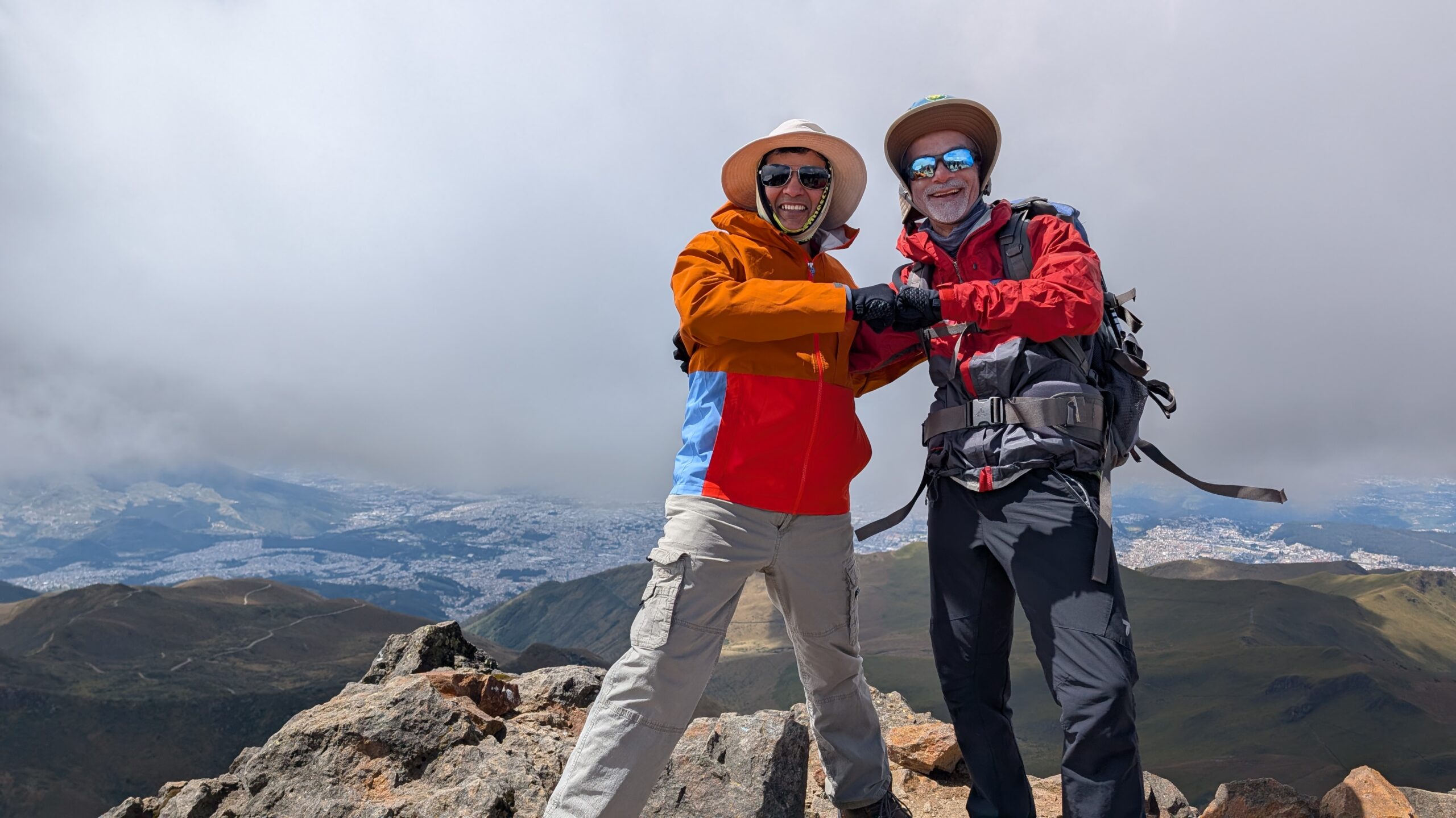
Arun, Ashutosh and I arrived at the top at around 12:50pm after over 3 hours of climbing. Sri joined shortly after. It was a really hard ascent. The rocks were slick due to rains and moisture and we had to be really careful to avoid slipping down. It also started to hail just as we were reaching the top. The wind also picked up making it really cold.
Once again we were denied the views from the summit due to intense fog. Cold, hail, wind and lack of shelter meant we could not stay at the top for too long. We started heading down at about 1:15pm. Going down was even harder at times. We had to sit down and inch forward on the steep rocky sections to avoid falling down. The sandy sections required a different technique – it was better to jog down using the plunge step technique while keeping the knees bent and weight slightly forward.
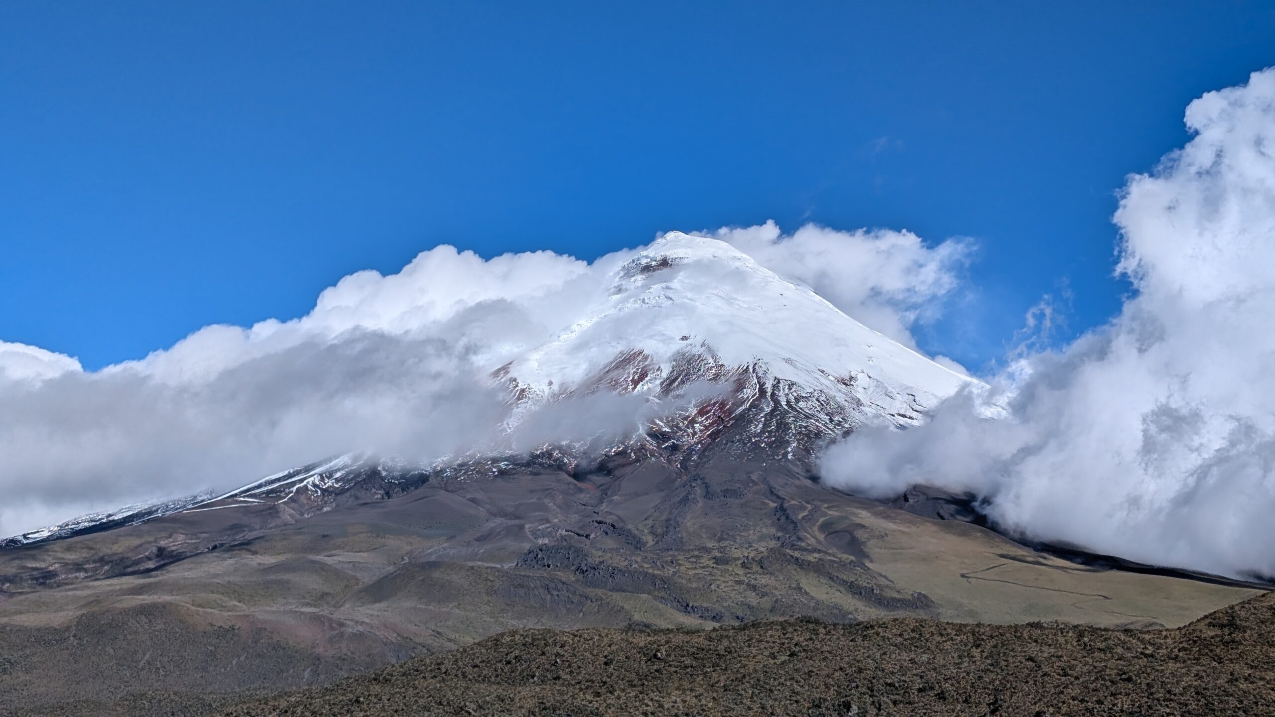
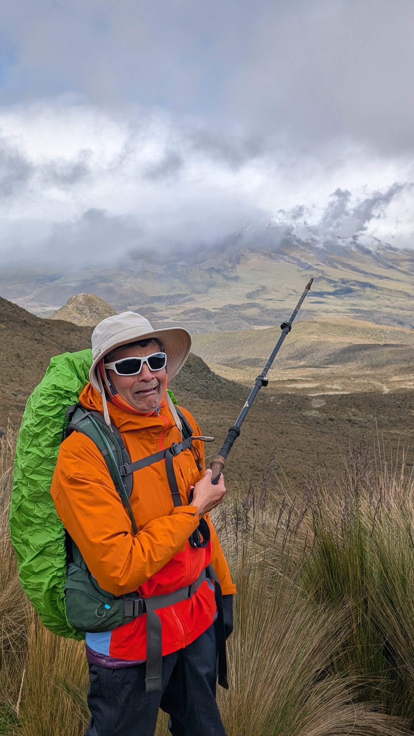
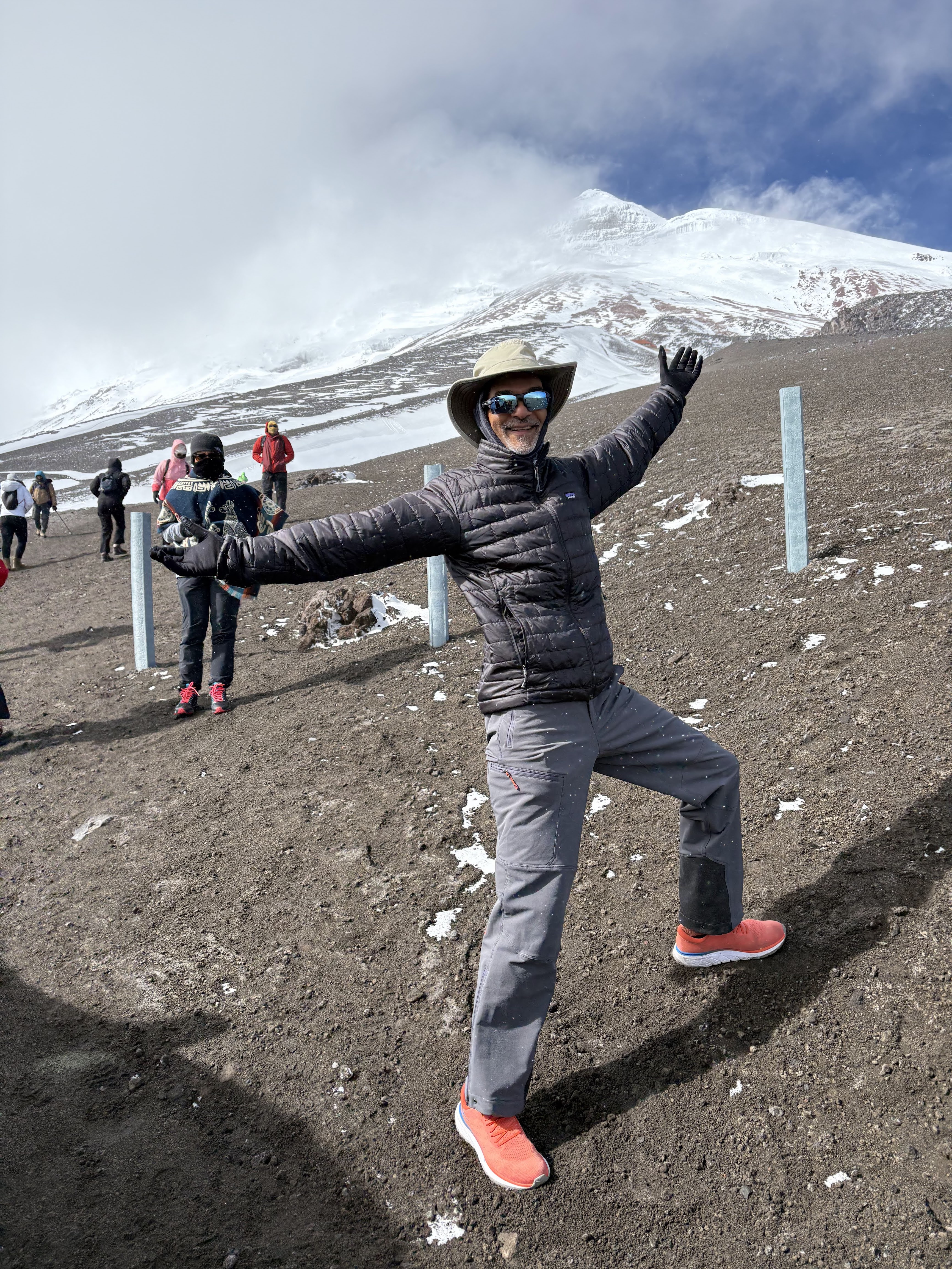
I was most excited about climbing the Cotopaxi volcano. These climbs were just in preparation to get to Cotopaxi. We got some great views of the mountain whenever there was a break in the clouds. It also looked like a difficult and scary climb!
We finally got back to our bus at around 3:30 after 2:15hrs of descent.
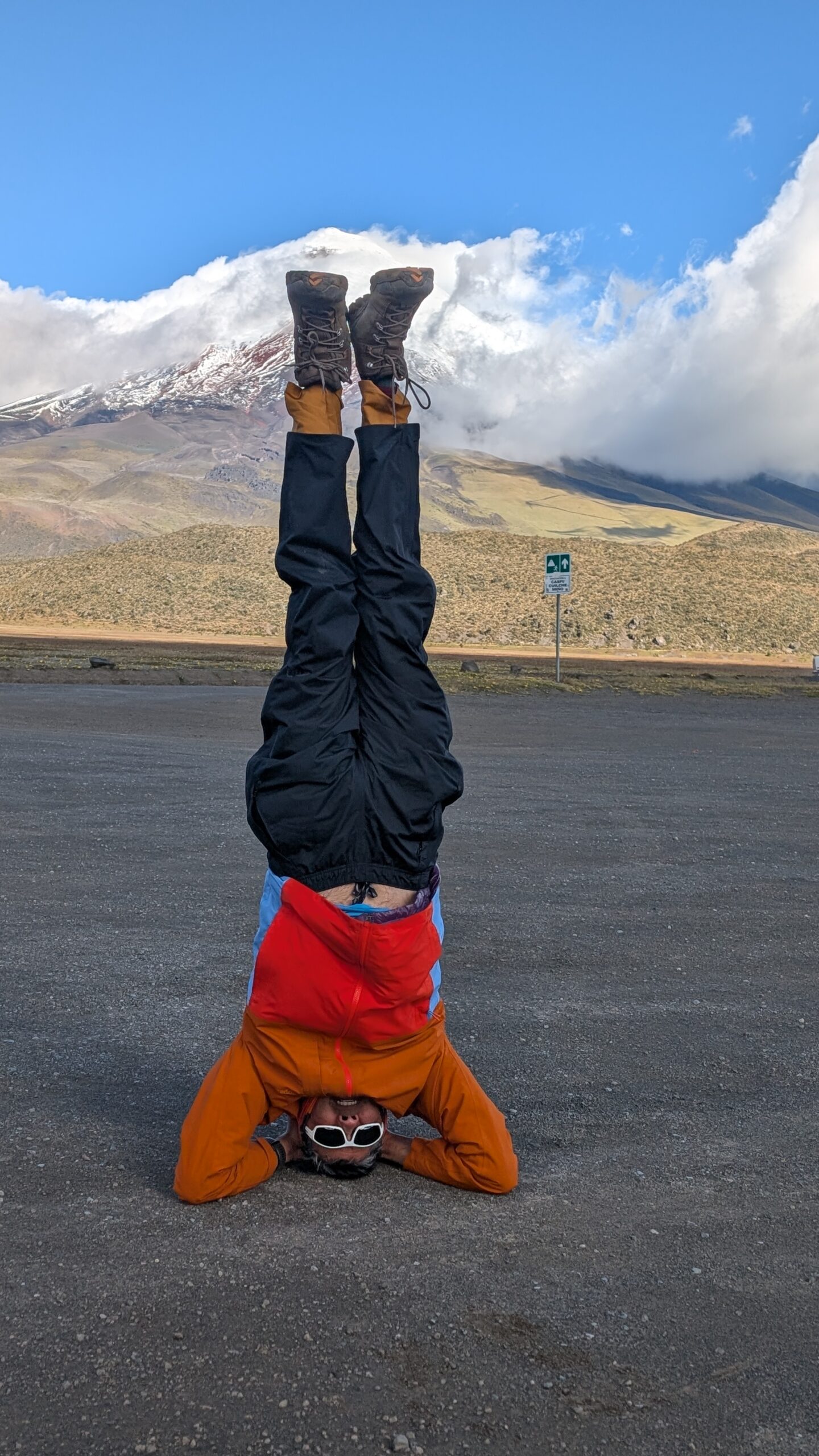
Since there was no space for a headstand on the summit, I did it after completing the trek. The picture belies the fact that it was extremely windy and cold. It was hard enough to stand in the wind, let alone be upside down. As it turned out, this was the closest my feet would get to the top of Cotopaxi summit – of course I didn’t know it at the time.
We could not do Corazon but thanks to Samir’s persistence in pushing the guides, we found a great substitute. This was a tough but memorable climb.
I don’t know how Neel handled all the rock scrambled with his injured hand. He was not able to put any pressure on it. We needed both hands at times to steady ourselves and for climbing.
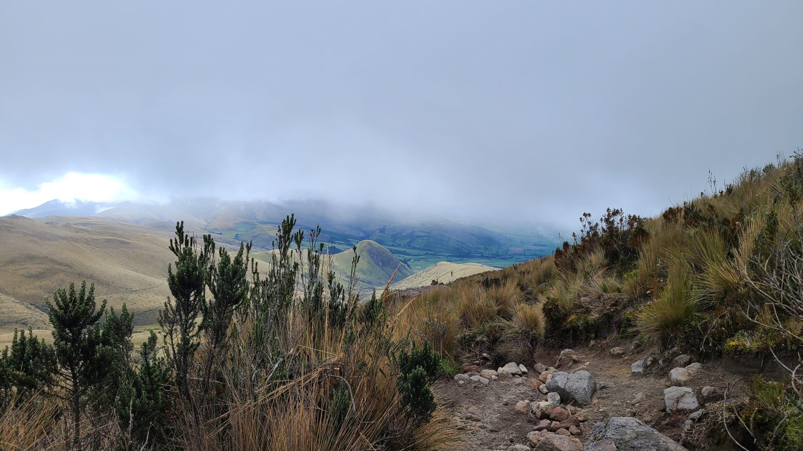
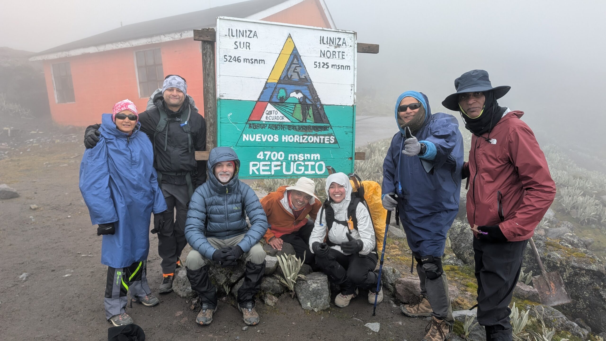
Day 3 (July 1)
Scheduled target: Climb to Nuevos Horizontes Hut, base camp for Illiniza Norte (15,583 ft)
What we did: Climbed to Nuevos Horizontes Hut
Start Elevation: 12,795 ft
Ascent: 2,788 ft
Start Time/Time to Summit: 11 am / 2:30 hrs (1:30 pm)
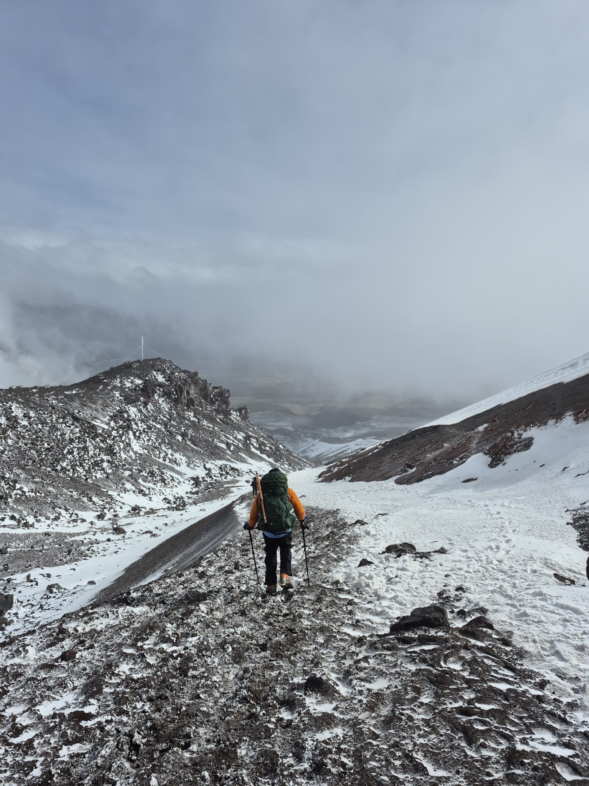
After the change in schedule yesterday, we were back on track today (at least so we thought!). We took a bus again to the village of El Chaupi and continued driving up to the La Virgen parking lot. Today’s goal was to climb to the Nuevos Horizontes Hut, which serves as the base camp for Illiniza Norte, and stay there. Therefore we decided to have a more leisurely start and left CDM at around 8:30am.
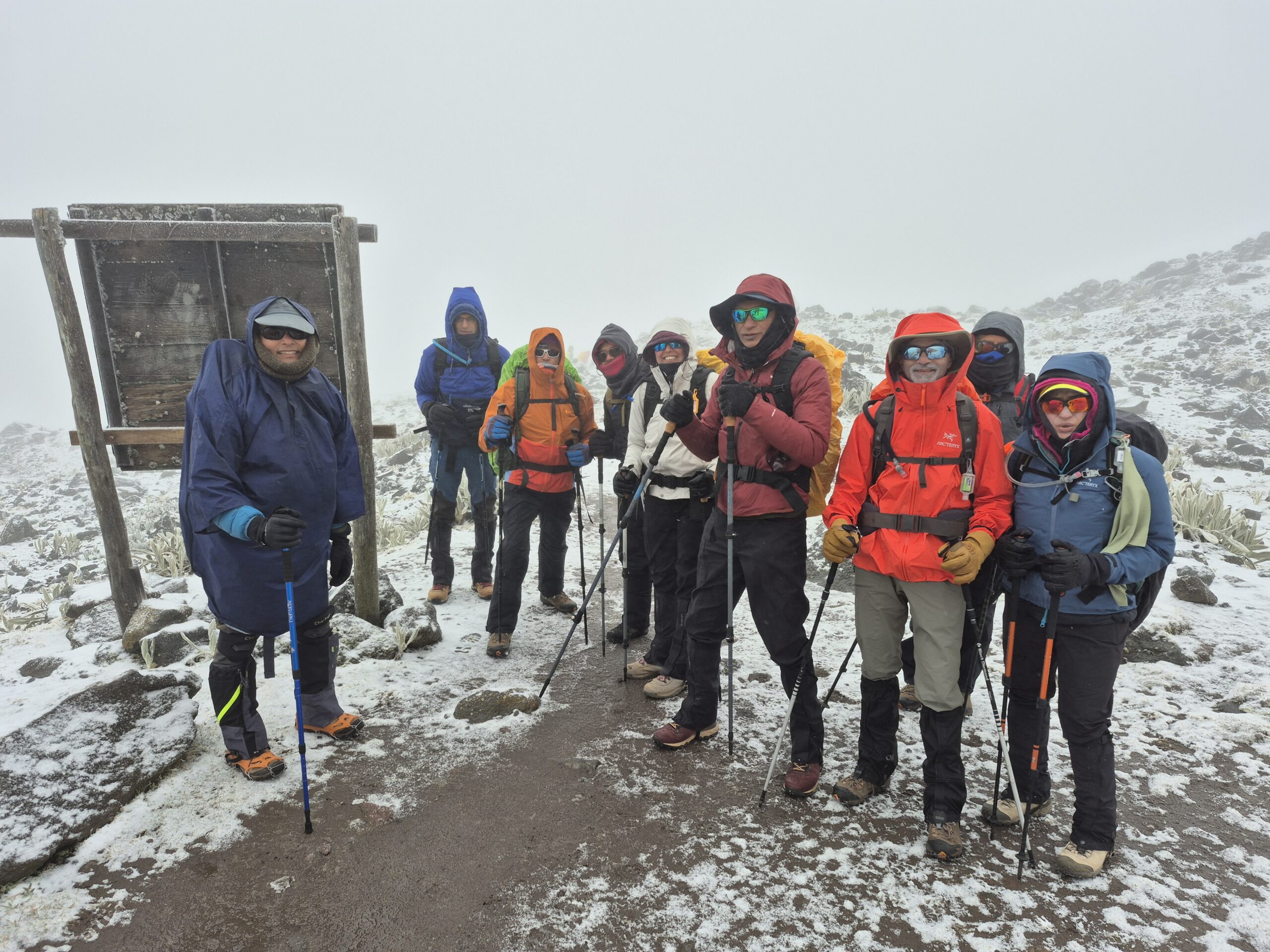
Having lost Sahil, there were 14 of us now. We arrived at the parking lot and got ready to start the climb. There were horses to carry our bags to the refuge. We only had to carry our daypacks. You can see one of the horses in the picture below.
We started at around 11am. Once again the weather was clod, foggy with a bit or rain. We had use our rain gear and cover the backpacks.
Along the way we heard our guide talking to other guides on the radio about someone in the team having to turn back. We later found out that Meenal was feeling some effects of altitude sickness and was had gone back to CDM. Meenal has done several high altitude treks in the past so it was unclear whether this was the right decision.
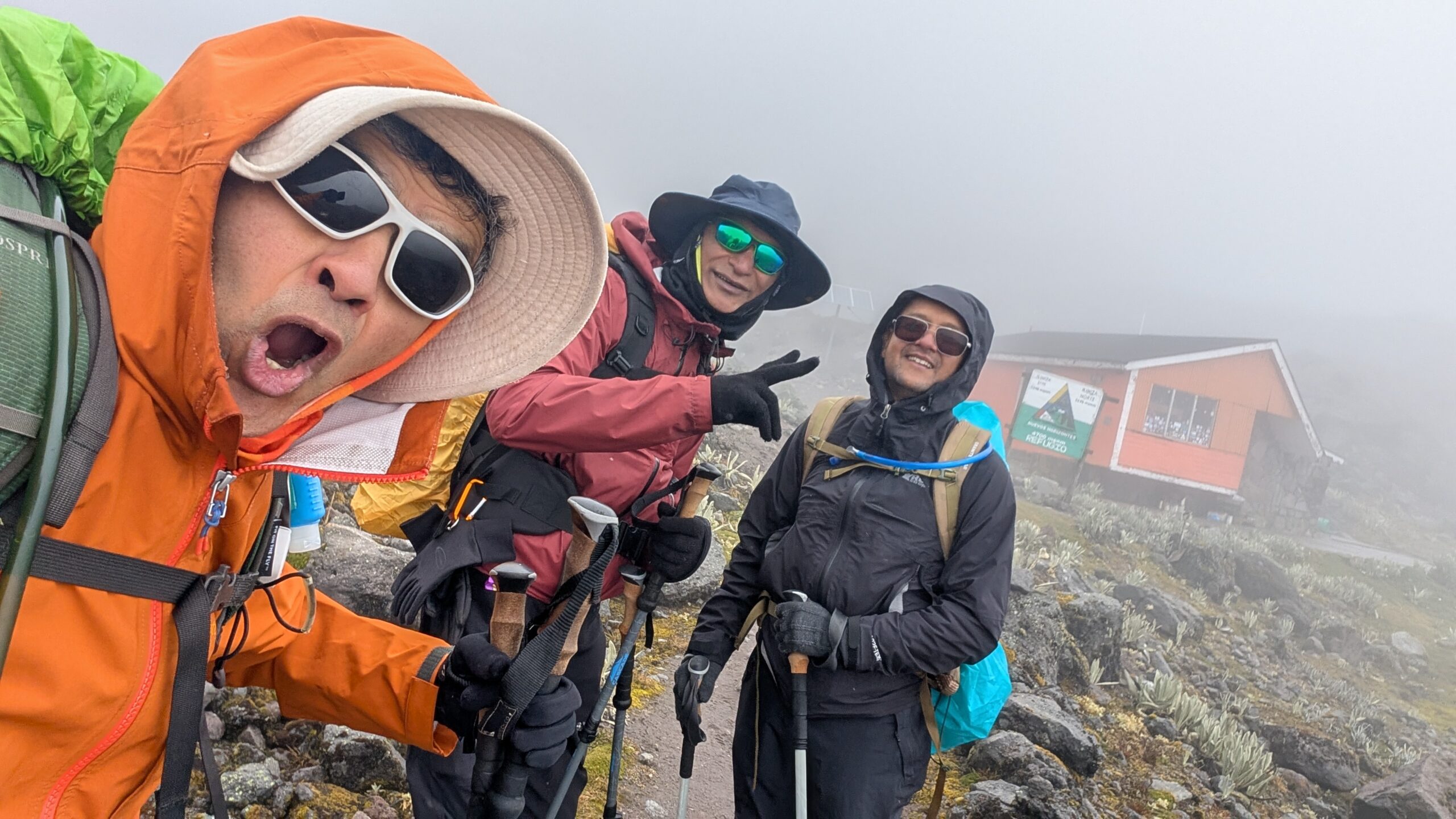
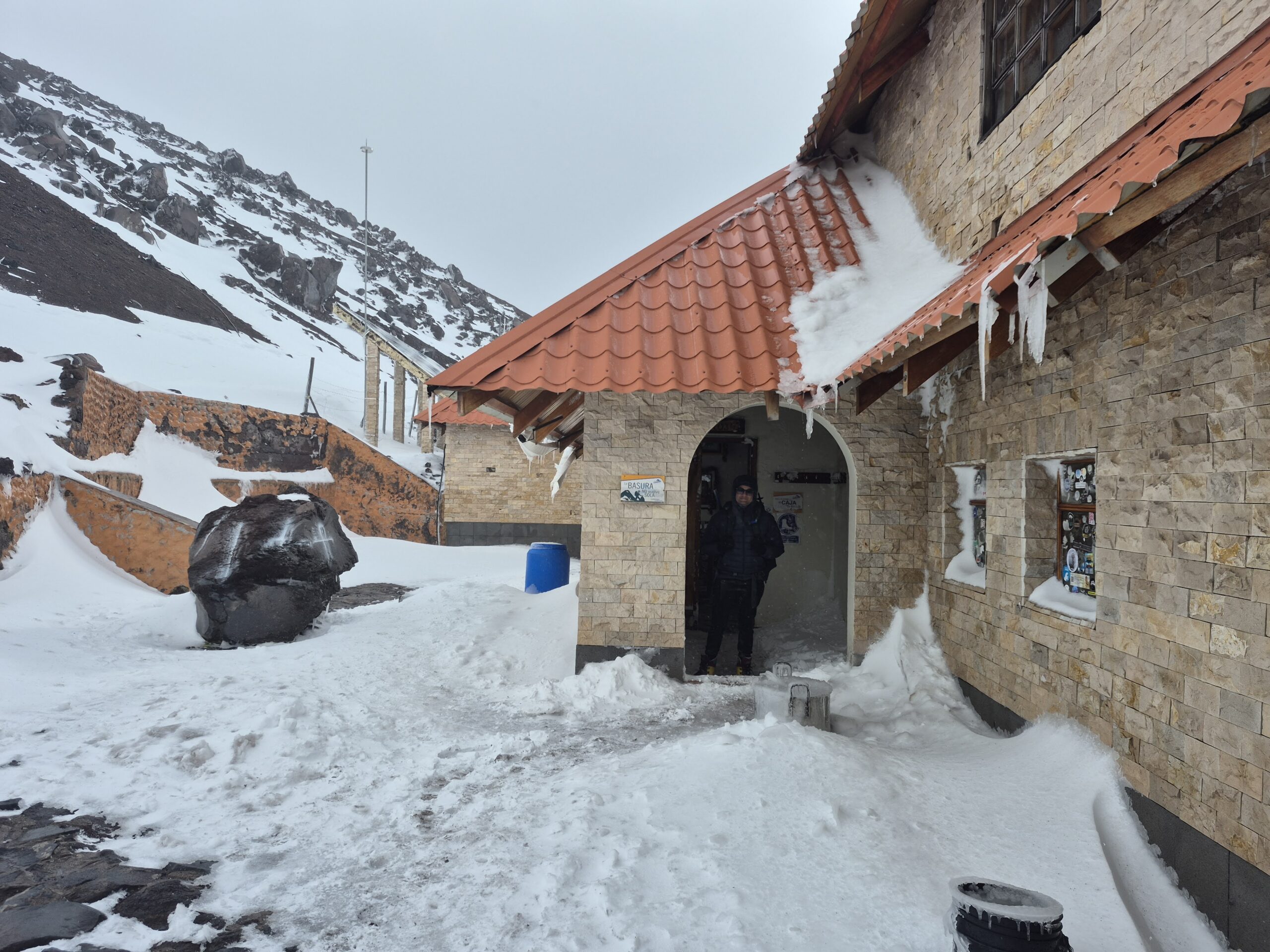
Arun, Ashutosh, Sri and I arrived at the refuge at around 1:30pm after 2:30hrs of hiking. It was a short hike but it was steep. We climbed nearly 3,000 ft in under 2.5 miles. It was also very cold, windy and foggy – once again denying us the views.
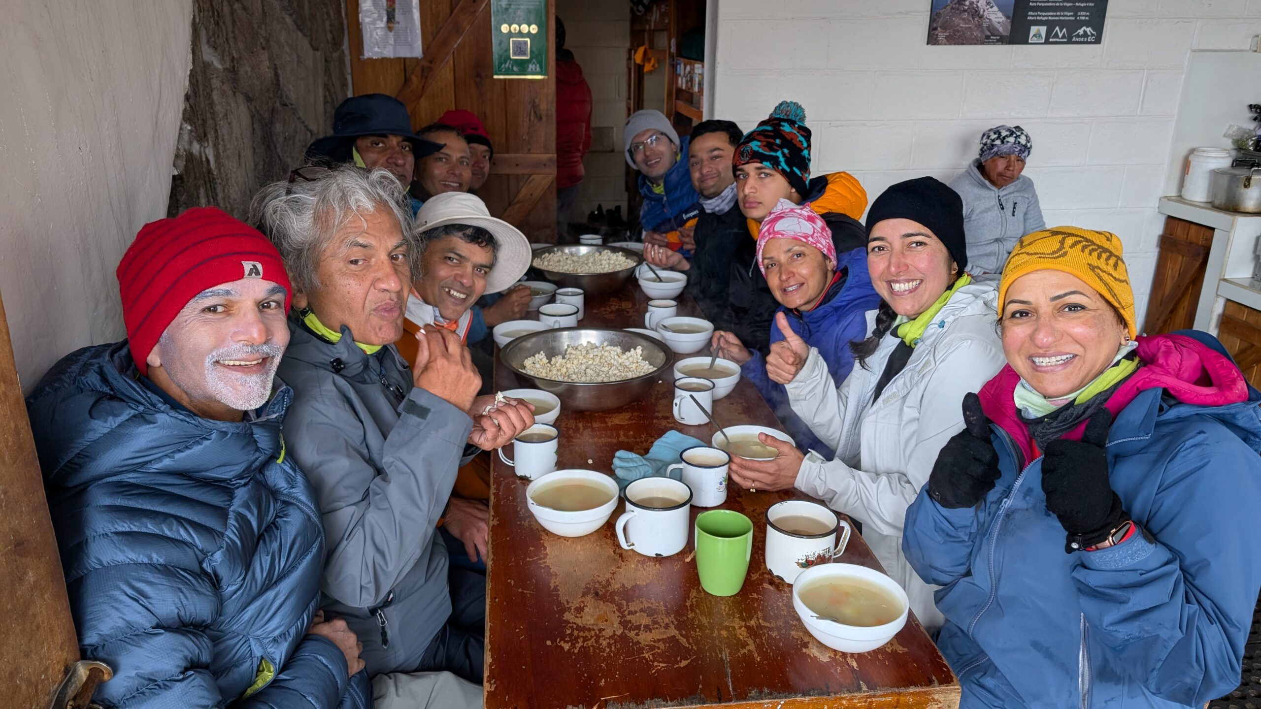
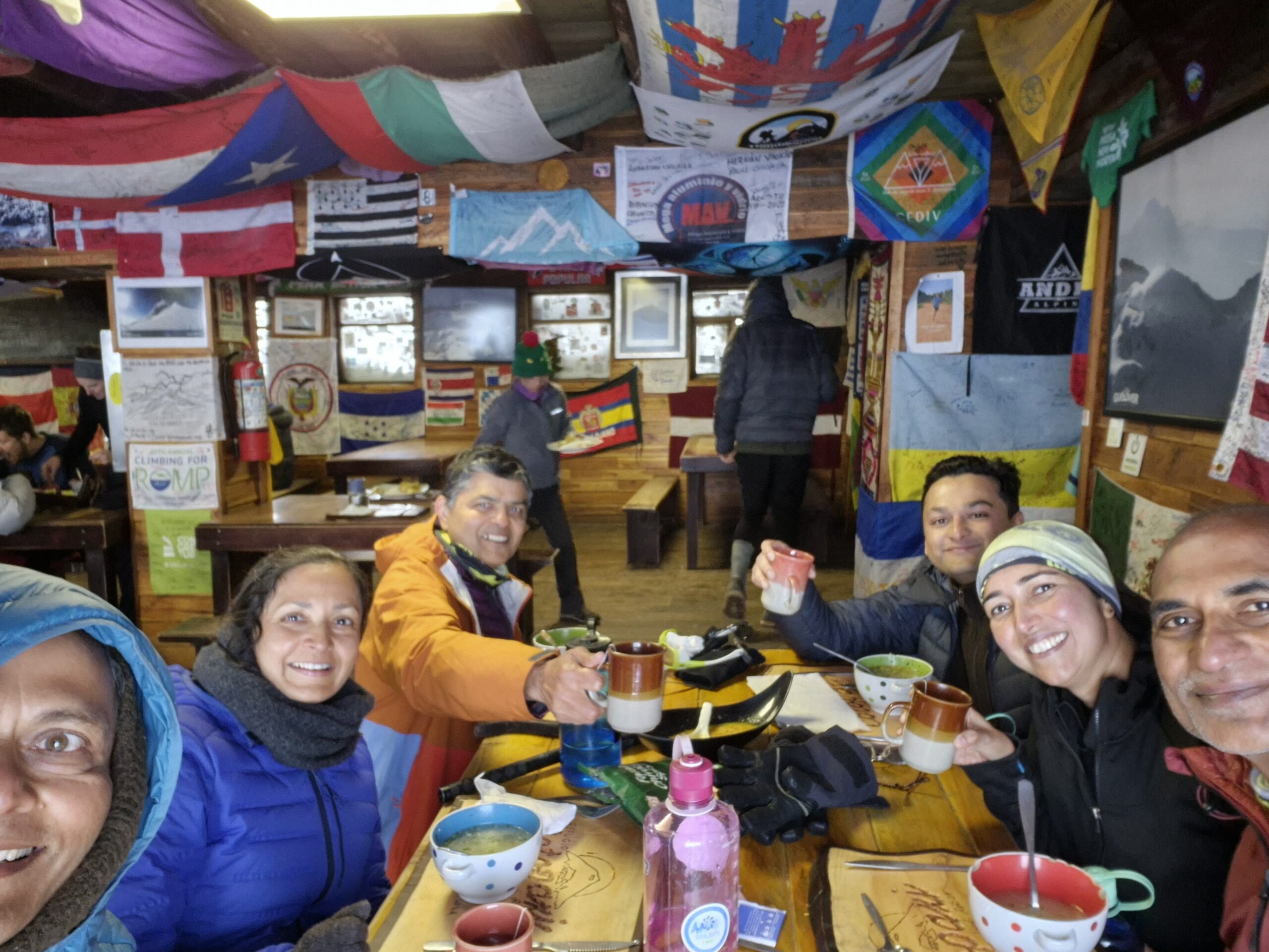
We were served hot coffee / hot chocolate, potato soup and popcorn by the staff at the refuge. I usually don’t like popcorn but it tasted so good in the cold 🙂
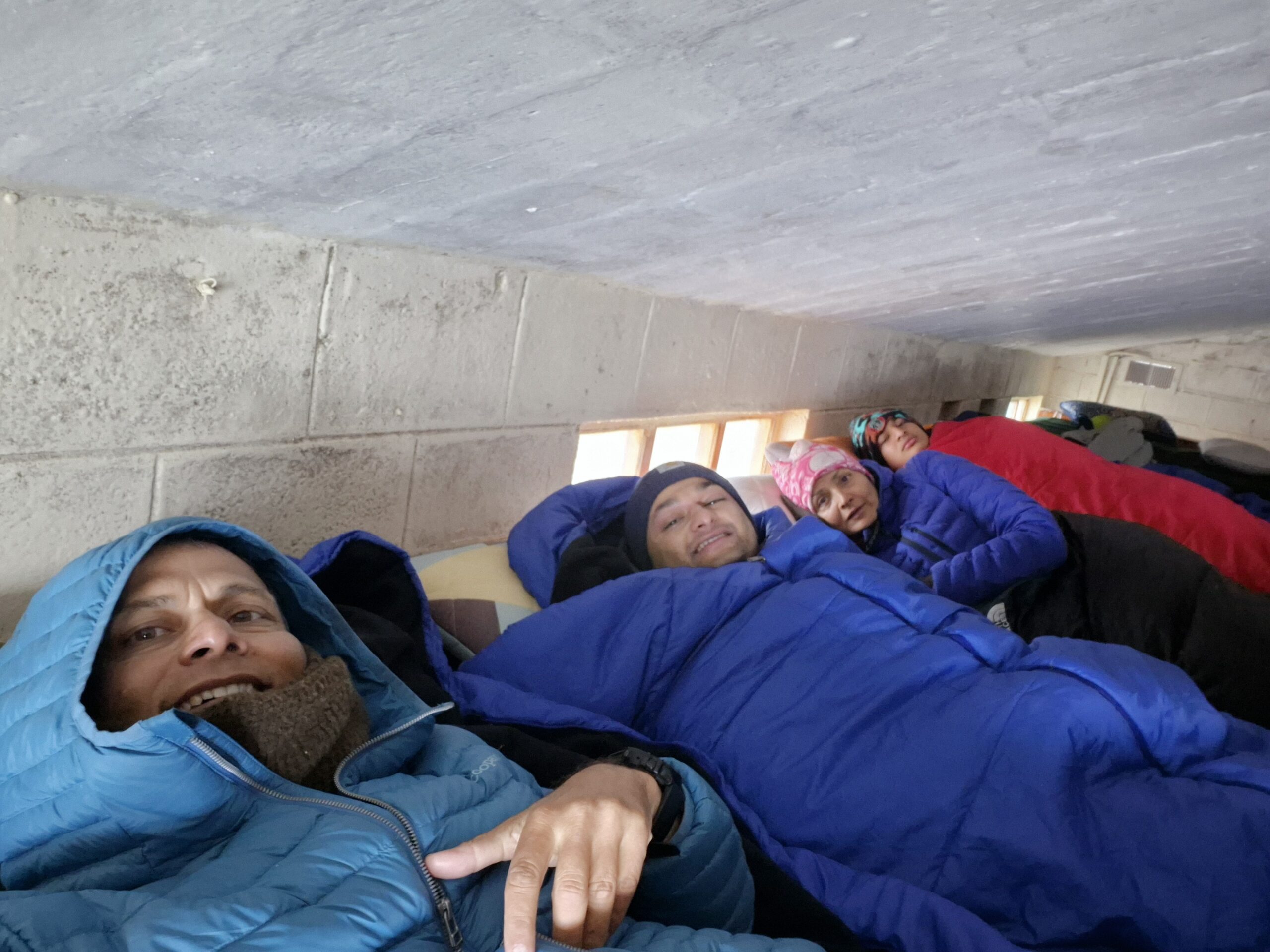
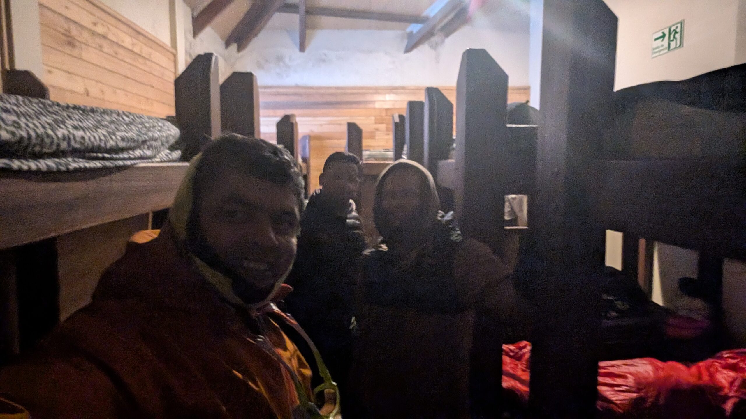
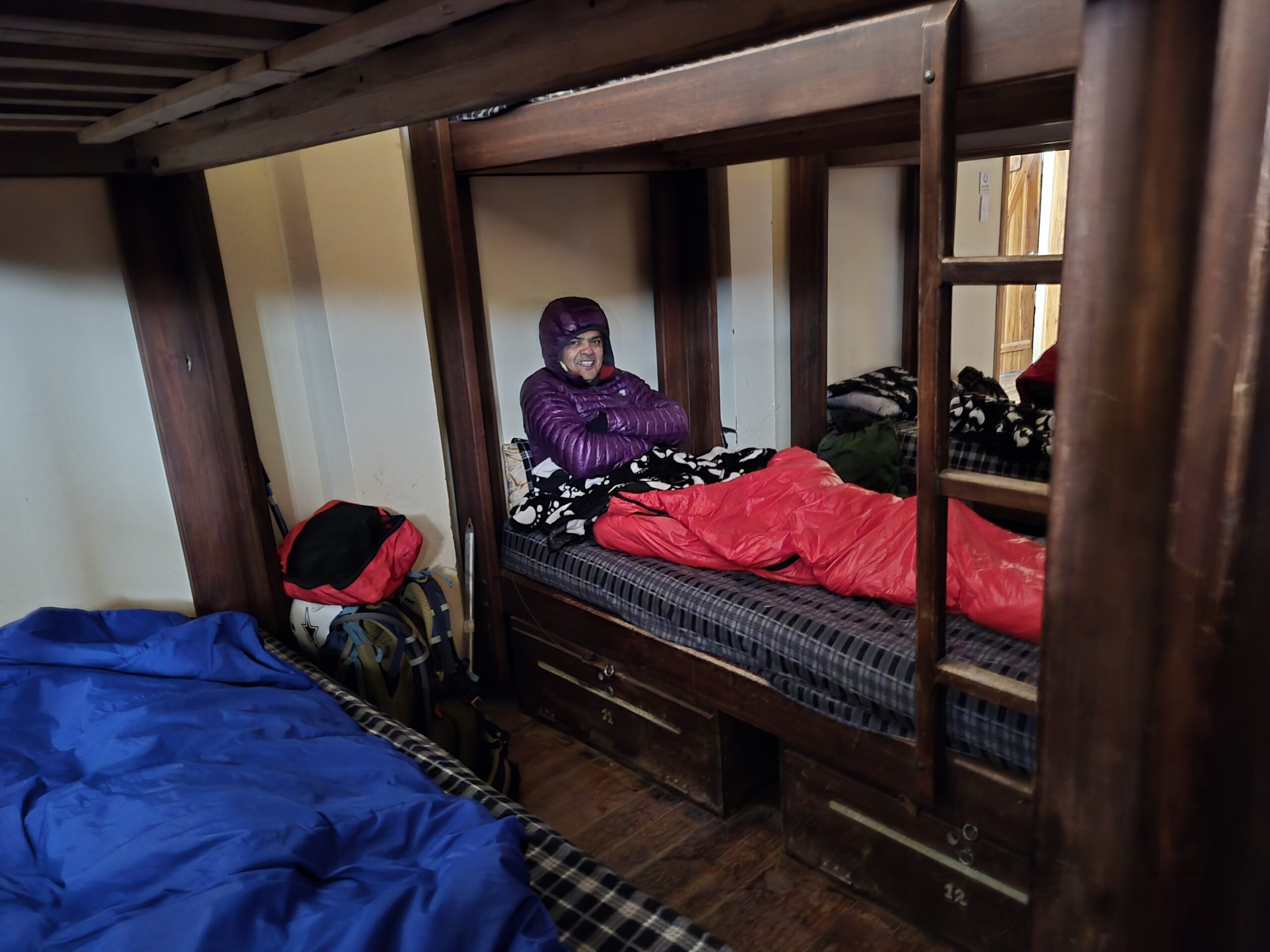
We then settled in the bunk beds. The total capacity was only about 20 beds. We were the only group in the refuge.
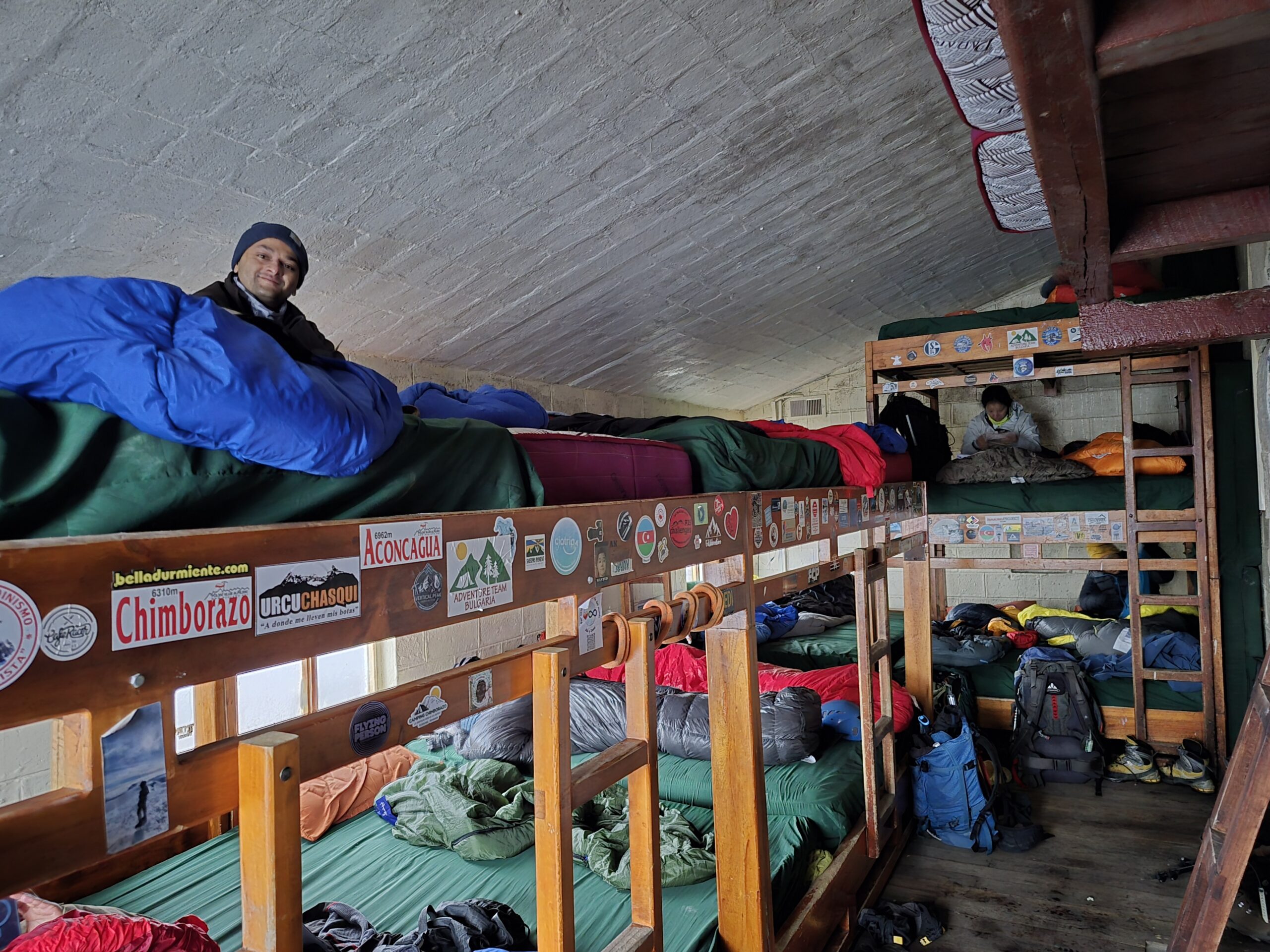
It was a really small refuge. There were just two rooms – bunk beds and a small kitchen. Restrooms were outside the hut. However, it was an ordeal to go outside because it was really cold. Flushing the toilet was a manual affair. There was a drum of water with a bucket inside it. We had to fill up the bucket and use it to flush the toilet. With near freezing temperatures, the water was extremely cold and it would take a while to get the feeling back in our fingers again.
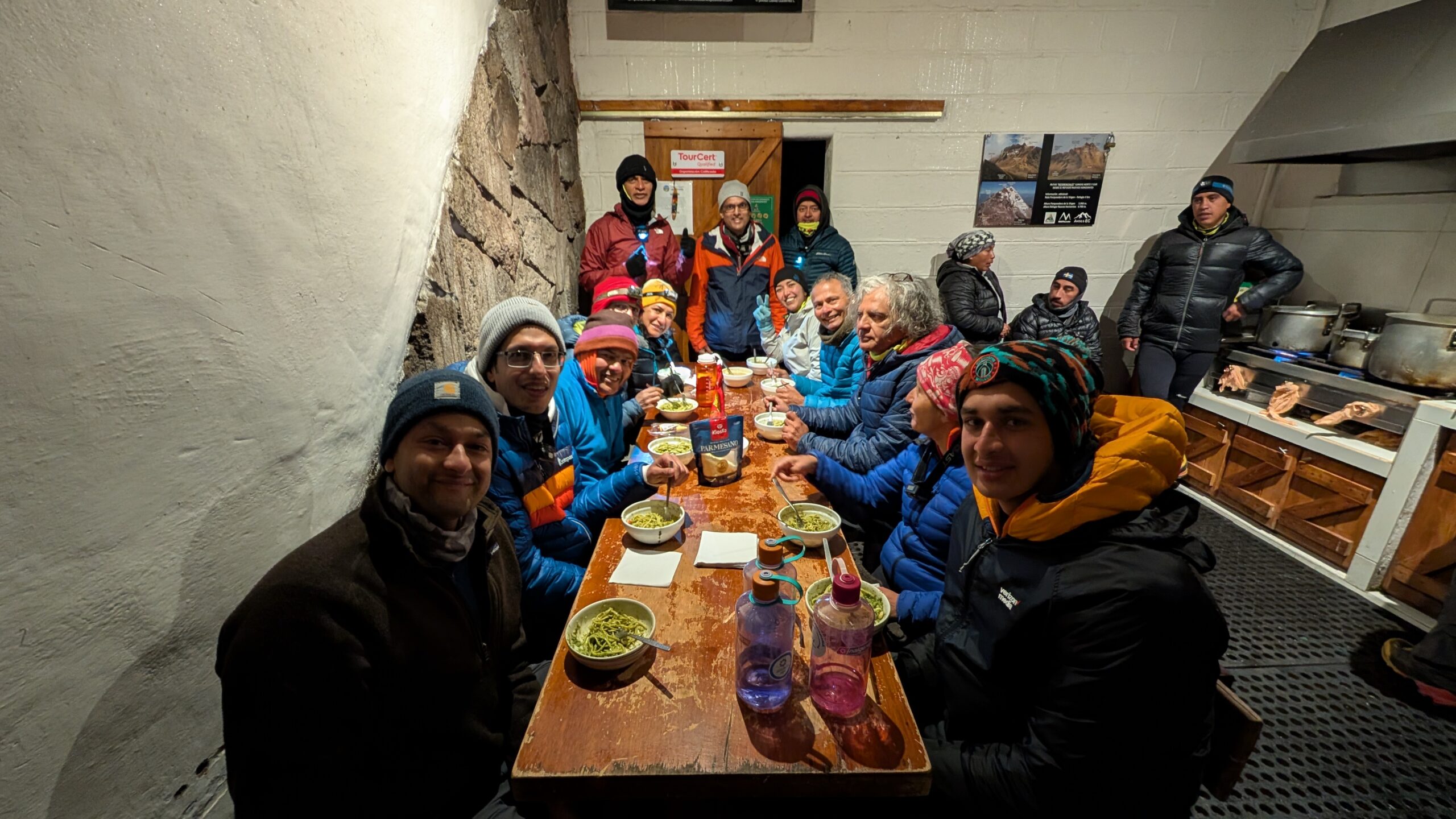
The kitchen staff made pesto pasta for dinner. The pesto was made fresh. It was perhaps the best pesto pasta I have eaten. We all enjoyed it tremendously. Usually your appetite goes down at high altitudes but the pasta was so good that we overate! We thanked the staff profusely for such a delicious meal.
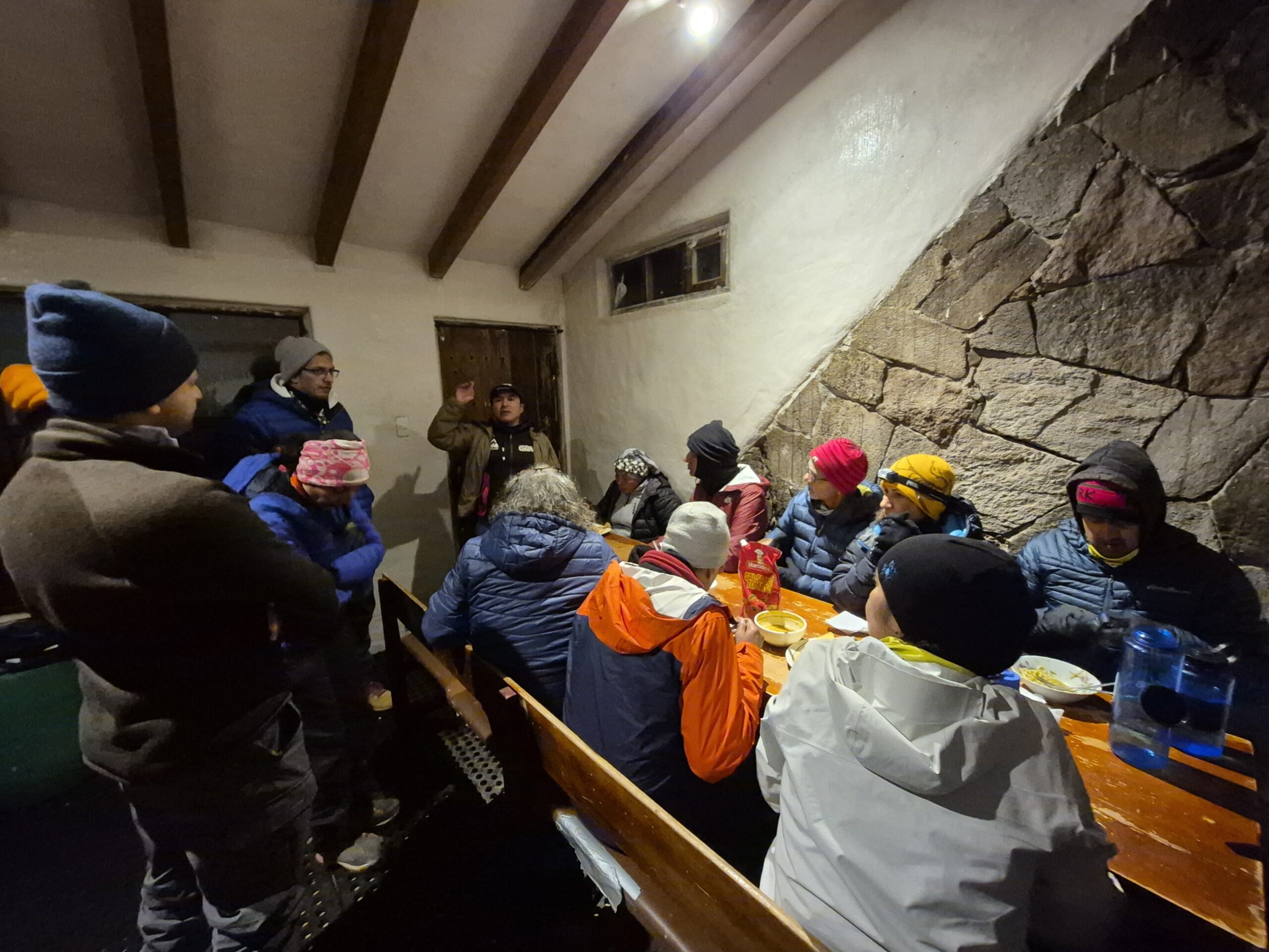
After the dinner we were briefed by the guides about the climb next morning. It had started snowing a bit which would turn into ice overnight and potentially make the climb really dangerous. The usual time for summit push is 5am. They were going to keep an eye on the weather and wait until about 8am at the maximum to see if it would be safe to climb.
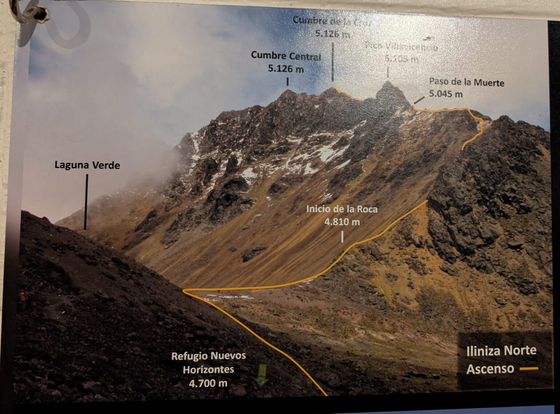
We studied the climbing route. While Rucu Pichincha and Ruminahui were mostly class 2 with class 3 scrambling near the summit, this route is class 3/4. The first section Inicio de la Roca means “start of the rocks”. The next section is Paso de la Muerte which literally means “Pass of death”. Although the guides assured us that it is not as deadly as it sounds, the name did send some shivers down our spines.
We went to bed with some uncertainty about the weather. It was so windy outside that the door to our refuge had to be kept closed using a long hammer which acted as a doorstop.
Day 4 (July 2)
Scheduled target: Summit Illiniza Norte (16,818 ft)
What we did: Returned back from Nuevos Horizontes Hut (15,583 ft)
Start Elevation: 12,795 ft
Descent: 2,788 ft
Start Time/Time to descend: 8:45 am / 1:15 hrs (10:00 am)
Unfortunately the weather did not improve. It was a blanket of snow outside.
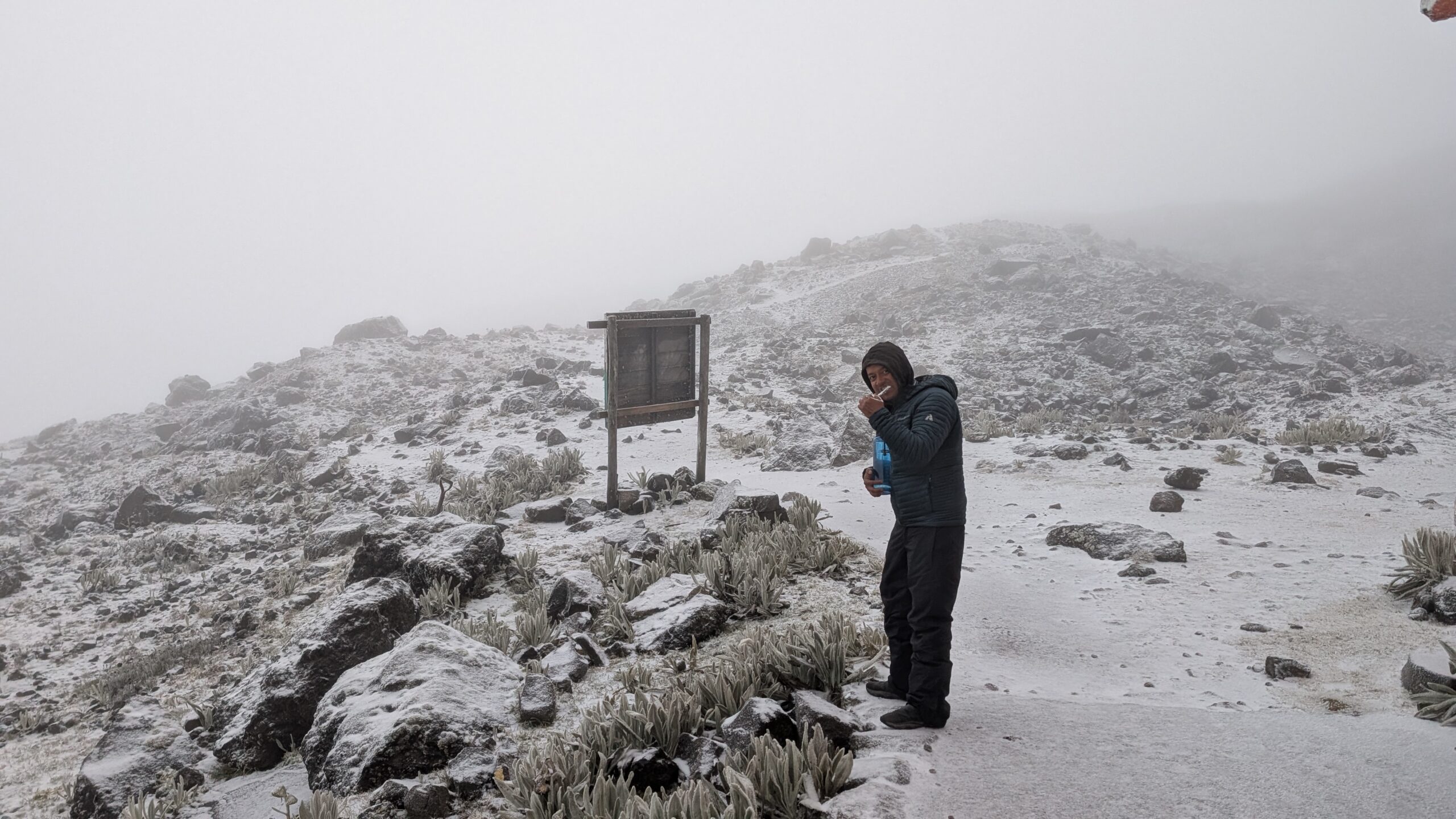
The guides deemed it unsafe to climb. They said that one of them went up the trail and the conditions were not good. It was slippery with low visibility. Going up the steep rocks and crossing the exposed pass would pose an undue risk. We were not happy about abandoning the climb but accepted their decision and decided to head back instead. In hindsight, the guides should’ve known about the weather conditions and provided us with micro-spikes. This was the first of many such ‘let’s abandon’ decisions by our guides. We didn’t realize it until it happened a few more times – it seemed that the guides were not really motivated to help us summit. They looked for an excuse to take the easy way out at the first chance they got.
Anyhow, we started our descent at around 8:45am.
The hike down was fairly easy and quick.
We made it down in just 1:15hrs.
It was disappointing that we had to abandon Illiniza Norte summit but we tried to take it in stride. We went back to CDM (our hotel in Machachi), had lunch and rested for a while. We checked on Meenal who was doing just fine. Later we found out that Diego charged her $6 for extra breakfast (because she had to return back and had breakfast at CDM instead of the refuge) and wanted to charge for bringing her down and also $20 for the extra electricity and water she used at CDM. This was absolutely shocking and we were wondering how he got these glowing reviews. Mind you, Ecuador is really inexpensive and you have a full dinner for $6. This was another sign that he really only cared about making money.
Our organizer, Diego gave us the climbing equipment needed for the next three climbs (Cotopaxi, Cayambe and Chimborazo). We already had our helmets. We now got the harness, crampons, ice axe and mountaineering boots. He also did a complete gear check for everyone to make sure that we had the right clothing and other gear – e.g. jackets, gloves, headlamp etc.
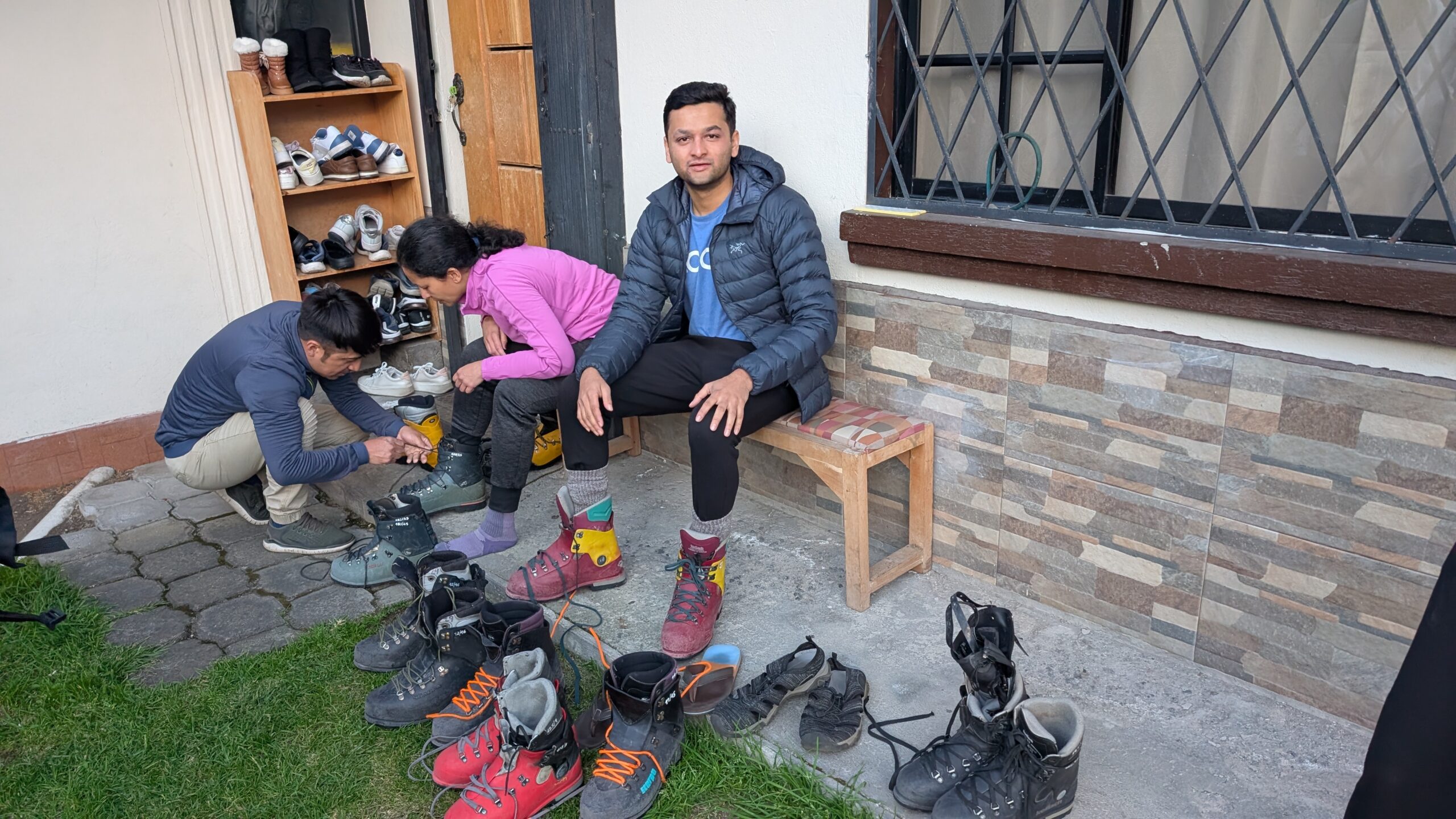
Mountaineering boots are heavy and have a very stiff sole and uppers, providing protection against sharp rocks, crampon pressure and ankle twists. It takes a while to get used to them.
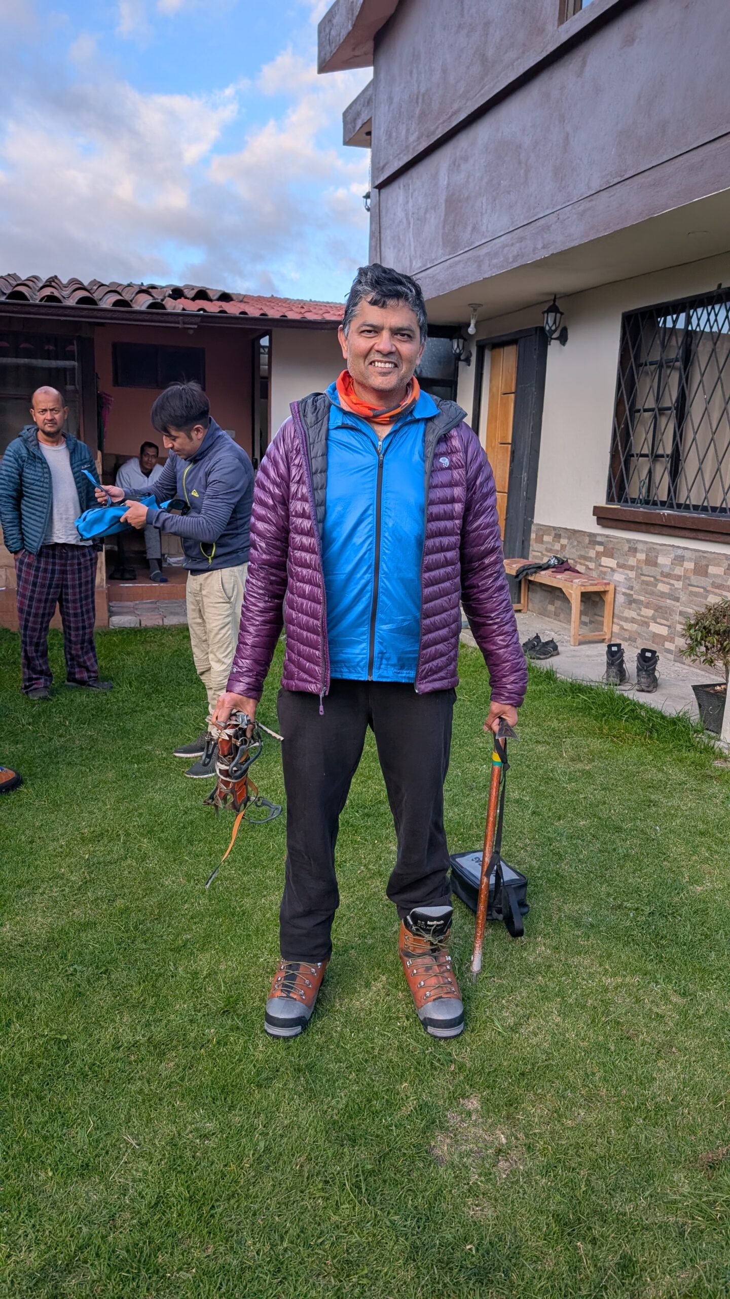
While he gave us the ice axe, Diego had not included a training session for using the ice axe! Only Arun and I had trained on it once earlier but it was a long time ago. My last training was 6 years ago when I climbed Mount Shasta. During that climb our guide had set aside the time to teach us the proper technique to hold ice axe, how to self belay and self arrest if you fall, climbing techniques using French steps and rest steps and how to glissade properly. There was no such training planned in our itinerary! To me this was a big oversight by Diego.
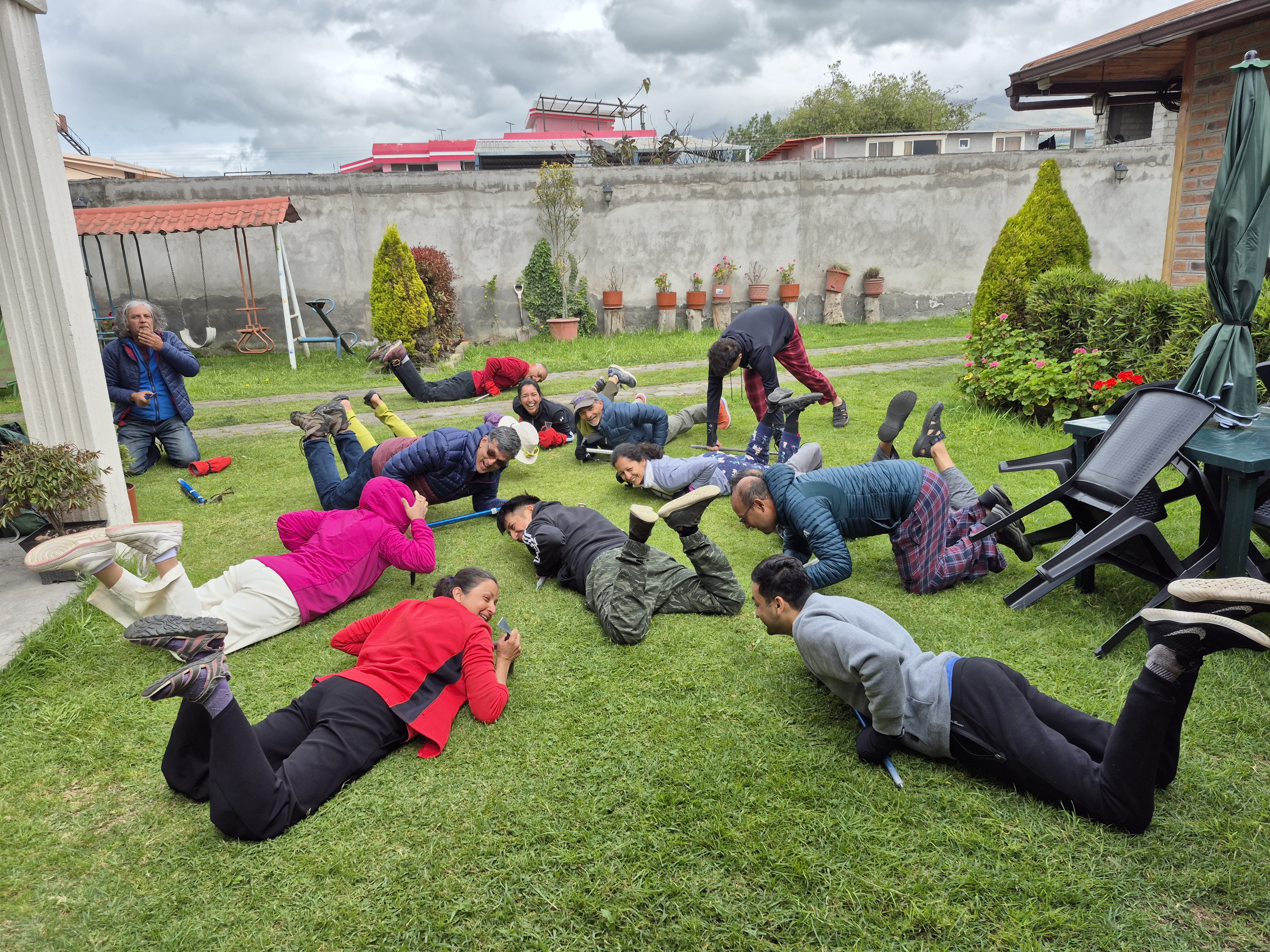
Anyhow, we insisted that we should at least get some training. Since we didn’t have time to train on snow, we had a short training session on Diego’s lawn instead.

We pretended to fall down and learned how to use the ice axe correctly to arrest a fall. We looked really funny doing it on a grass lawn. The lawn was full of holes by the time we got done :). This was definitely not adequate but the team gained at least some confidence.
Day 5 (July 3)
Scheduled target: Rest day
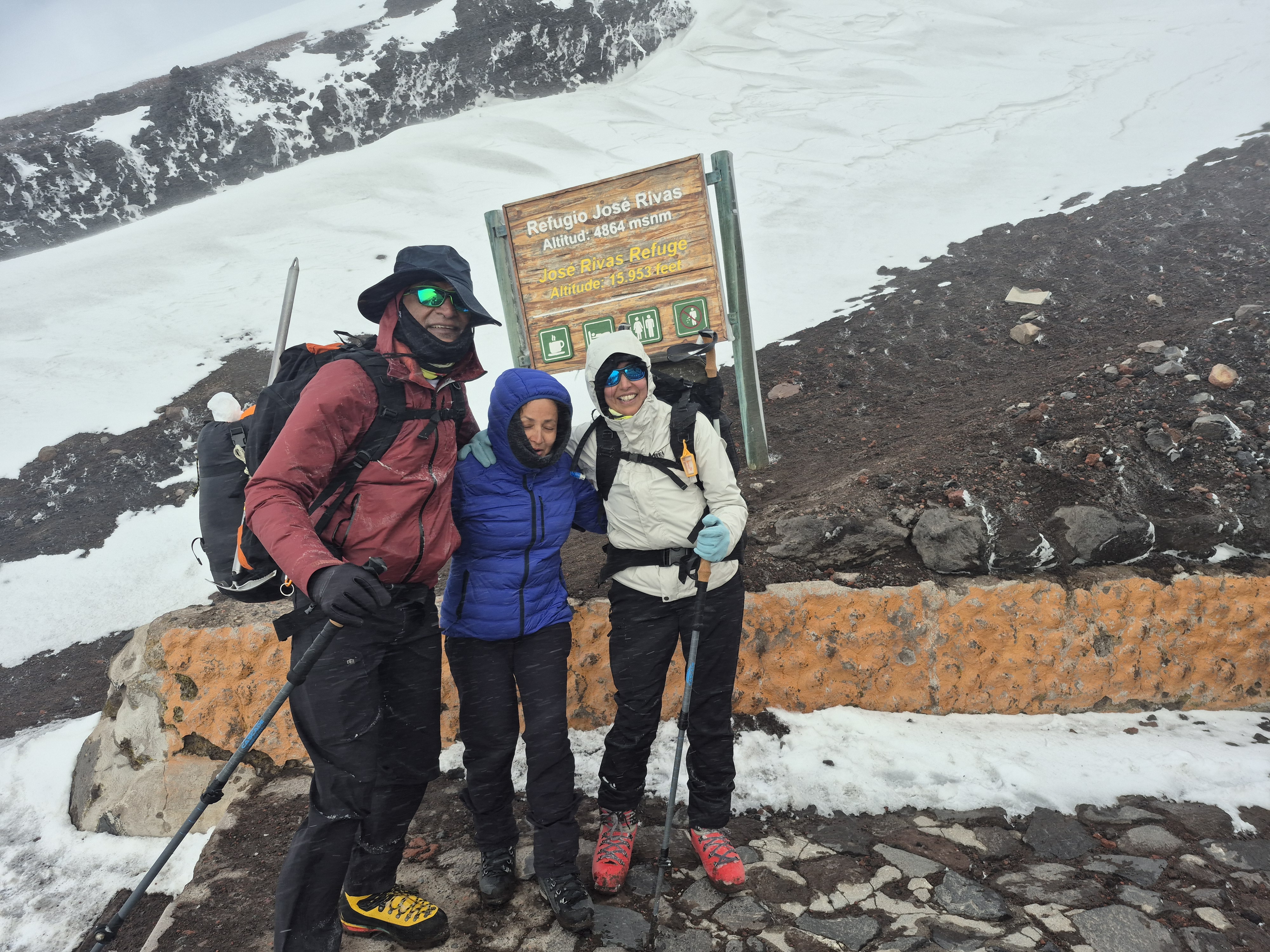
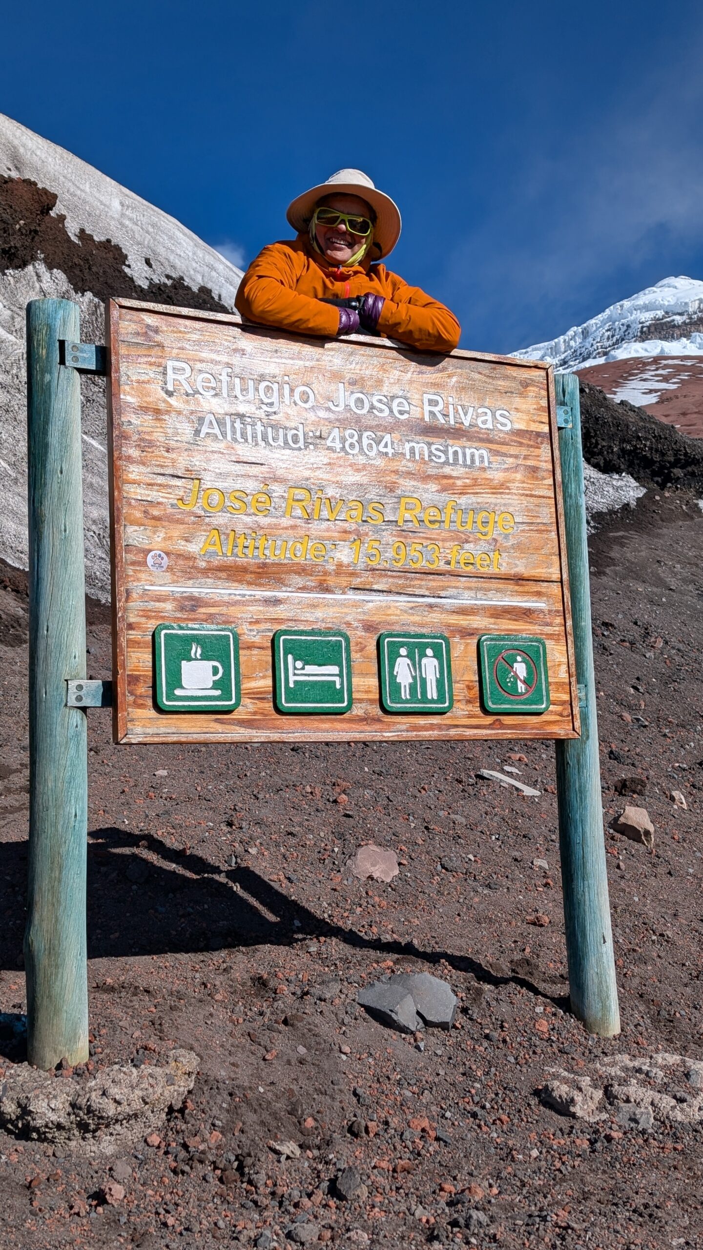
What I did: Went to Cotopaxi Refuge (15,985 ft) knows as Refugio Jose Rivas
Start Elevation: 15,100 ft
Climb: 885 ft
Start Time/Time to ascend: 3:15 pm / 1 hr (4:15 pm)
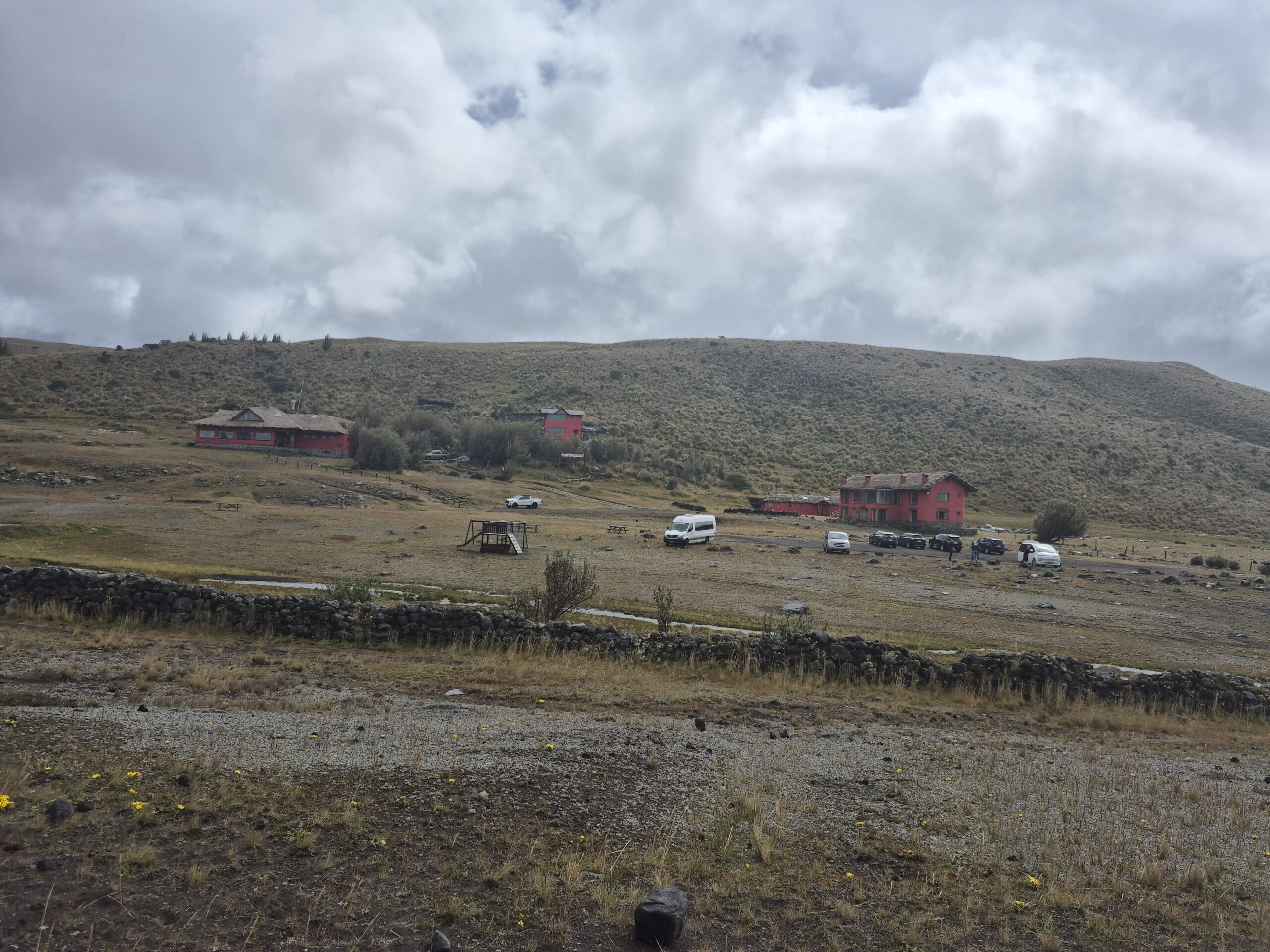
Today was supposed to be a rest day. However, six of us (Anu, Samir, Aditya, Divya, Sri and I) decided to go to the Cotopaxi refuge one day early to get extra acclimatization for our Cotopaxi climb. There were two reasons for that. First, yesterday was practically a rest day because we had to abandon our Illiniza Norte summit and second, Illiniza climb was supposed to provide extra acclimatization which we missed. We knew that staying in the refuge will be hard because there are no comforts there but decided that we should take the opportunity to spend some time at a higher altitude to maximize our chances of success.
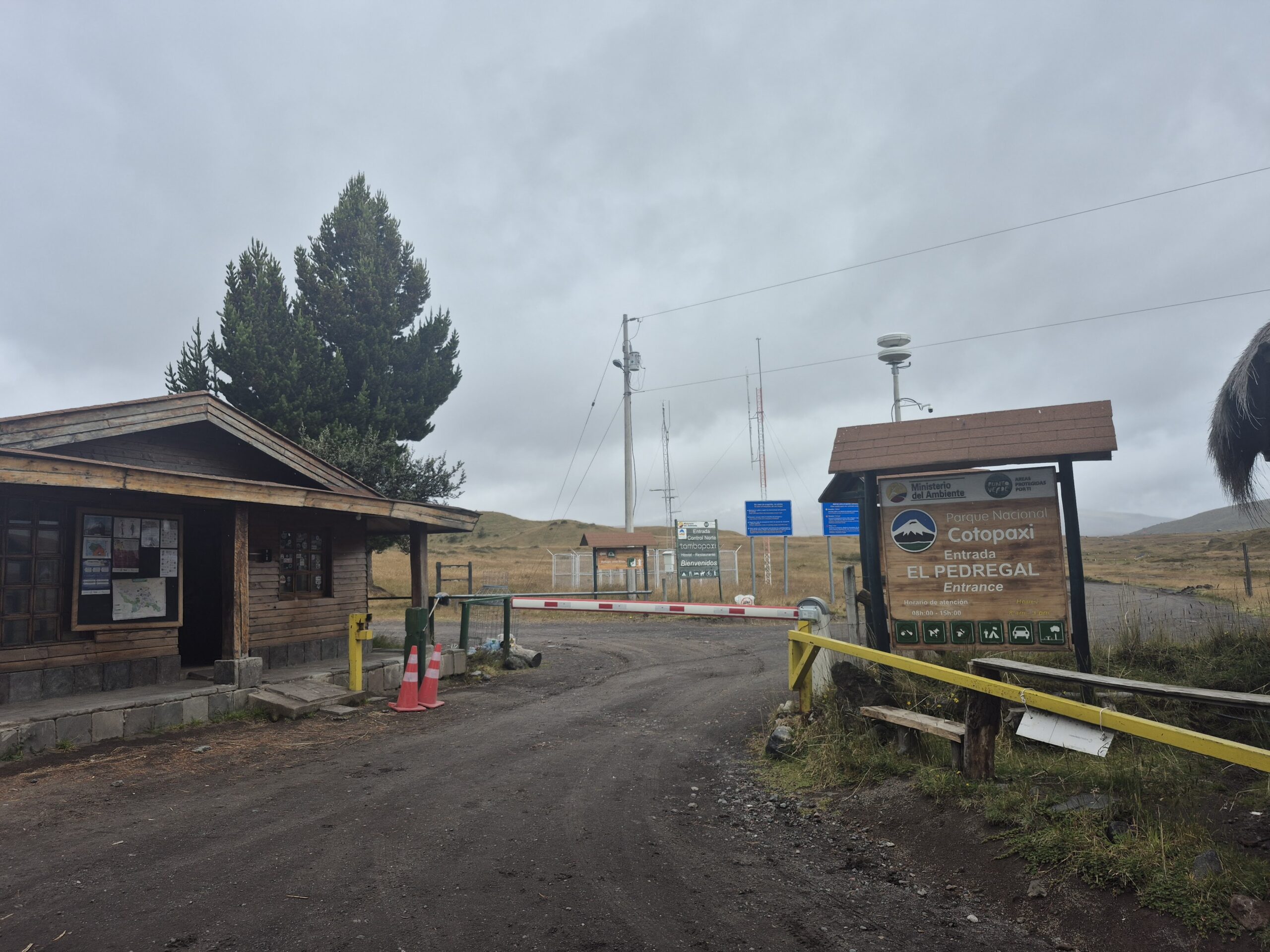
The road takes us past Tambopaxi, all the way to a parking lot which is at about 15,100 ft. Instead of our regular bus, we were cramped together in a small van with one driver and his assistant who sat in the trunk for most of the ride until we convinced her in our broken Spanish to sit with us.
We saw many big boulders strewn around along the drive. These must be from one of the explosions of Cotopaxi. It is still an active volcano. When we got out of the car, it was really cold and windy. The driver was really nice and helped us put on our gear.
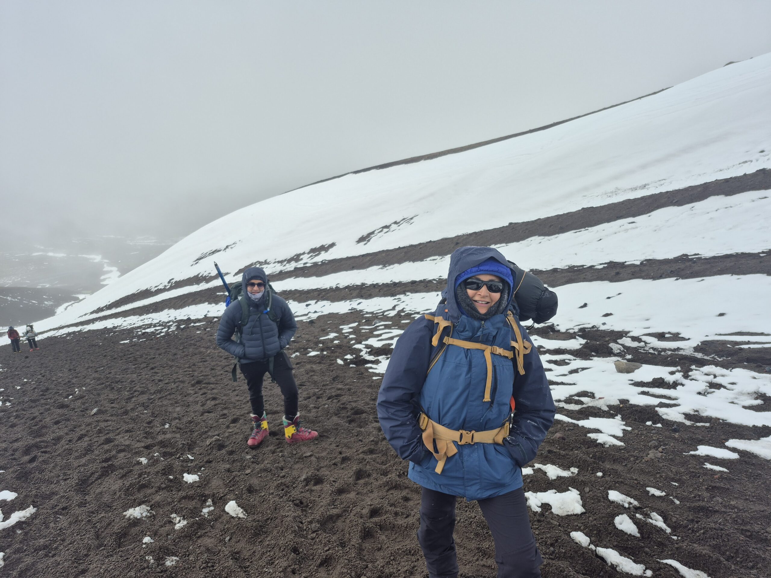
It was a short but steep climb to the refuge. The initial section was sandy with many snow patches. It was actively snowing and the winds were even more severe here.
After the initial climb, we turned left on an exposed ledge. The winds were so strong that I had to be careful not to get blown away! I struggled at times to stay on my feet and tried to stay away from the drop-off.
That short climb took us an hour and left us somewhat breathless.
The video above captures the snow covered grounds around the refuge. You can hear the howling wind, the frozen water in a bucket at the entrance and inside of the refuge (dining area and sleeping quarters)
You can see the frozen water in the metal bucket. The path to the left of the picture goes to the outside restrooms. Inside restrooms were only available for user from 6pm to about 7am. It was an ordeal to go outside because we had to bundle up and brave the cold, wind and snow. There were even a couple of instances of the doors jamming up trapping a person inside. Thankfully someone else came along soon enough to avoid a frozen death inside a toilet !
We got hot chocolate, coca tea, soup before our meal. Coca tea is very popular in the area. It contains a small amount of cocaine and supposedly helps with altitude sickness.
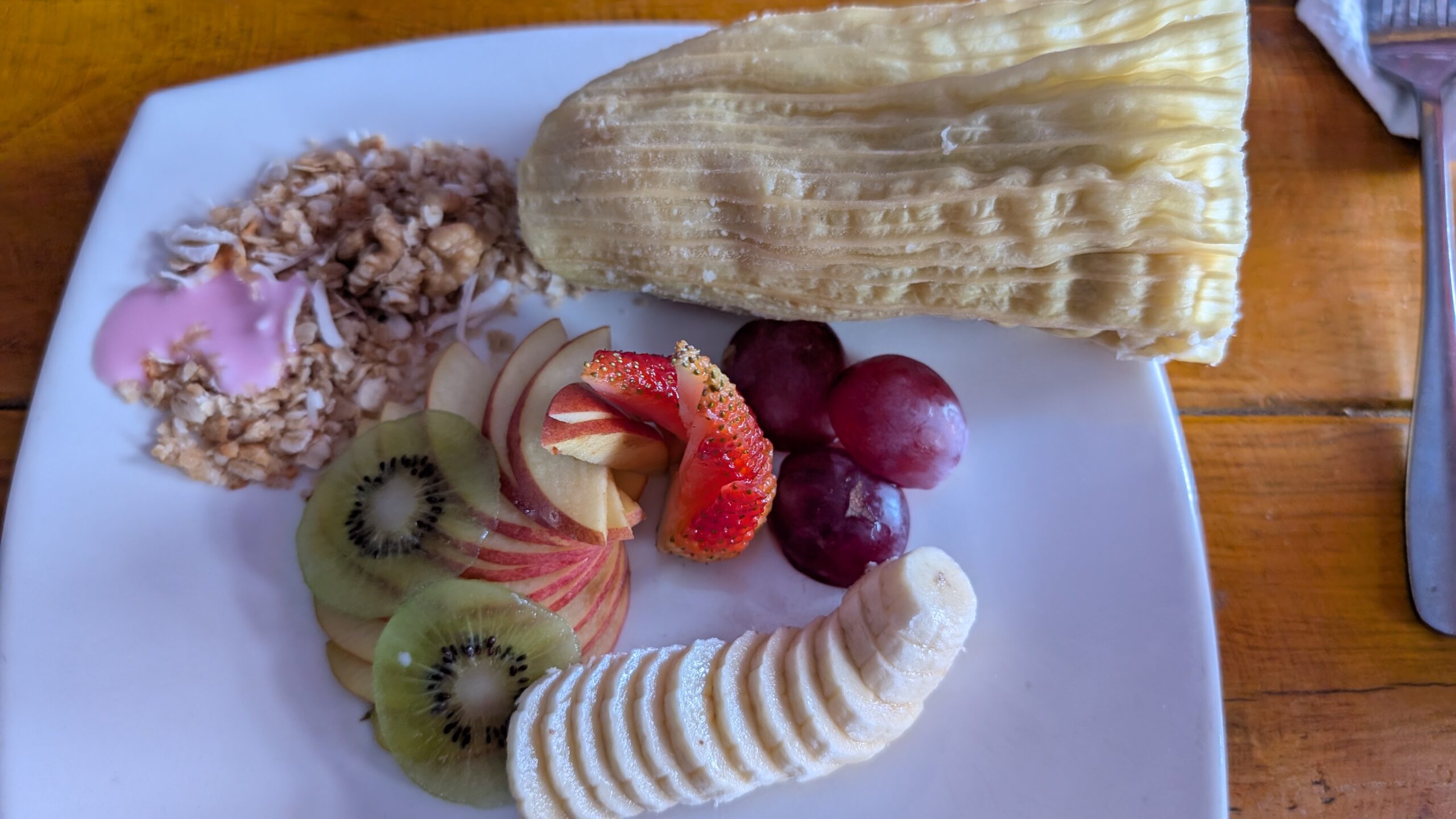
The food at the refuge was surprisingly good. Even the presentation was very nice.
We retired at around 6:30pm. There really wasn’t anything else to do anyways.
The winds picked up significantly during the night. I have never heard such howling winds. It sounded like wolves were fighting with each other or the mountain was telling us to go away and get lost. I recorded a short audio clip of the wind noise at night. It doesn’t quite capture how ominous it sounded but you will get some idea.
The wind did not let up the entire night, it was incessant. I also woke up with a massive pain in my neck. I think it was the pillow. Other than that, the beds were more comfortable than I had expected. They also provided us with a blanket. We had to use extra layers though because it was really cold. I had a gadget to measure the temperature – it clocked 34F (1C) in the sleeping area. The outside temperature, including wind chill would easily be 10-15 degrees lower.
Day 6 (July 4)
Scheduled target: Hike to Cotopaxi Refuge
What I did: Stayed at Cotopaxi Refuge (15,985 ft) to acclimatize
The six of us tried to make the best use of our time at the refuge. It was too cold to go outside. So we stayed indoors and played cards, waiting for the rest of the team to join us. There wasn’t anyone else at the refuge. The norm is for climbers to arrive at 4-5pm and start the climb at midnight. We six were the only ones braving an extra day at the refuge to optimize our chances.
The rest of the team arrived at around 4:30pm
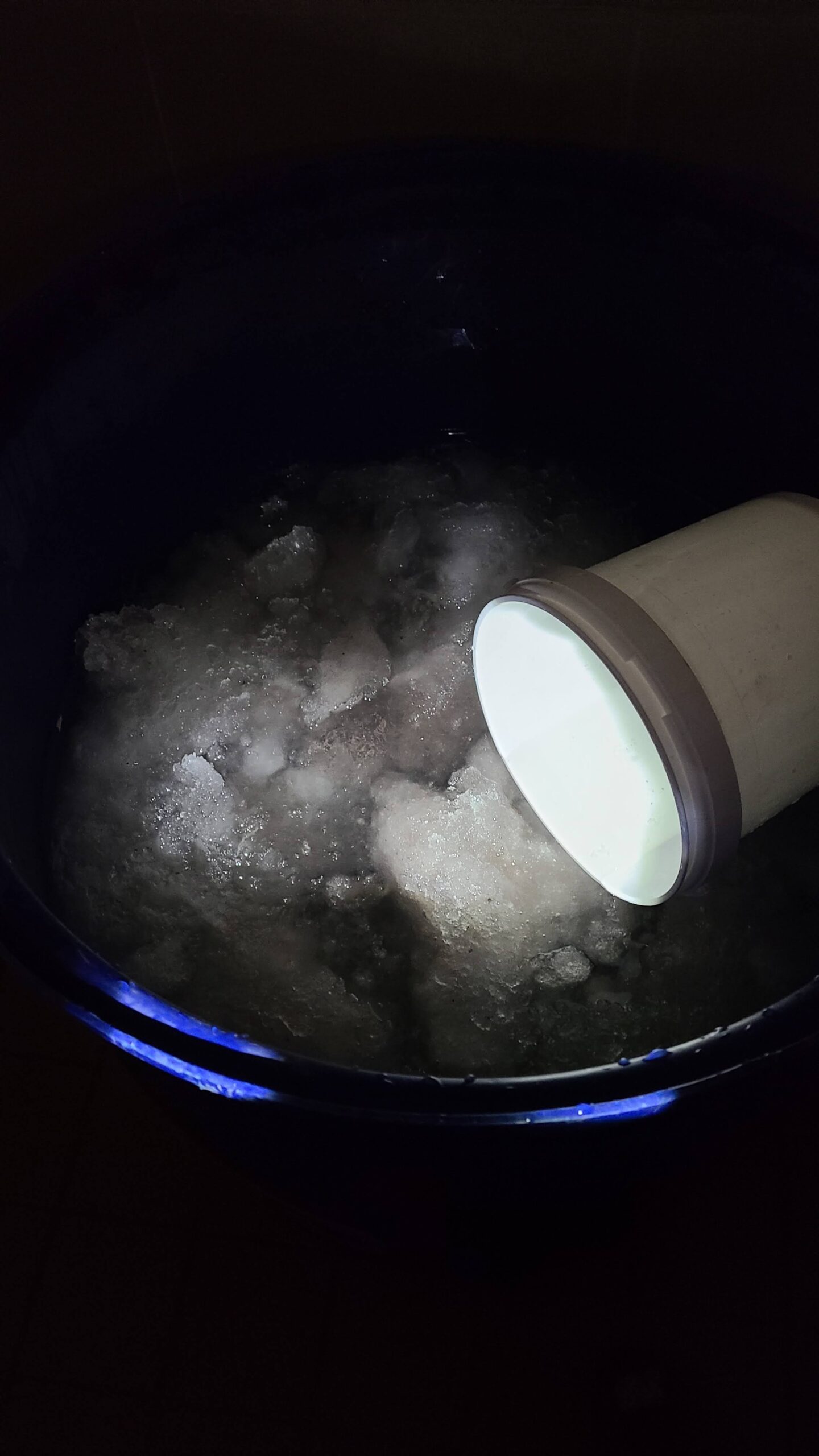
This picture was taken at 6:39pm. This is the water bucket for flushing the outside restroom. The water is completely frozen already. There was barely any sunshine during the entire day. It was just stormy weather with high winds and snow. This did not augur well.
We had 7 guides and 14 climbers (Sahil had already left). Therefore each guide would have two climbers attached to him. We decided on the pairings based on matching speeds. Sushil and Meenal decided to leave at 11pm to get a head start. The rest of the group was supposed to leave at midnight. Guides told us that the chances of summiting are very slim and we will have to take it on the fly.
I had a rather sleepless night. The guides never came to wake us up (which is customary). I did wake up a few times but the wind was still howling like crazy and I assumed that the climb was off.
Day 7 (July 5)
Scheduled target: Summit Cotopaxi
What we did: Hiked down from the refuge and went back to CDM
In the morning I heard about all the drama that happened at night. Some team members had come down on time to check if the climb was still on. The guides asked them to wait. Later the guides insinuated that our group was not ‘serious’ because everyone did not come down at the specified time. Samir really lost his cool. We have been training for months, have come all the way to Ecuador, taken 15 days off from work, spent a fair bit of money – because we are not serious? It felt yet another cop out by the guides – looking for a way to make money without putting in the work.
As it turns out, only a couple of climbers dared to go out in the night for the summit. They came back within an hour and reported 70mph winds! It was going to be impossible for anyone to climb. But the guide’s attitude left a poor taste in our mouths.
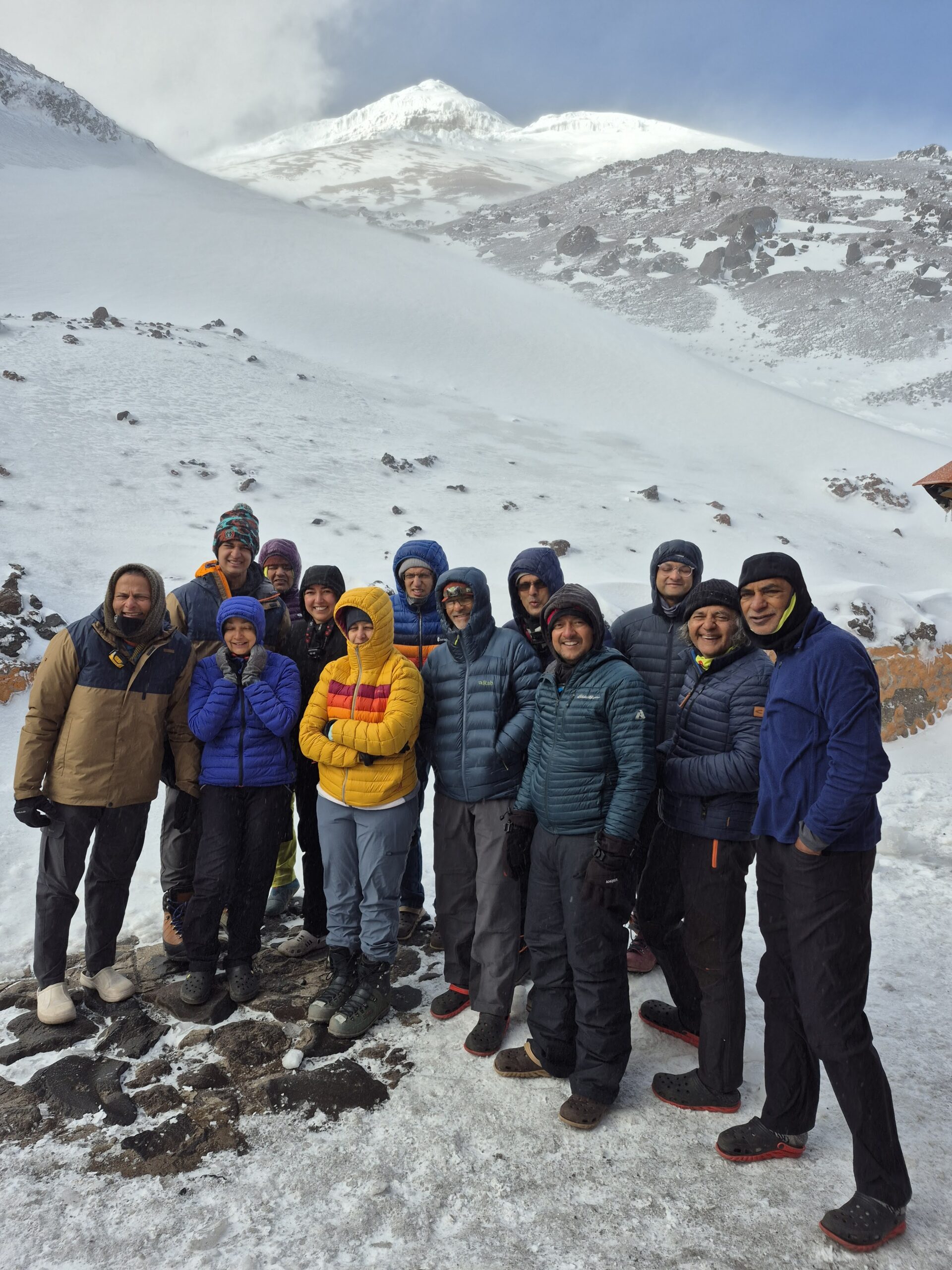
The weather looked better today morning. We could see Cotopaxi in the distance and there was even a bit of sunshine. However, it was not possible or practical to stay at the refuge for another day. The guides were not available either.
All we could do was to take some lots of pictures and head back. In Gautam’s words – only Photopaxi, no Cotopaxi 🙂 🙂
Grounds were completely covered in snow from the snowfall overnight. We started our descent back to the parking lot at around 8:45am. Winds were still very strong and we had to frequently balance ourselves. It was strong enough to topple us especially with our big rucksacks on the back.
What took us an hour to climb, took only 16min to descend! Divya dropped one of her gloves on the way down which promptly flew away and we thought it was lost. Miraculously we found it on the road on the drive back!
We reached our lodge (CDM) at 10:30-11:00. I had taken the Indian flag with me to the refuge in the hopes of taking a picture with it on the summit and then pinning it up in the refuge with all the other flags. However, that was not to be. So I got everyone to sign the flag and we took at picture with it at CDM.
The gap on the right was supposed to be filled by me using the “Add me” feature of Google Pixel. We weren’t quite able to make it work though 🙁
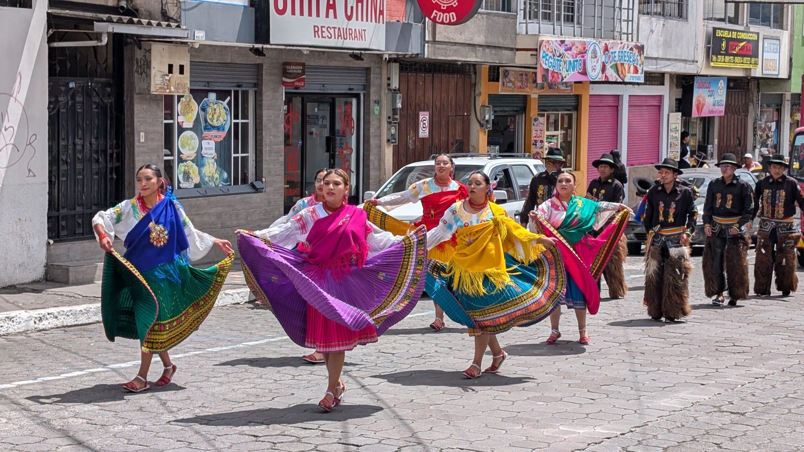
We then went out for lunch. There was some celebration parade going on in the town. People were dressed in colorful costumes and dancing to the music. No idea what the parade was about. Google search says that there the Paseo Procesional del Chagra (Parade of the Chagras) takes place on July 19. Sometimes there are costume parades in the days leading up to it.
Aditya had joined us only until July 5 to be able to climb Cotopaxi. Unfortunately that did not materialize. He went back so now there were 13 of us left in the team.
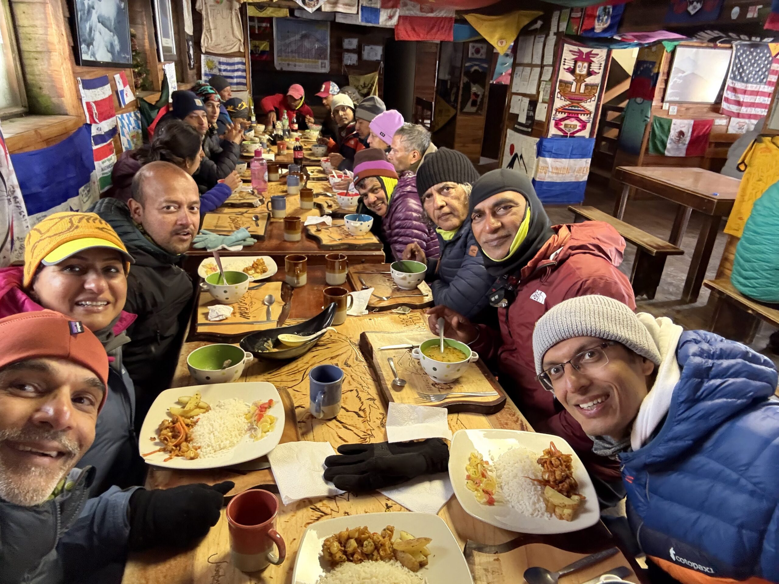
At dinner time we had a musical session. Both trained and untrained singers gave it a go. It was a fun evening.
Day 8 (July 6)
Scheduled target: Rest day (after Cotopaxi summit)
What we did: Rest day (without Cotopaxi summit)
We had not really earned a rest day but there wasn’t anything else to do. Divya and Sri had a great idea to cook a meal instead of eating out. We had been eating out for 10 days so far and in Machachi for the last 5 days. We had already exhausted all the dining options in Machachi which is a small town. It was also Sunday, which is farmer’s market day in Machachi.
Most of us went grocery shopping and hit the local market. Samir and Sagar stayed behind.
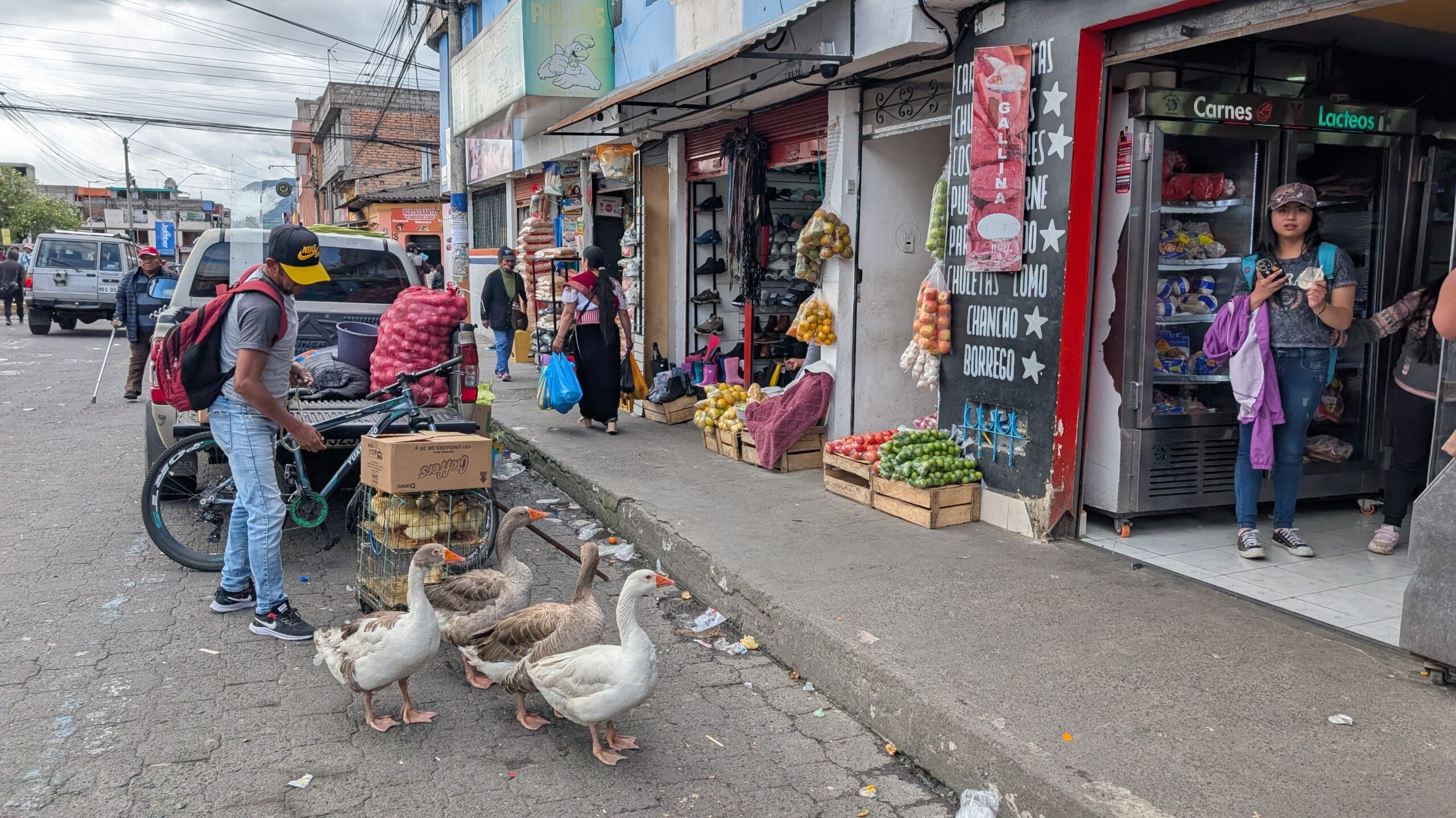
It was fun to use broken Spanish + Google translate to do our shopping. Divya and Neel knew some Spanish so they did most of the talking 🙂 Ecuador is very inexpensive compared to the USA.
Our plan was to go to the farmer’s market but we had somehow ended up in the mall. We now tried to find our way to the actual farmer’s market. We passed these small shops along the way and bought some rice, oil and spices. The whole vibe was very reminiscent of Indian markets – small shops, street vendors etc.
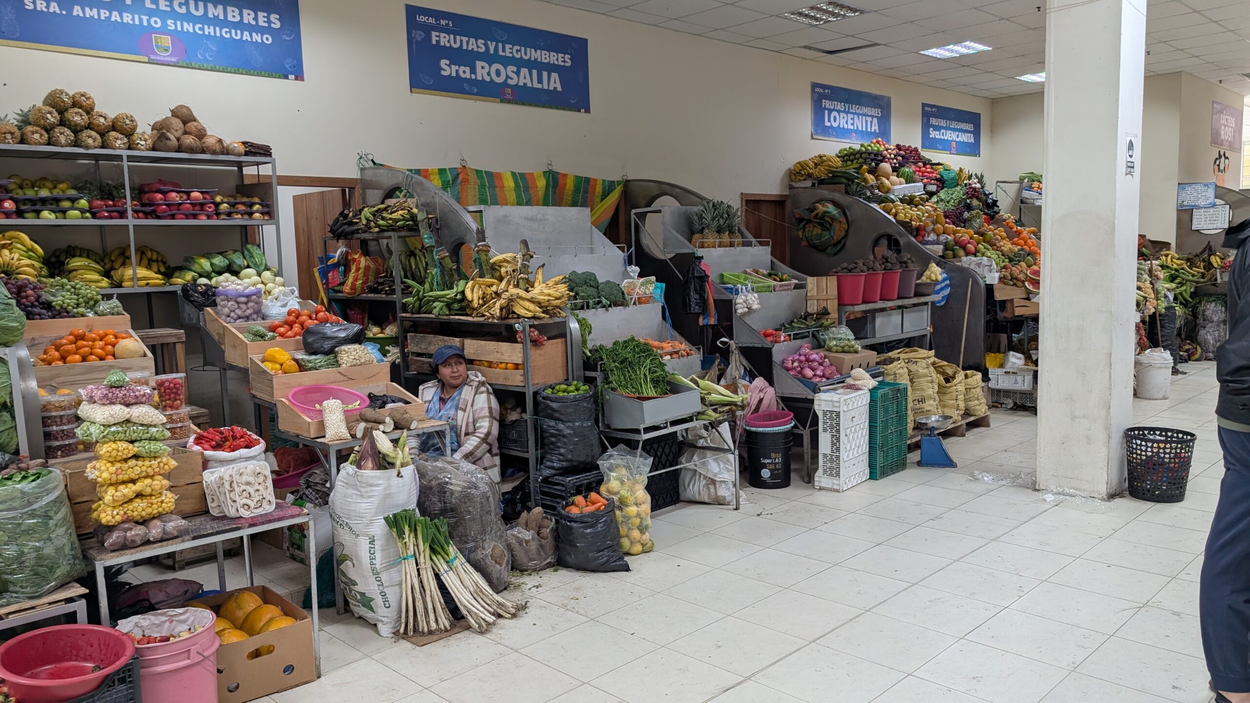
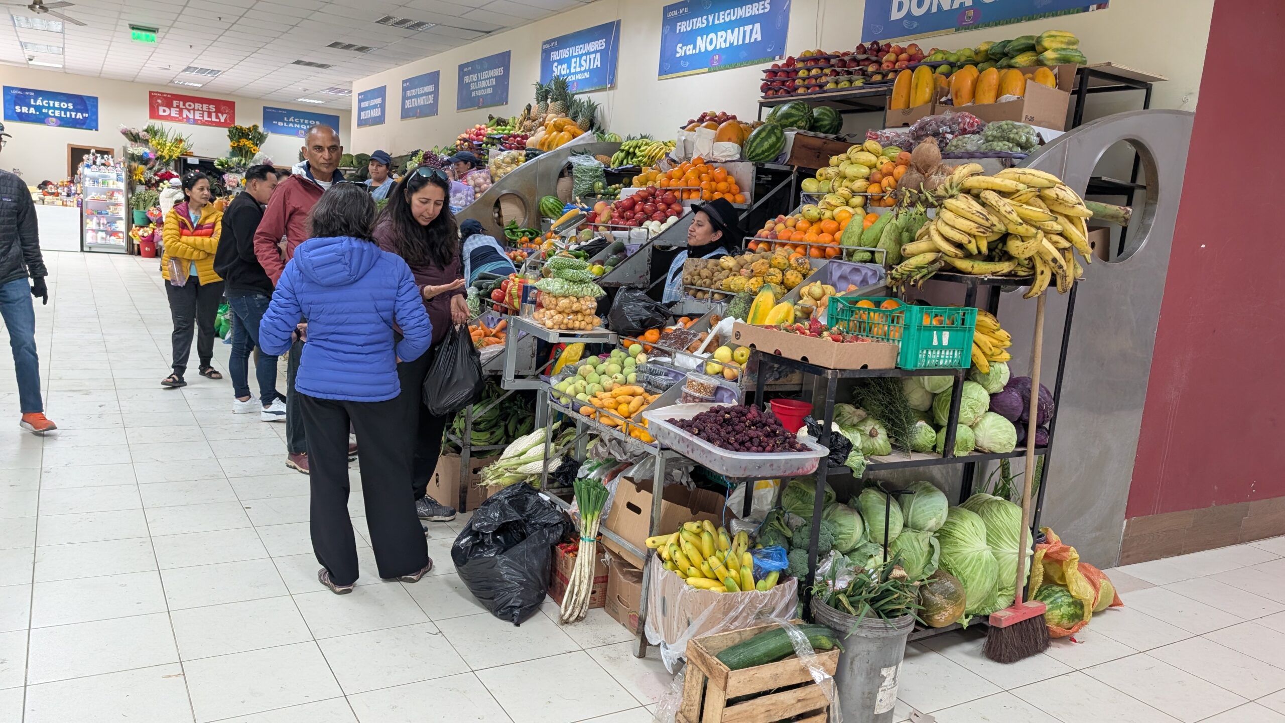
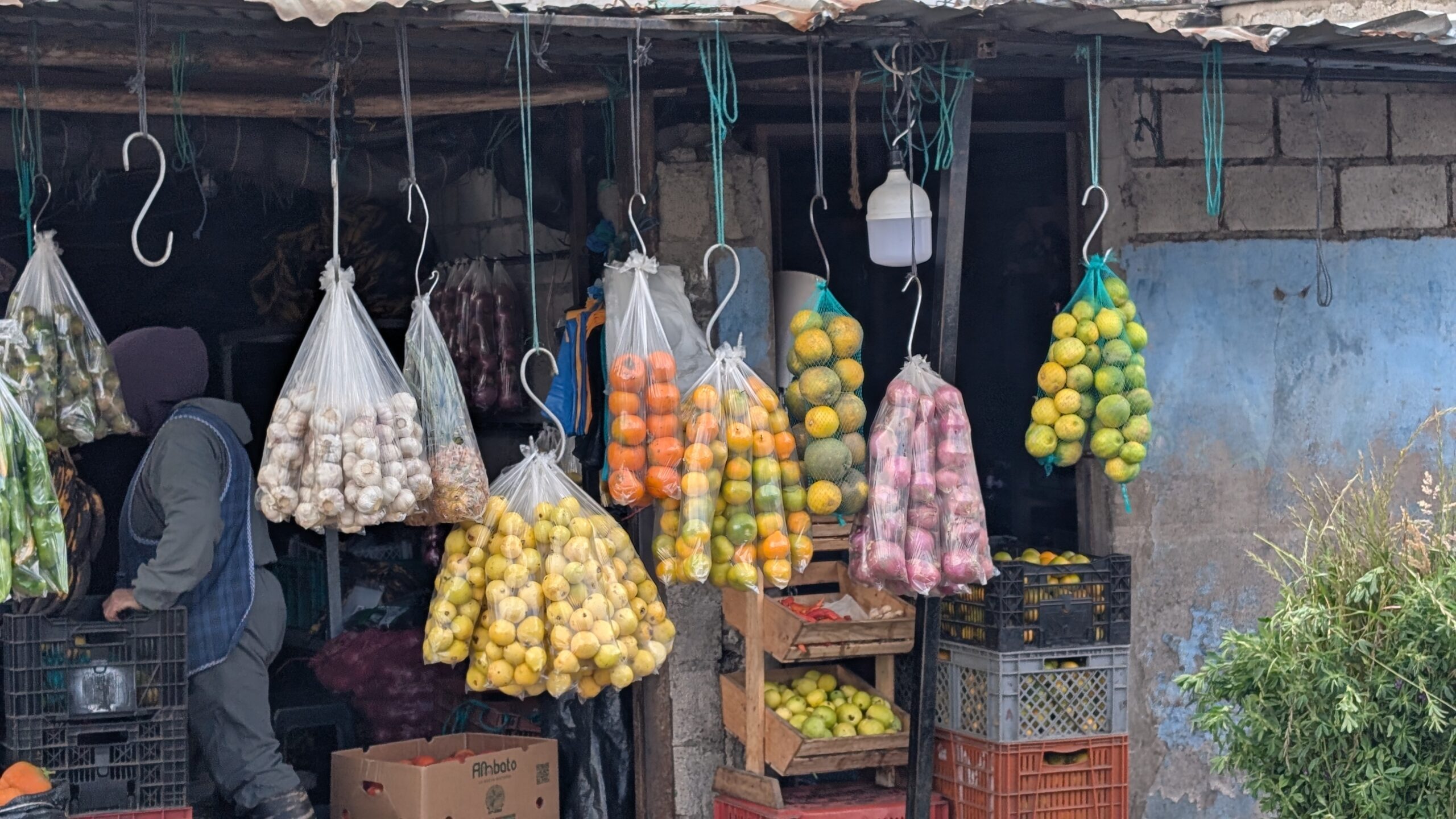
We discovered that a lot of fruits and vegetables are sold in in long plastic or mesh bags. They are all packaged for $1. As you can see below, you can get 10 oranges, 8 garlic cloves, 12-15 lemons, 12 onions etc., all for $1 each. Although we didn’t need these quantities, buying them unpackaged was a lot more expensive.
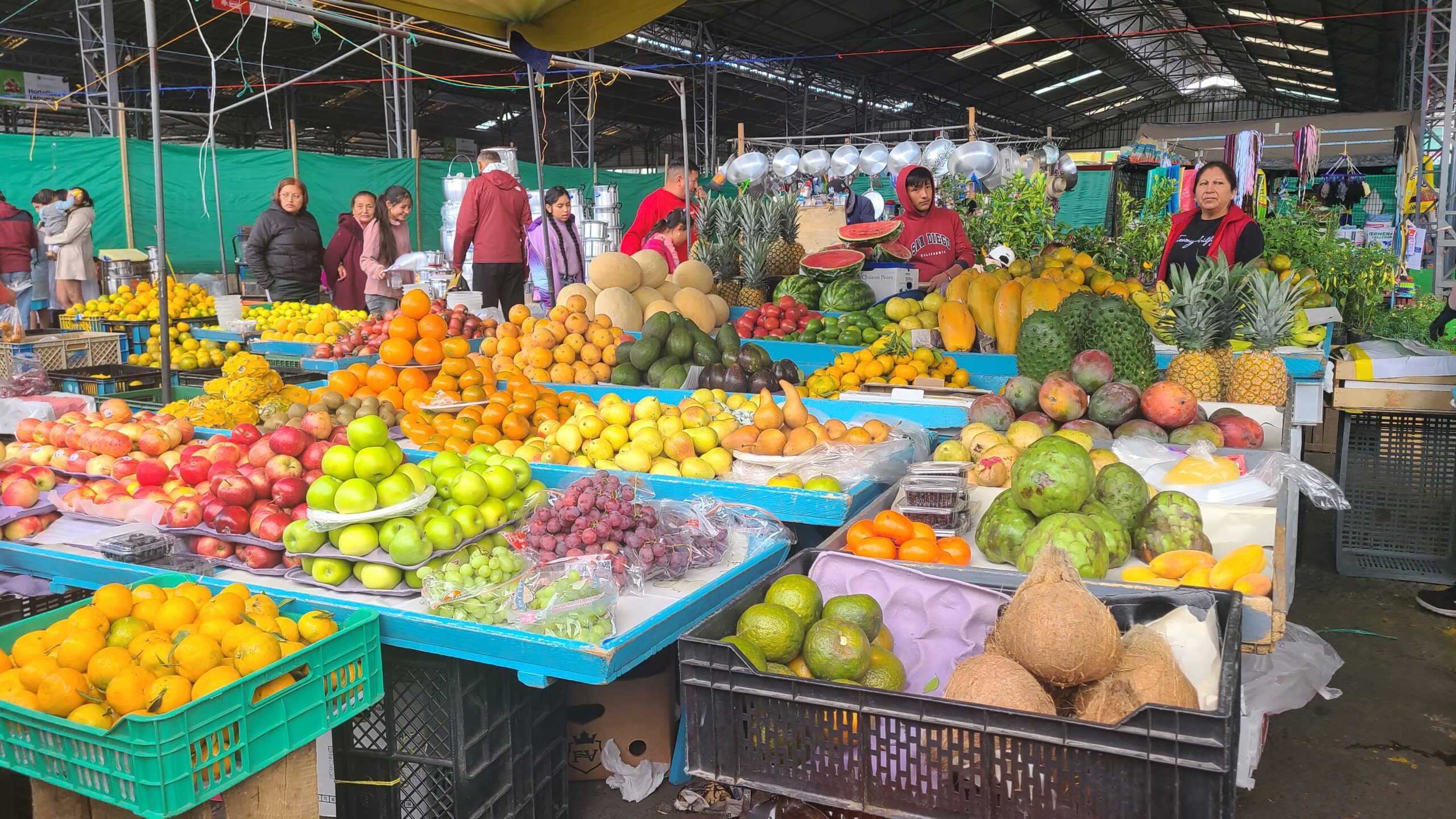
We finally found our way to the farmer’s market. We had to be extra careful with our wallets and phones here. The market had sections for all kinds of products including fruits, vegetables, pots and pans, grains, packaged food and more. It was set in the backdrop of mountains all around us. We had a great time shopping for groceries for our dinner. We also picked up some tortillas and disposable plates and spoons. CDM had a guest kitchen with some utensils which we were allowed to use.
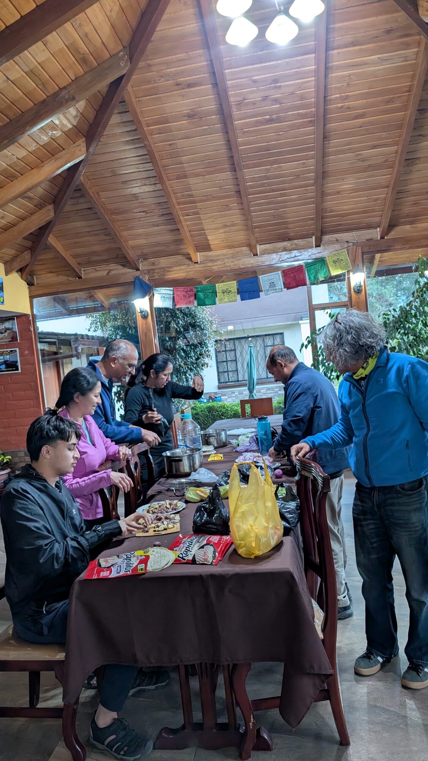
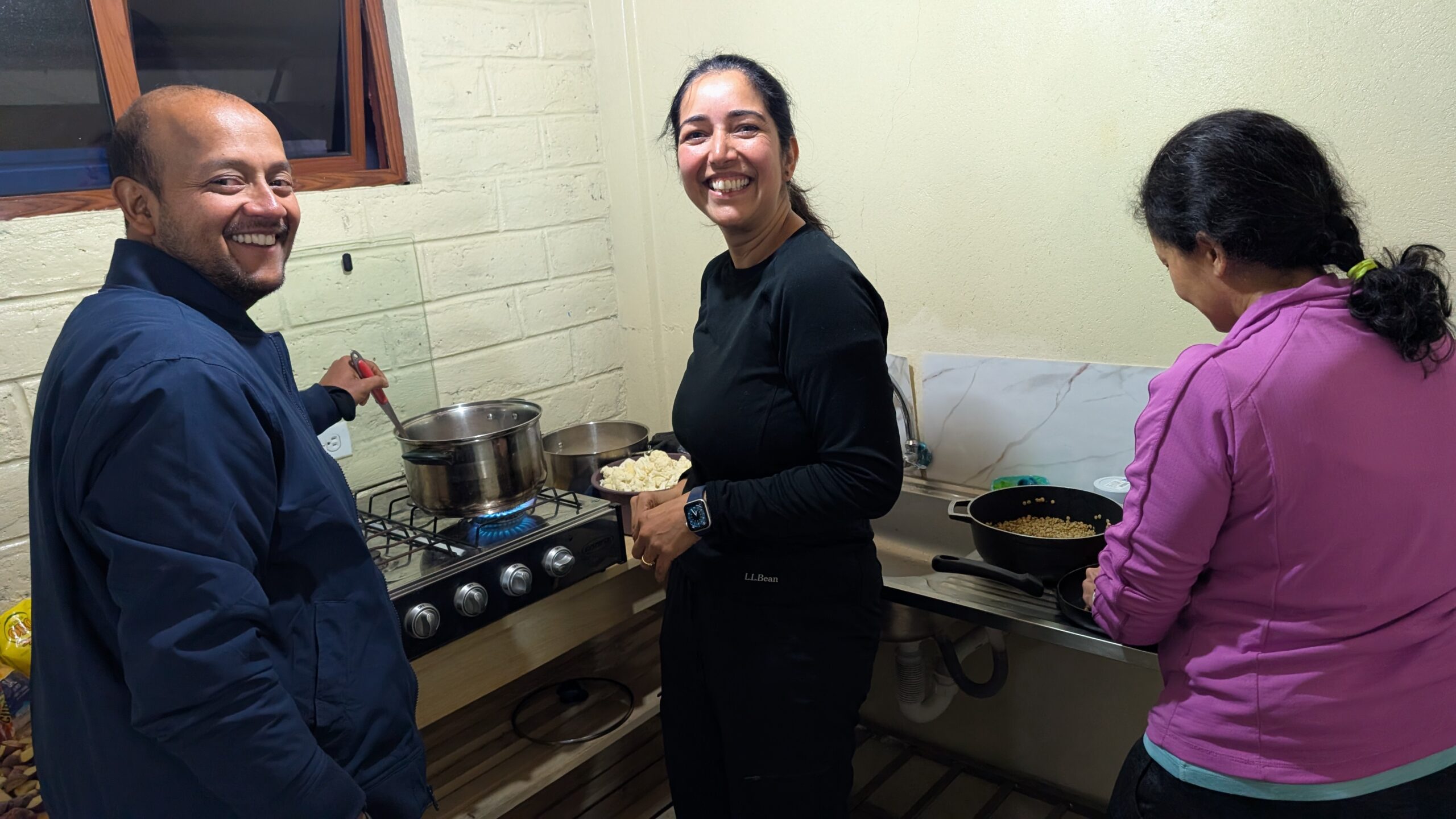
We all pitched in and the dinner turned out to be really delicious. It was great to eat a home cooked meal.
We were supposed to start the Cayambe hike tomorrow. However, we heard that climbers were able to summit Cotopaxi last night so we decided to have another go at it. Divya, Sri, Arun, Priti, and myself were determined to try Cotopaxi again. The rest of the team was not so sure. However, in the evening Gautam started researching the weather patterns which showed that the storm may have passed. Ashutosh, Samir, Anu, Gautam, Sagar, and Sushil also decided to join in for re-Cotopaxi. Meenal and Neel decided to stay back.
Day 9 (July 7)
Scheduled target: Hike to Cayambe Refuge
What we did: Hiked to Cotopaxi Refuge (for a second shot at Cotopaxi)
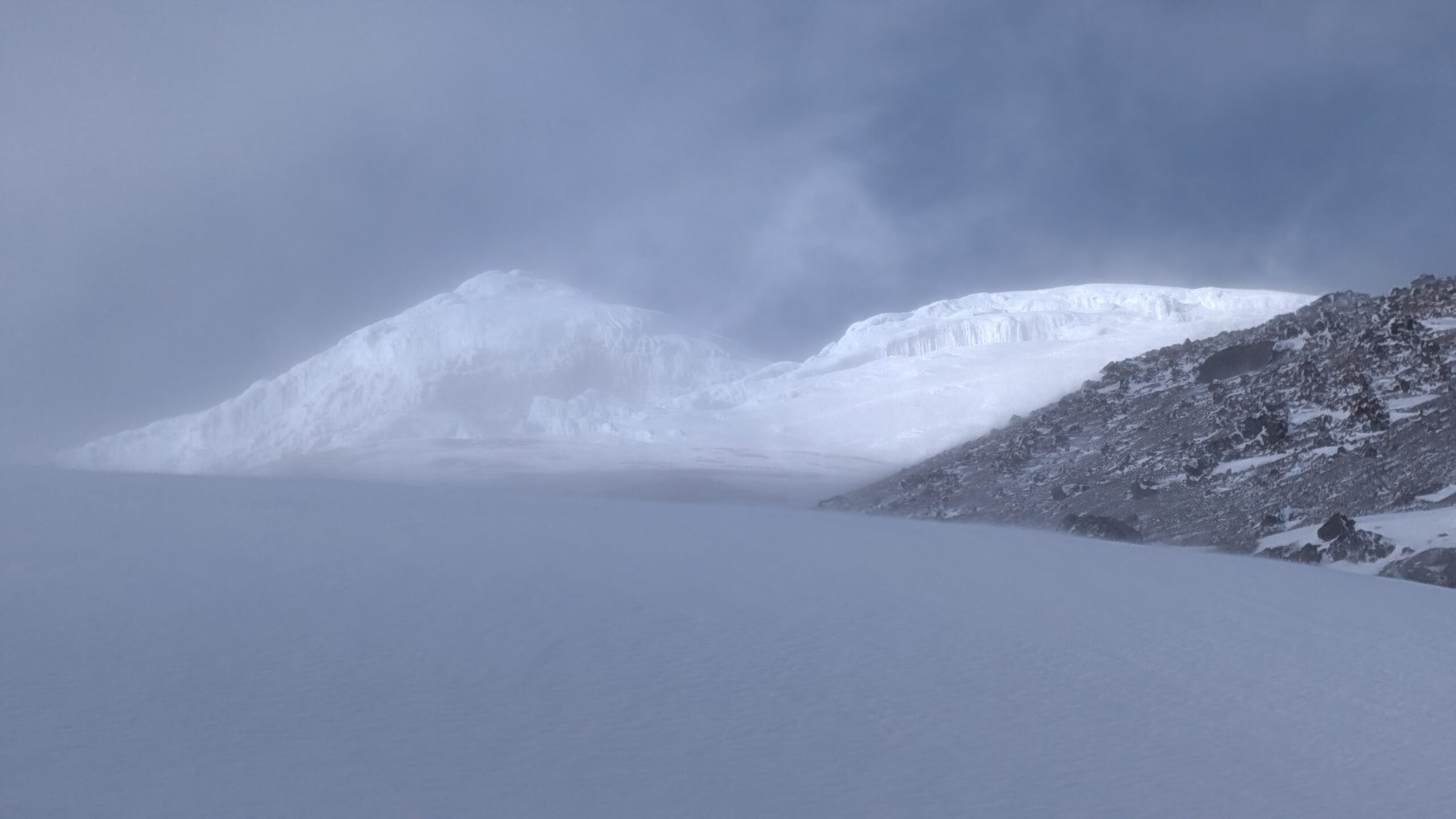
We were supposed to start the Cayambe climb today but we headed back to Cotopaxi instead. We climbed to the Cotopaxi refuge once again and arrived at around 4pm. The weather looked much more promising.
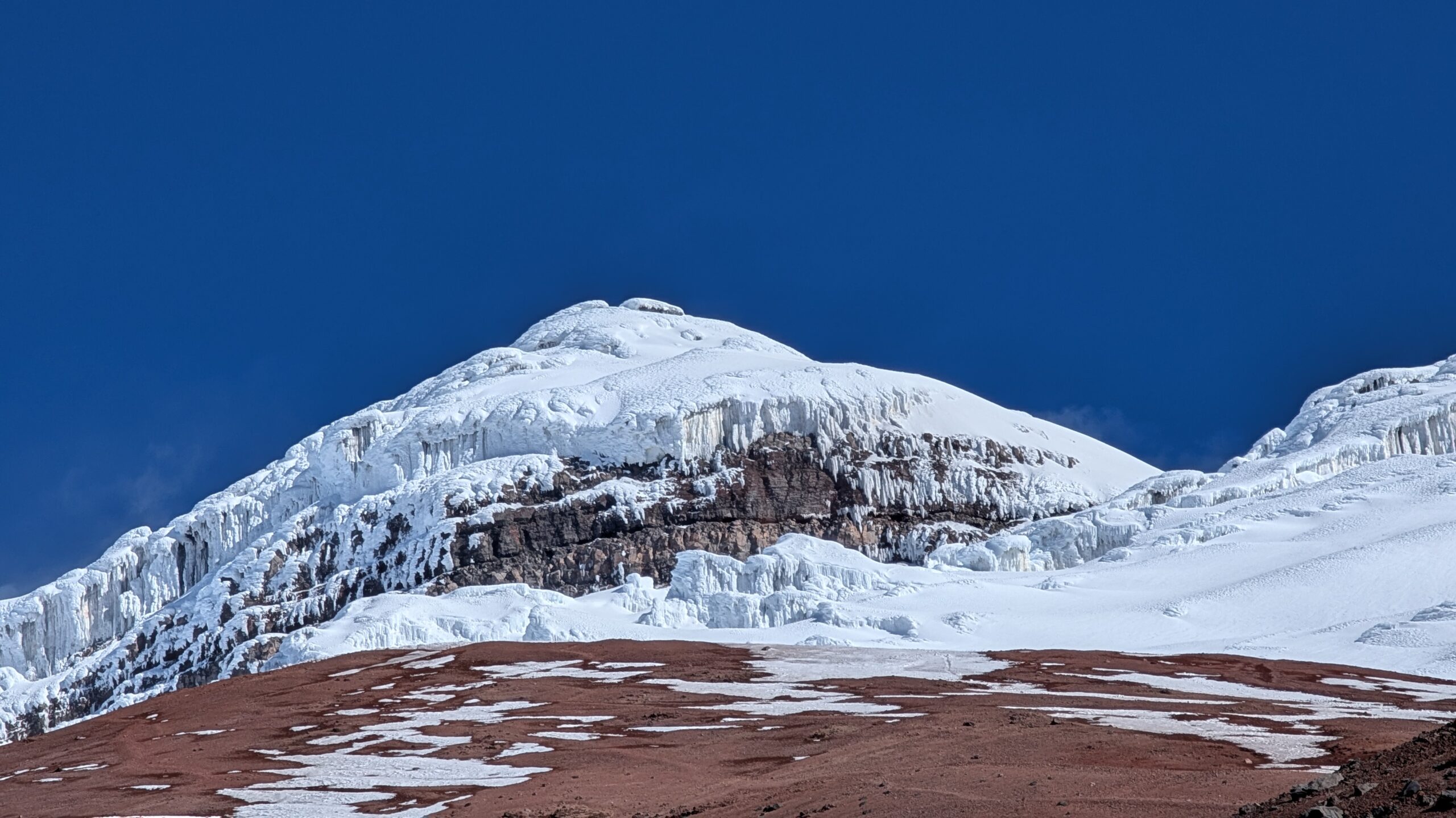
We got our best view of Cotopaxi so far. It still looked like a scary climb but also looked very inviting. We had our dinner and then decided on the groupings again. Now there were only 11 of us with 7 guides. Therefore we 4 guides were paired up with two climbers each and the remaining three guides had one climber each. Arun and I were paired up with our guide Marco who was very experienced.
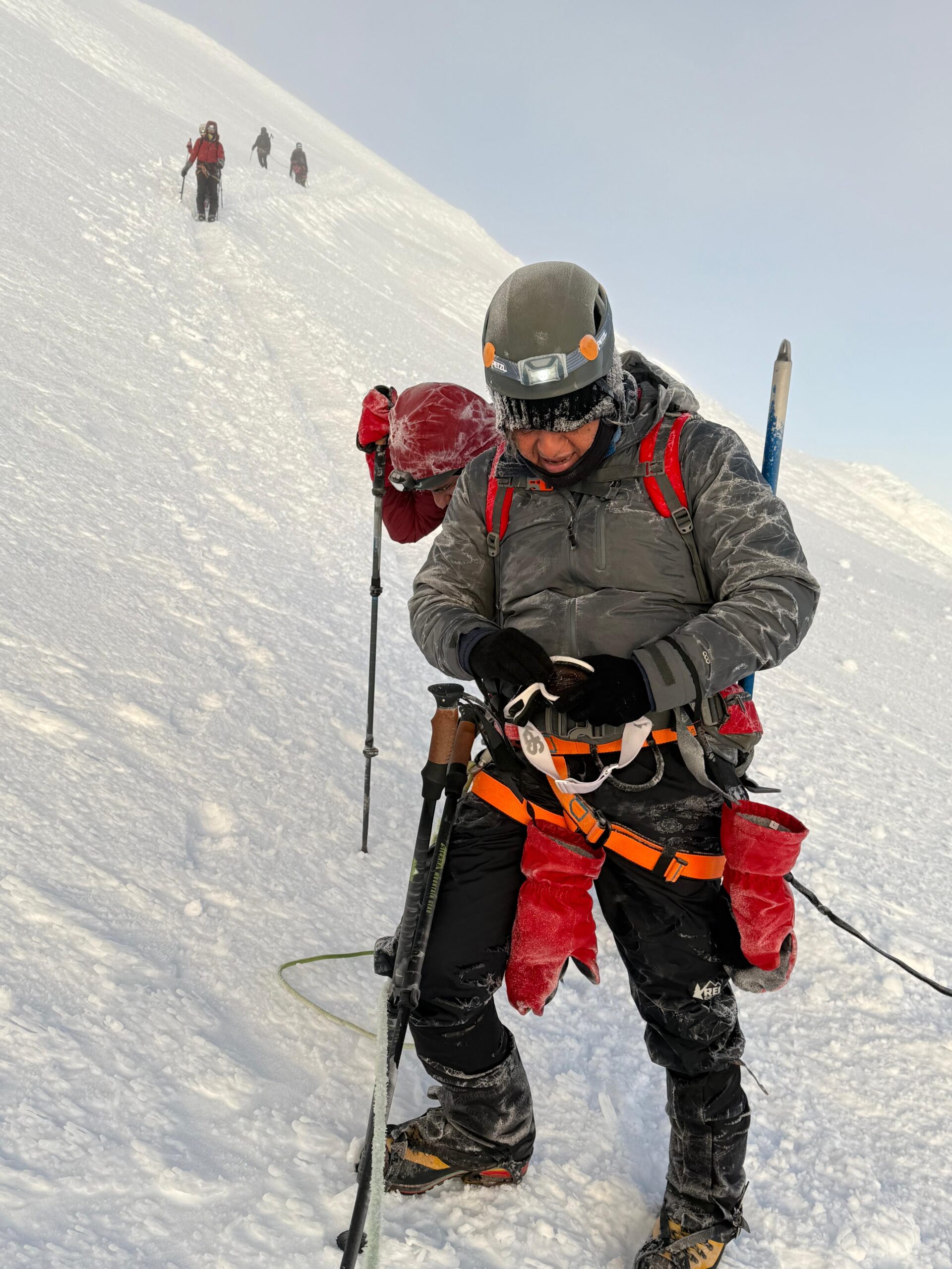
We woke up at 11am to get ready to climb. This time the weather looked much friendlier. It was still extremely cold with some winds but nothing like our previous attempt. We felt hopeful and confident. My temperature gadget later revealed that minimum temperature was 20F (-5C) during our hike – and that was without accounting for the wind chill. My best guess is that with wind chill, it was close to 0F (-18 C). Brr.
It took us an hour to gear up – both because there was a LOT of gear to put on and also because at high altitudes, everything takes effort. Just going to the restroom can and back can make your breathless. Here’s how I geared up:
- Top: merino wool base layer + t-shirt, fleece jacket, big puffy jacket and a hard shell jacket on the top with another down jacket in the backpack just in case.
- Bottom: merino wool base layer, fleece lined pants and waterproof pants
- Head: buff, balaclava, beanie, helmet and hoods from my puffy jackets and hard shell!
- Hands: Smarwool gloves, two sets of hand warmers and thick snow gloves
- Feet: two layers of socks, two sets of toe warmers (put them on both top and bottom of my toes) and mountain boots
- Additional gear: Backpack, snow gaiters, headlamp, hiking poles, rope harness and ice axe
I was planning to carry 3 liters of water but Marco insisted that 1.5 liters would be fine. I filled up 1 liter in my camelbak and another liter in my Nalgene. I knew from experience that the camelbak tube will freeze in a couple of hours during the climb and will unfreeze on the way down once the sun comes out.
Day 10 (July 8)
Scheduled target: Summit Cayambe
What we did: Attempted Cotopaxi Summit again (19,347 ft)
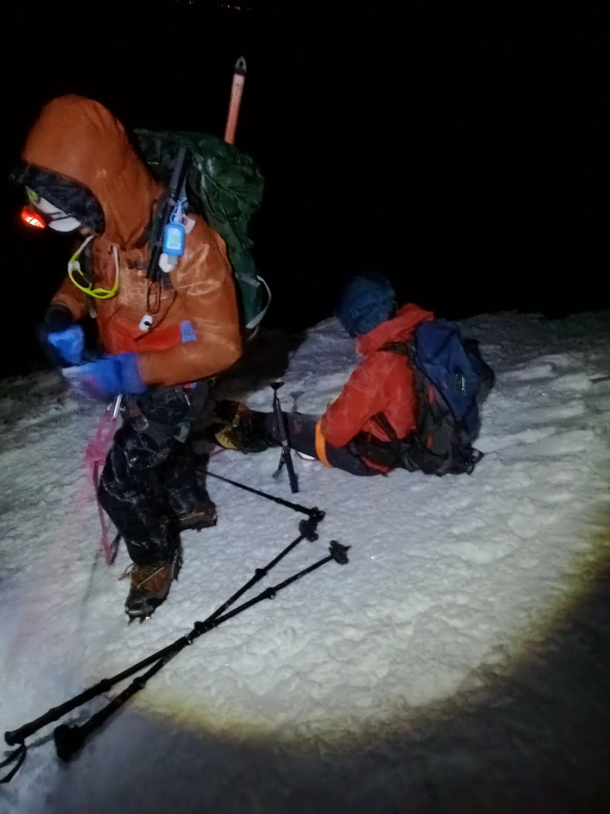
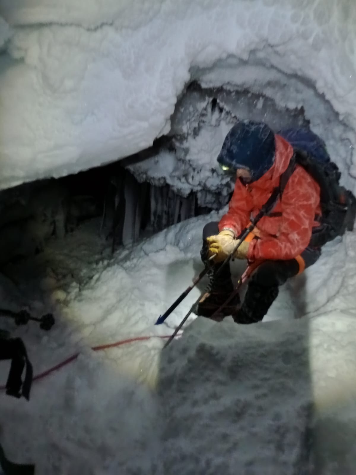
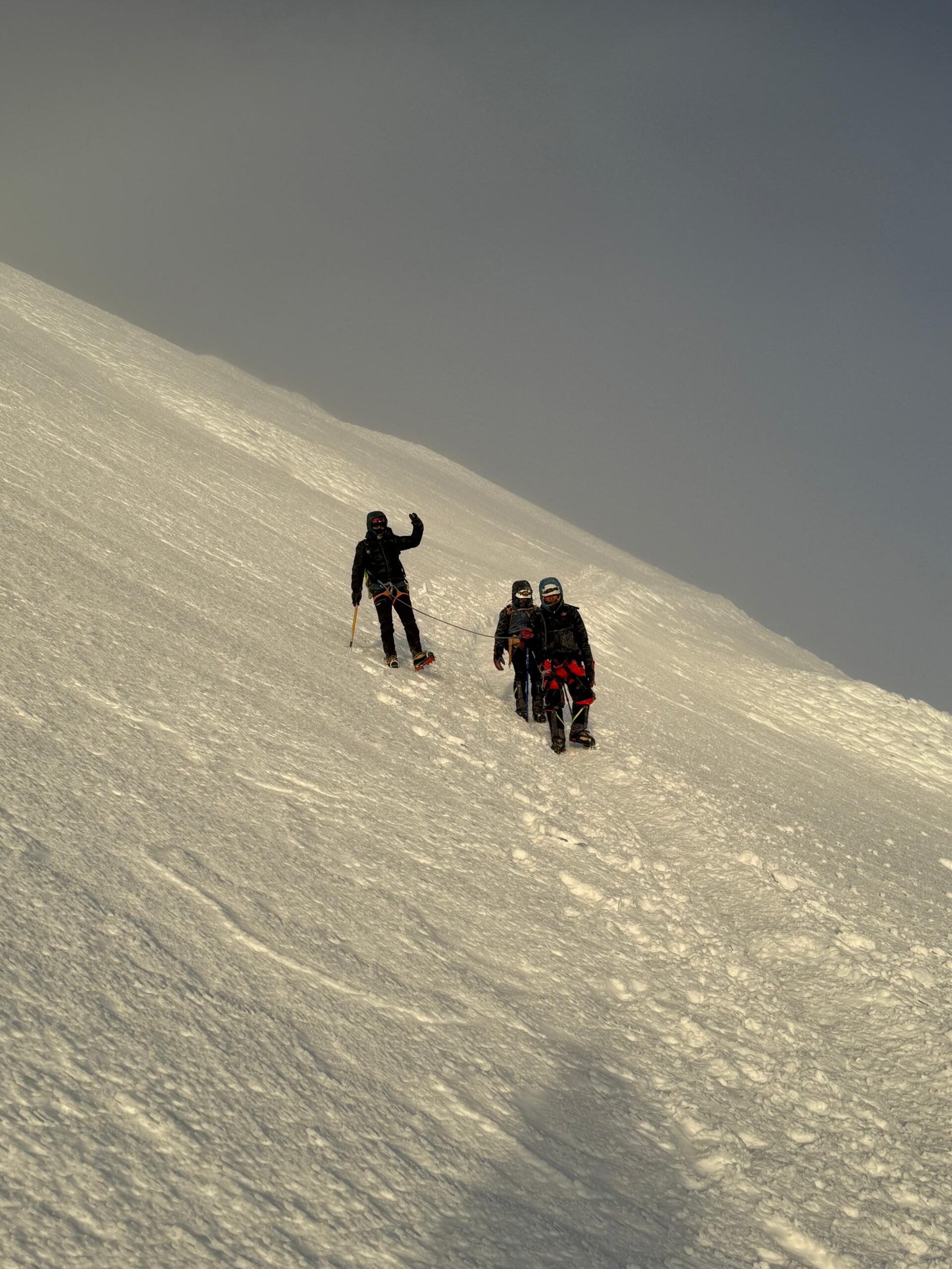
We started at midnight in the darkness. Moon was shining in the sky and the glow of all the headlamps was dotting the path. I think it took us about an hour or so to reach the glacier. There we put on our crampons and continued the climb. The climb started getting steeper and steeper. At some point Marco used the rope harness and Arun and I were tied to him for safety.
I captured a short clip using a body cam I had attached to my hard shell jacket pocket.
I have done my share of high altitude, steep climbing on ice. However, this felt harder than anything I have done before. Soon it got to a point where I had to take a few breaths with every step. I felt that our progress was very slow. I could see that the guide was using some fancy foot technique to climb rather than climbing straight up. He could see that we were struggling but didn’t offer to guide us. I was too tired and disoriented to ask.
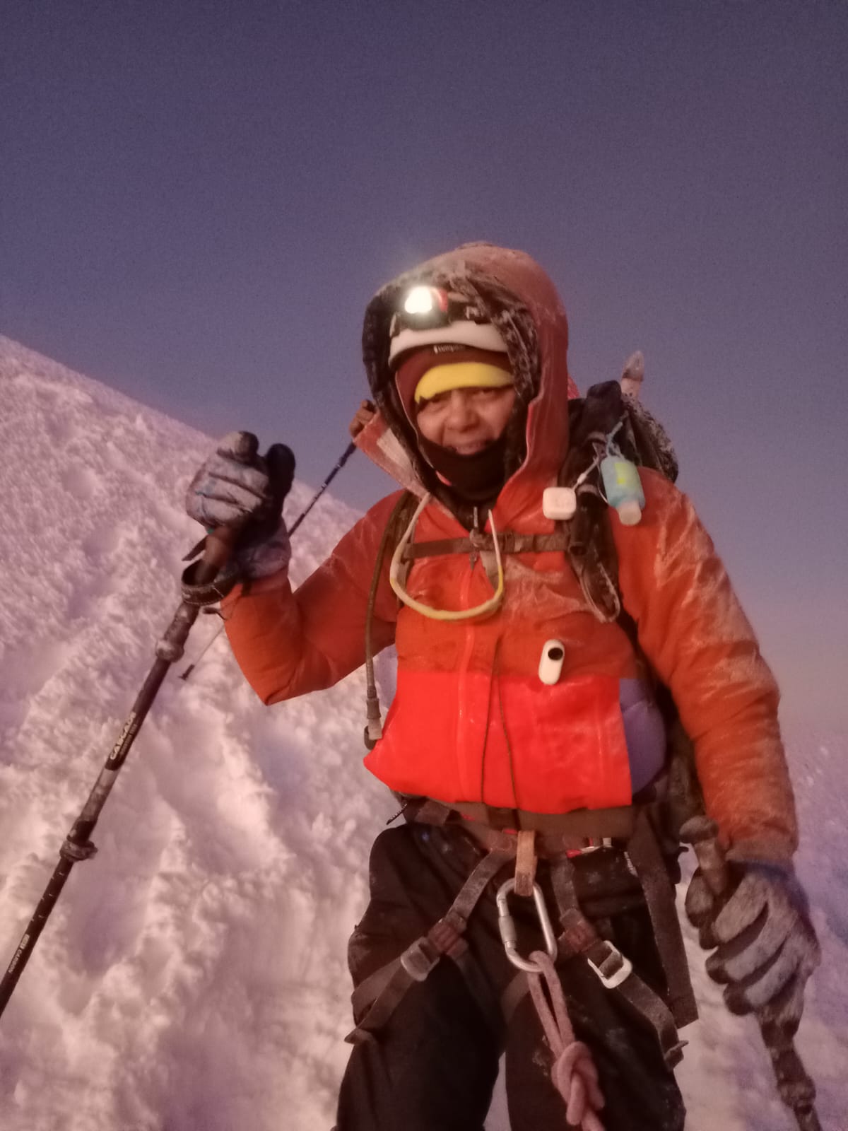
We continued our climb for a little over 5 hours. Even at our slow pace we were already an hour ahead of the next group in our team. I was exhausted at this point. Winds had started picking up as well making the climb even harder as we had to battle against the wind. I also had very little water left in my Nalgene and the water in my camel bak was completely frozen. The guide told us that we had another 2+ hours of climb left and that it was going to get even more steeper and windier. Arun and I discussed and decided that it was safer to head back. I wasn’t sure if I would be able to make it to the top and even if I did, if I would have enough energy left in the tank for the climb down.
It was a REALLY hard decision. This was the first time ever that I was not going to be able to complete a challenge. However, safety has to be the #1 priority and it was the right decision.
My watch showed that we had reached an altitude of 18,300 ft – we were more than 2/3 of the way and only a thousand ft away from the summit. It was heart breaking.
Disappointed, we started descending. We met some of our groups on the way down who were still climbing. When they saw us, they initially thought that we had already summited and were delighted! Their guides compered notes and decided to turn them back as well. The other groups were at least an hour behind the ice cave and were probably not going to reach the summit within the cut off time.
I had a really tough time on the descent. Usually I am very fast and sure footed but I felt like I was really struggling. It took me 1:30hr to get down.
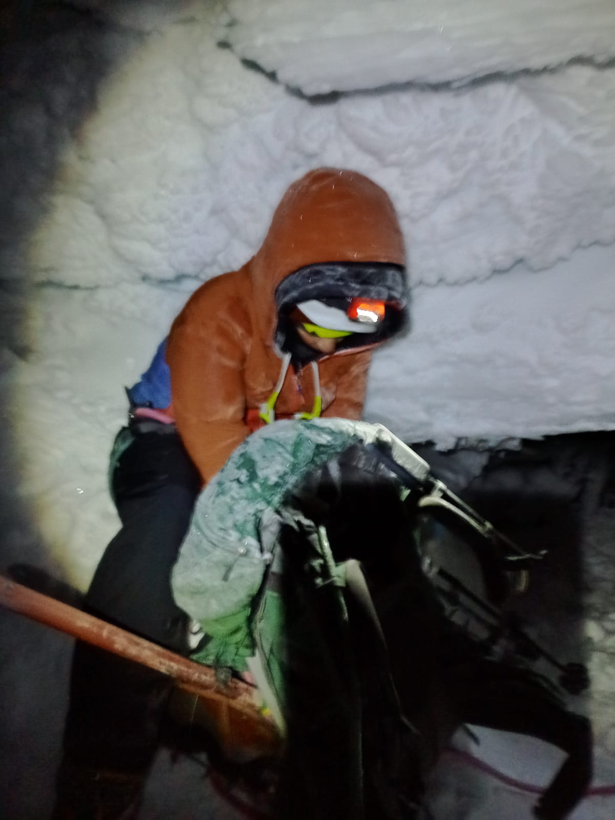
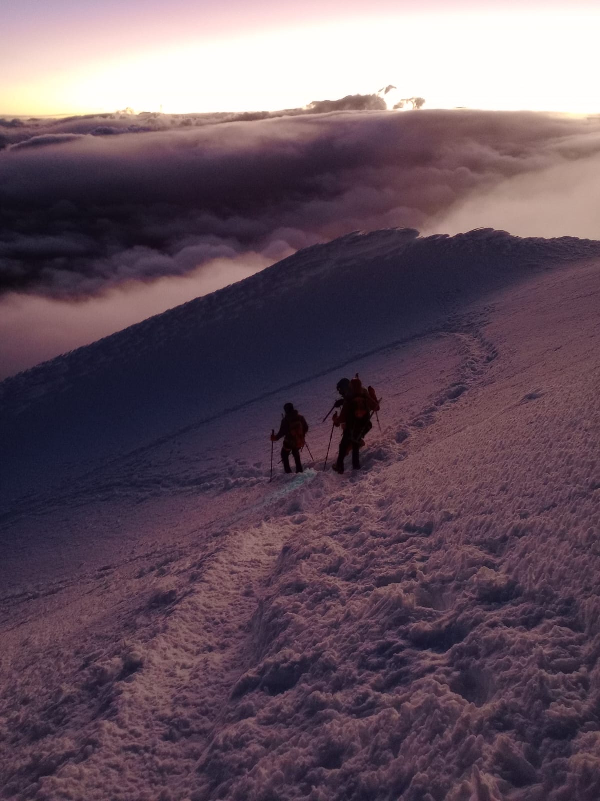
Sun was just starting to come out as we made our downward journey. It was an incredible and one of the most beautiful sites I have seen. I was too tired to enjoy it fully but it was truly magical. I had the presence of mind to turn on my body cam for a few minutes. The video below captures the magical glow of dawn on the glacier. It also captures the moment we met Sri and his guide and they decided to turn back as well.
The picture above captures almost the full gear. You can see the body cam in the middle of my jacket and the small white temperature meter cube hanging from the backpack strap. We were complete crusted with snow. Big chunks of snow fell from our gear once we reached the refuge making a big puddle of water.
Here are some more pictures which capture the beautiful glacier and the steep terrain.
I reached the refuge at around 7am. I have never felt so tired in my life – not even when I did my 50 mile ultramarathon. I felt nauseated and could not get up from the bench for a while. I was completely bonked – a term used by runners when they reach a point of exhaustion that makes it impossible to go further.
Reflecting upon it later, I realized that I had barely eaten anything since our dinner at 6pm. I should’ve been fueling myself at least once an hour during the climb but I remembered eating just one cookie during this whole time! I should’ve known better but in my defense, I was disoriented and had lost complete track of time. In my previous climbs, the guides would direct us on when to take a break, eat, hydrate and get going again. Marco did no such thing. I think I would’ve had a good shot at summiting if I had done a better job of keeping myself fueled and hydrated.
After reaching CDM, Priti and Sagar decided to cut their losses and headed back to the US to get some PTO back.
Day 11 (July 9)
Scheduled target: Rest day after Cayambe summit
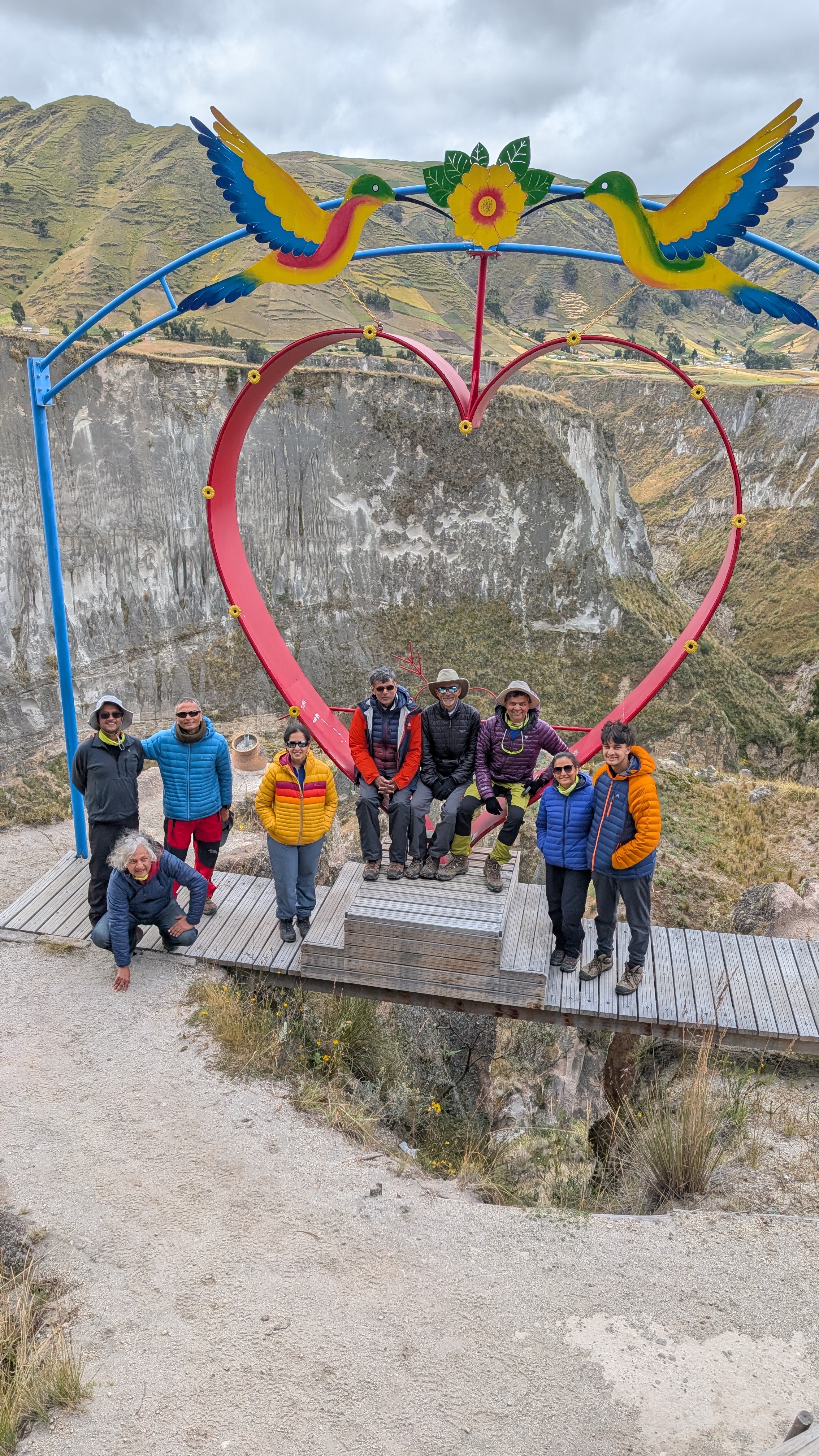
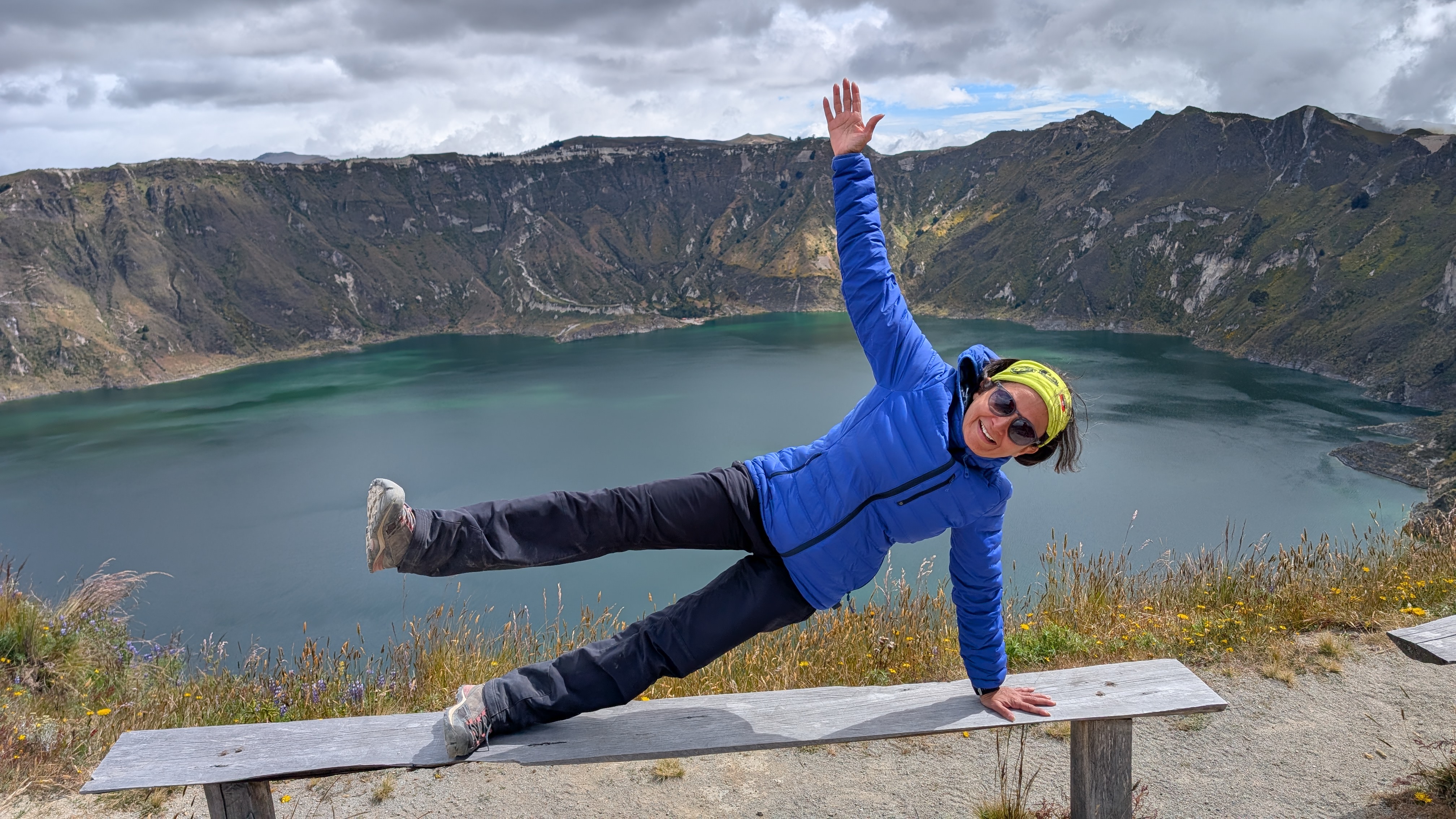
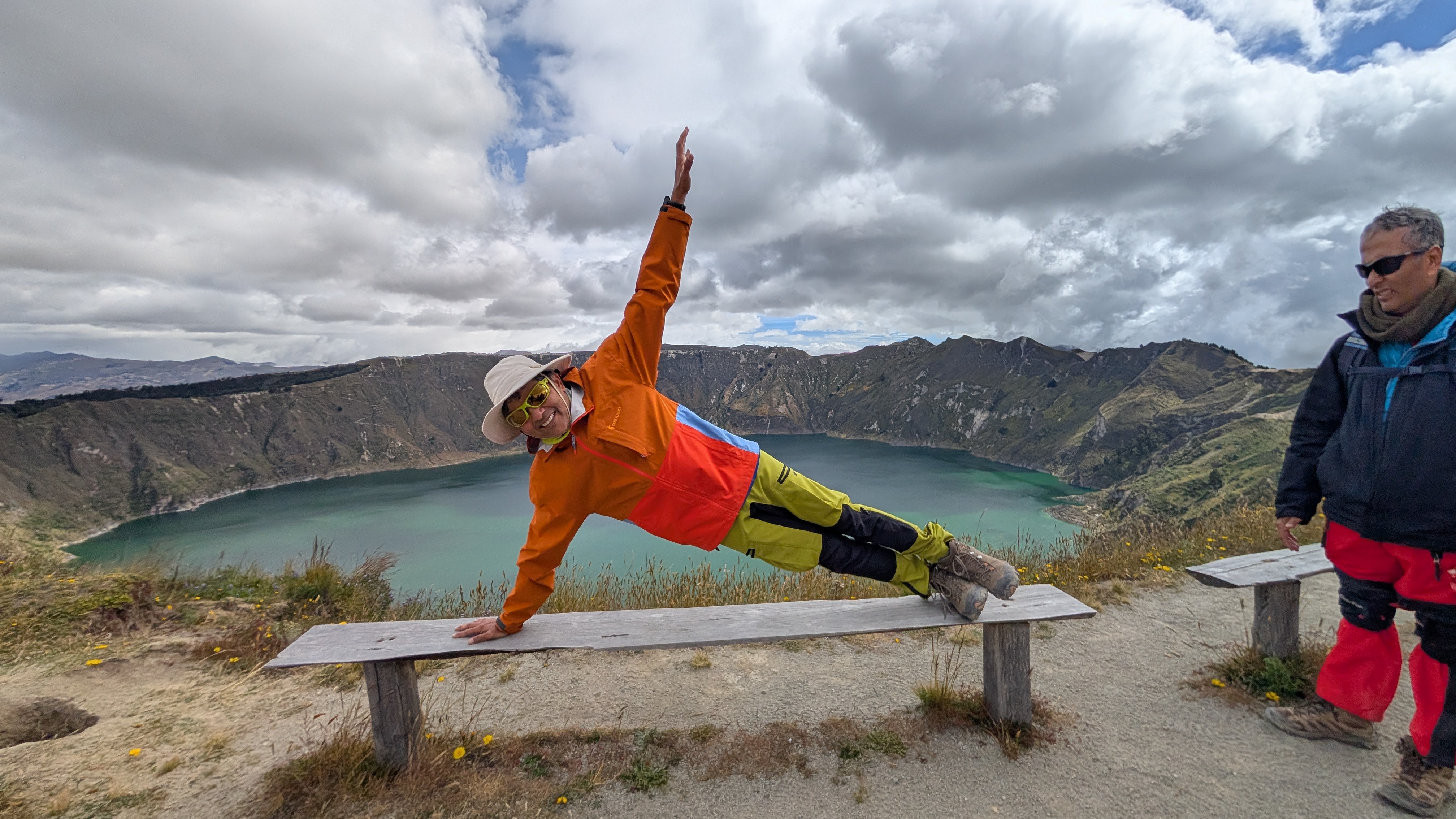
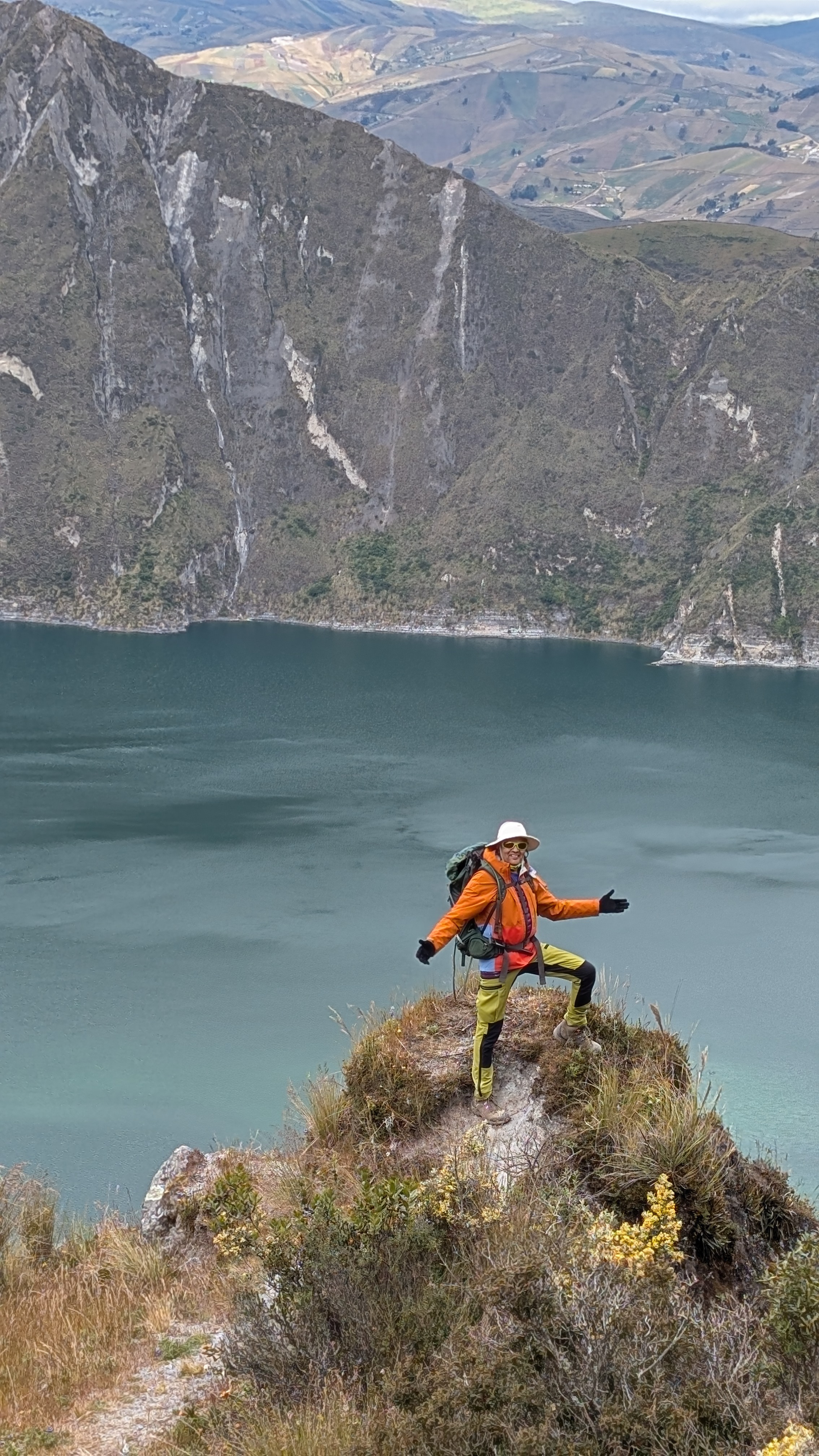
What we did: Went to Lake Quilotoa
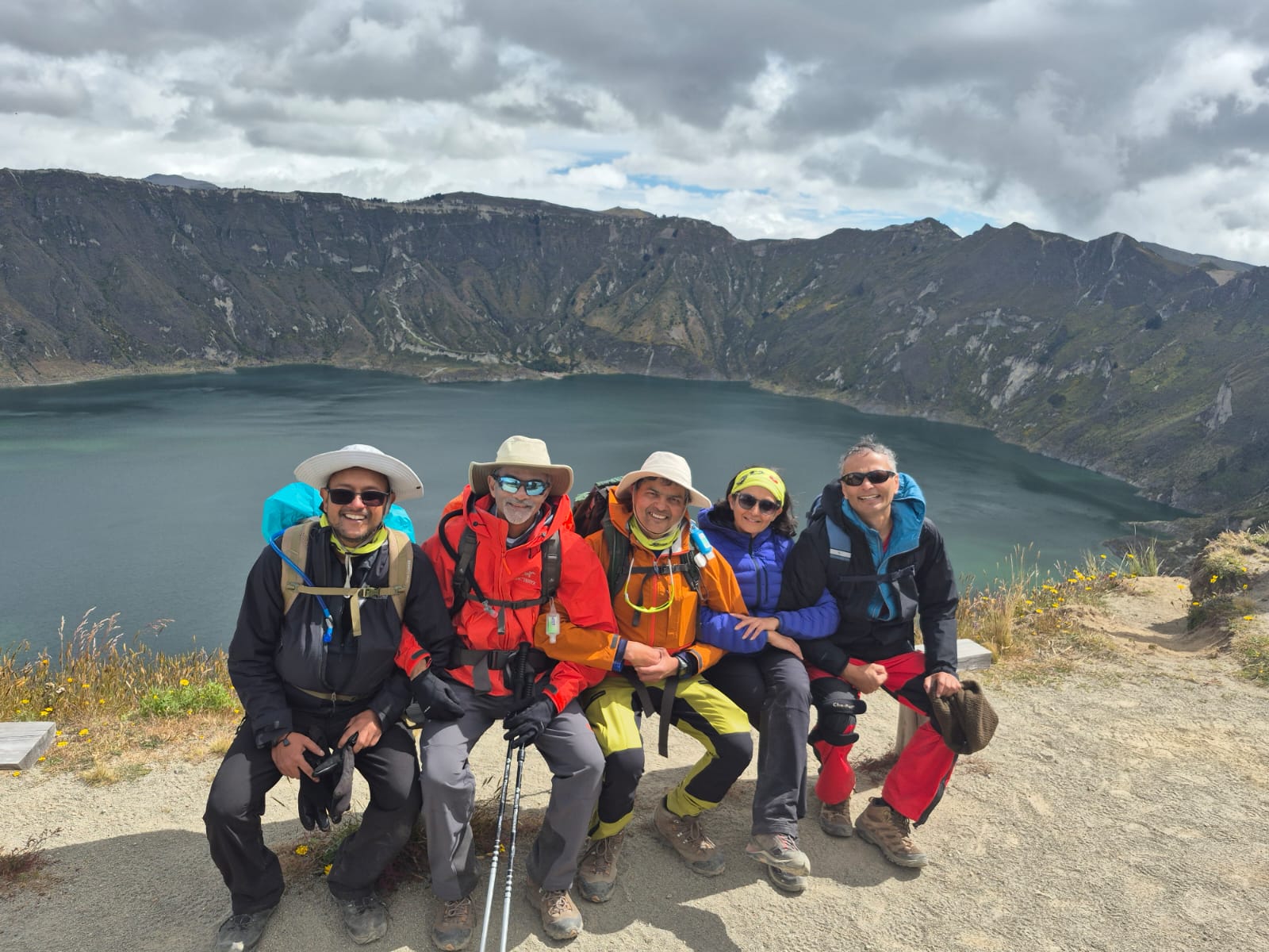
At this point we had given up the idea of climbing our last peak – Chimborazo. By all accounts, the weather at Chimborazo was even worse. Rather than risking another failed summit attempt, we decided to make the most of the time that was left and went to Lake Quilotoa instead. By now Priti and Sagar had decided to cut their losses and had gone back to the US. There were only 11 of us left in the group now. Sri and Divya had also decided to leave early and were packing up. Therefore they did not join us for the Quilotoa tour.
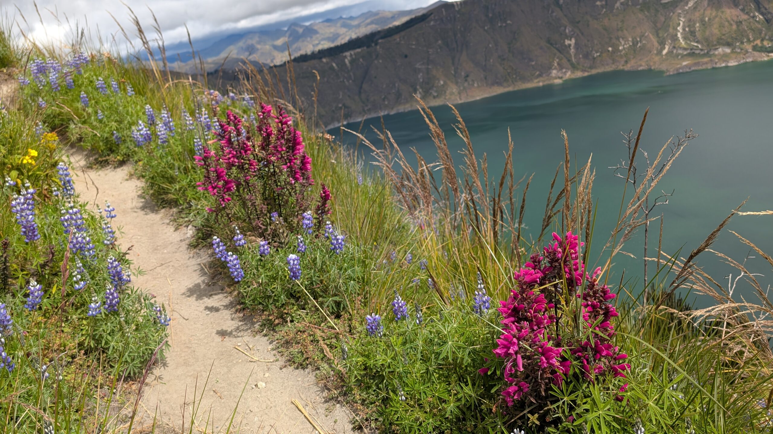
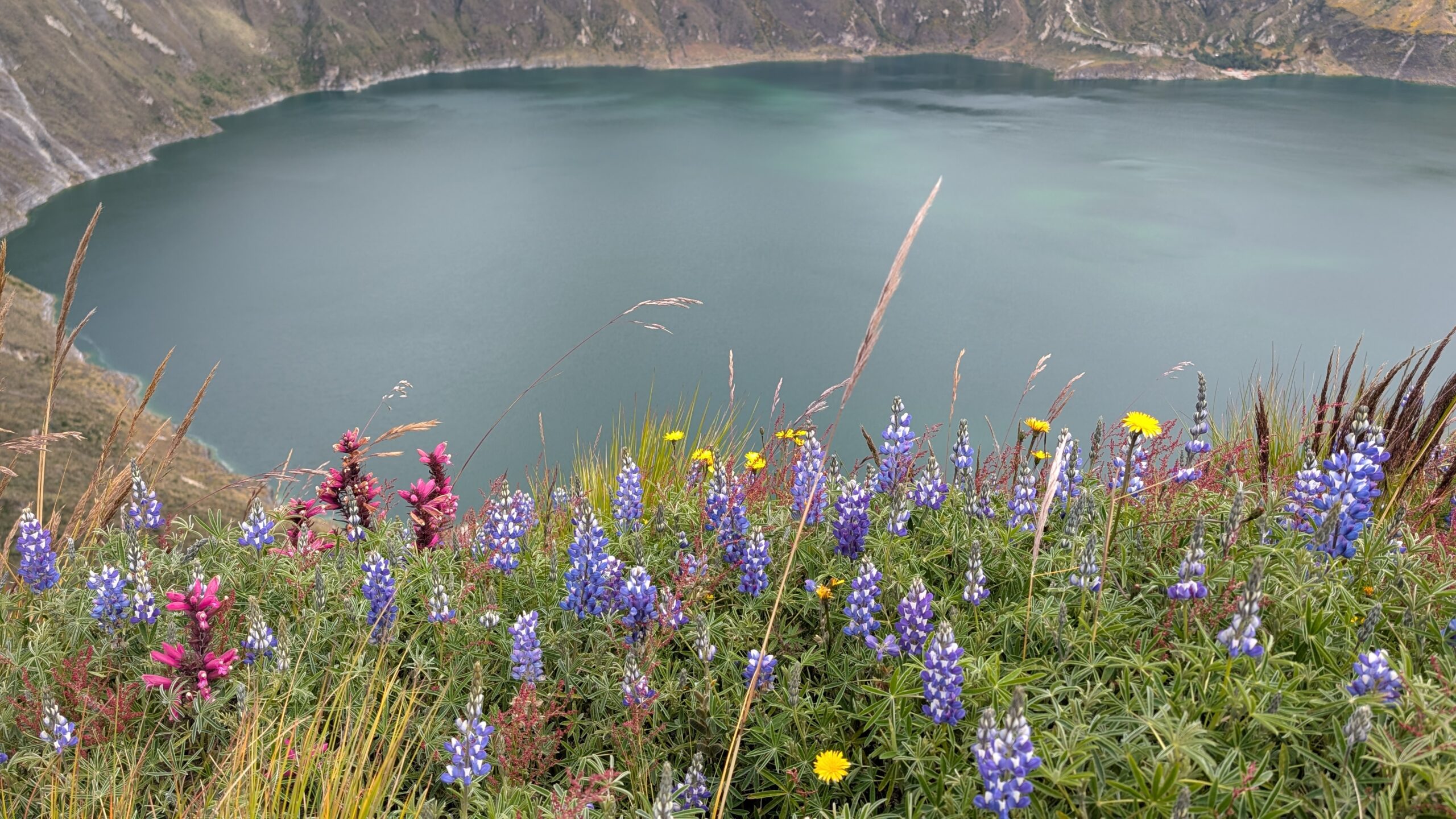
Lake Quilotoa is a volcanic crater lake, situated at nearly 13,000 ft. It was formed 600 years ago from a volcanic eruption. It is a really beautiful lake with stunning blue-green water.
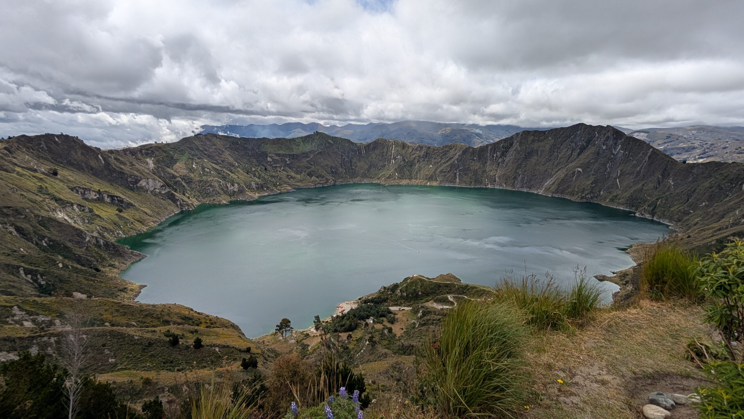
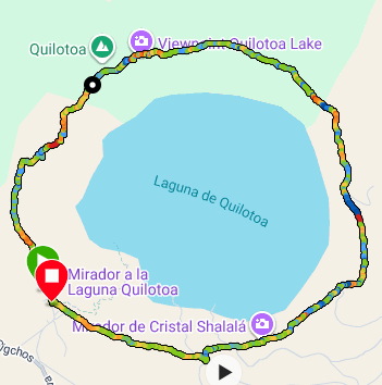
Samir, Anu, Arun, Ashutosh and I decided to go for a hike around the rim of the lake. The total distance is about 6.5 miles with constant ups and downs resulting in 2,500 ft of ascent! See the trek path recording by my Garmin:
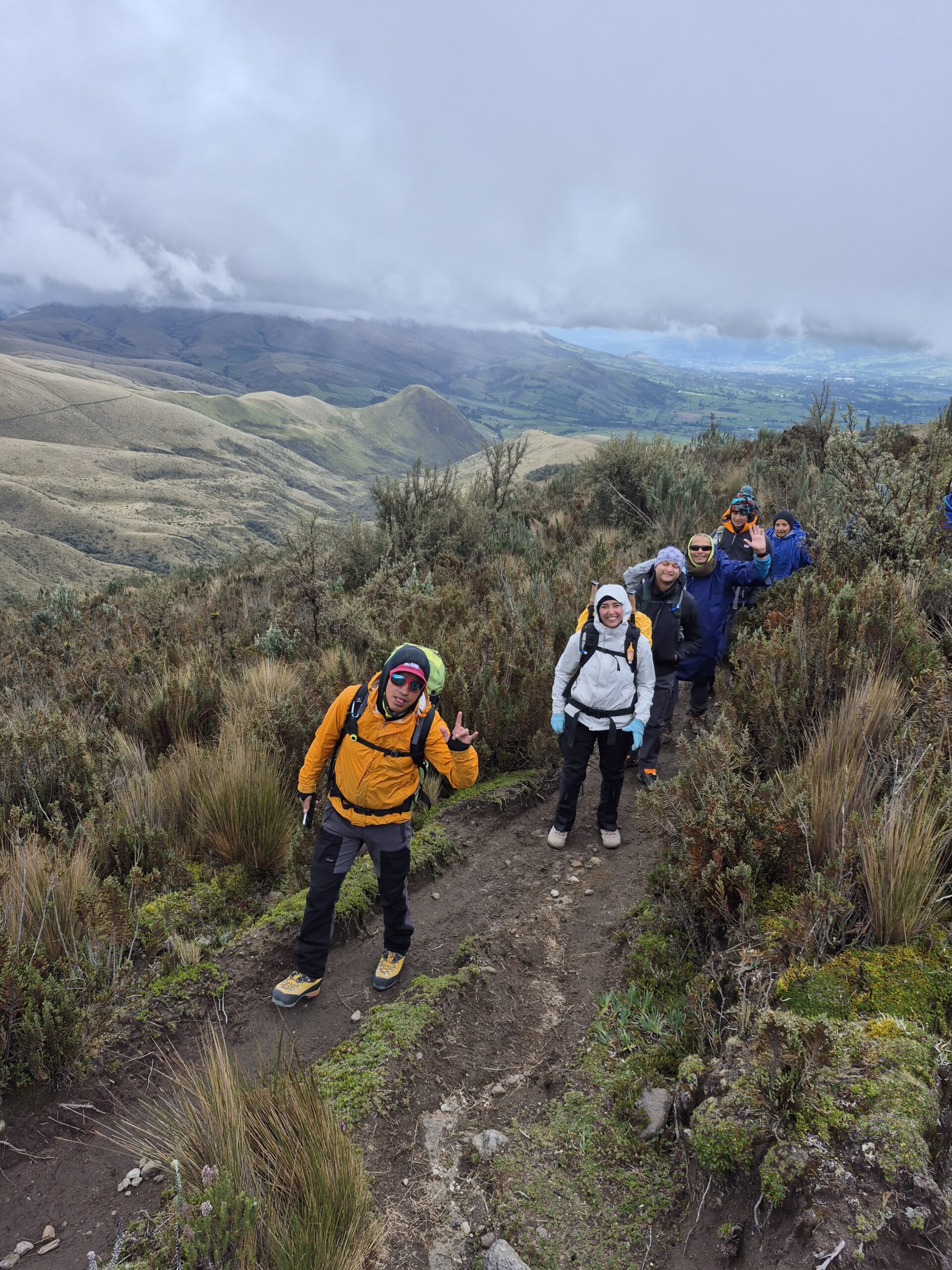
It was one of the most beautiful hikes I have ever done. The weather was perfect – it was a little windy and threatened to rain at times but that just added to the beauty.
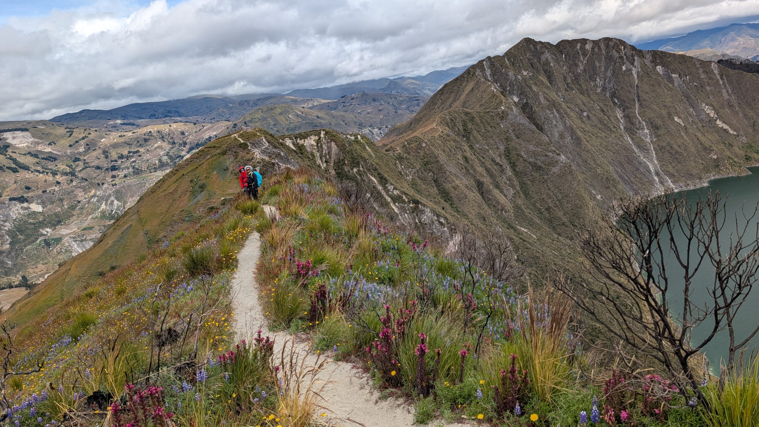
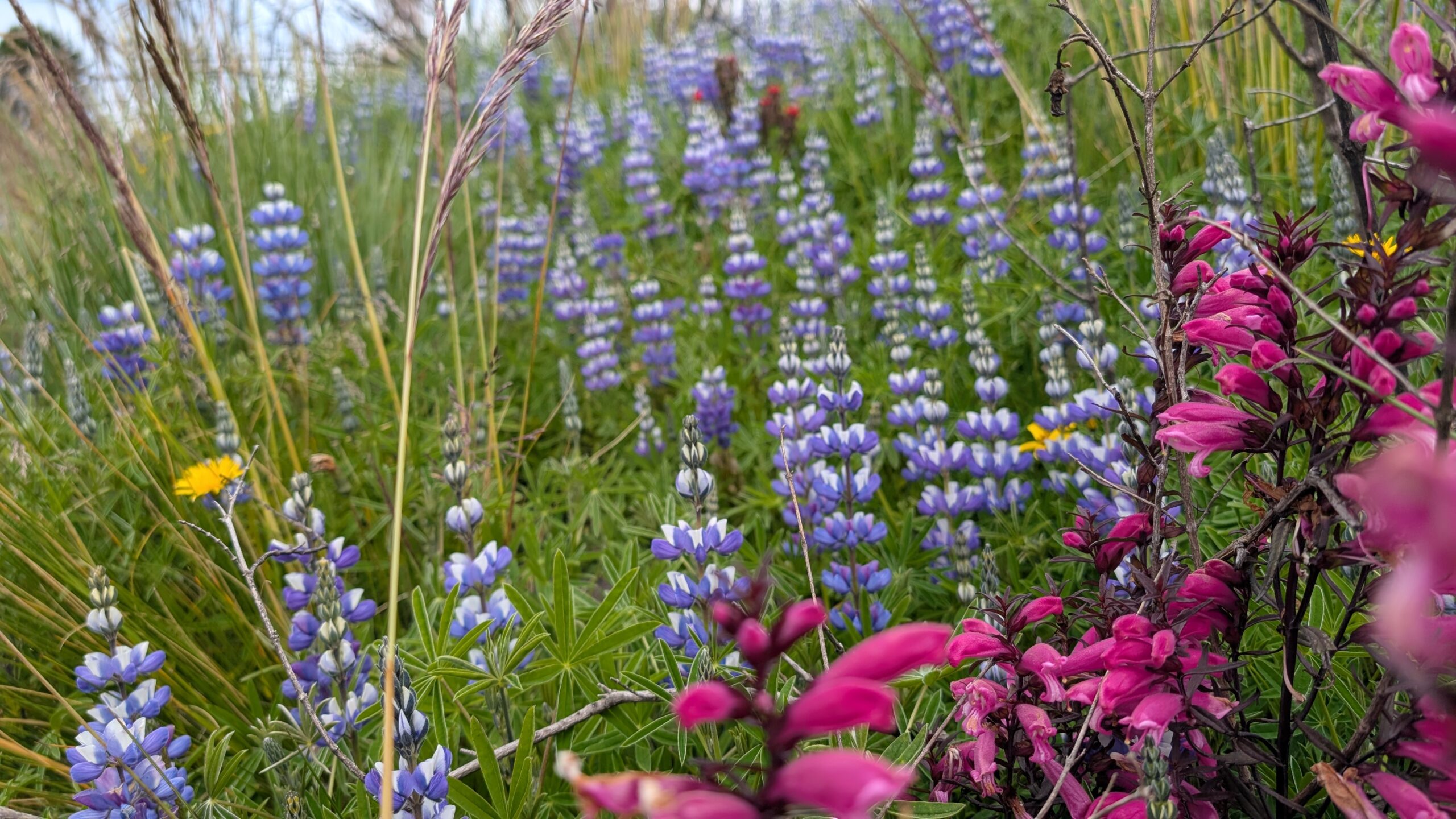
The trail was covered in wildflowers. It was absolutely stunning. The entire trail was along a ridge line with the lake on one side and a valley on the other side.
Day 12-13 (July 10-11)
Scheduled target: Climb Chimborazo
What I did: Went back to Quito to surprise my wife!
Our plan was to go to the Galapagos islands on July 12 after the trek. My wife, Jyoti was going to join us for that trip. She was arriving Quito on July 10 and was planning to do some sightseeing on her own while we finished our trek.
While the rest of the team decided to climb a couple of smaller nearby mountains (Corazon and Wawa Pichincha), I went back to Quito and to surprise Jyoti. She was thrilled and somewhat incredulous that I would give up a chance to hike and climb to surprise her. Her faith in my love was fully restored and I have hopefully earned some brownie points to last for a while 🙂 🙂
Summary
The trek did not go as expected. As they say in Nepal, “you don’t decide if you are going to climb a mountain, the mountain decides if it is going to let you climb.” The mountain definitely did not want us to climb. Weather was the biggest spoilsport – even when we were able to summit, we didn’t see any good views. Bad guides and my lack of preparation also contributed to the failure. But hey, if you never fail, that means you are not trying hard enough!
It was still an incredible and rewarding experience. It does feel like unfinished business though. I hope to be able to go back and climb Cotopaxi one day. कहानी अभी बाकी है मेरे दोस्त (The story is not yet over my friend)
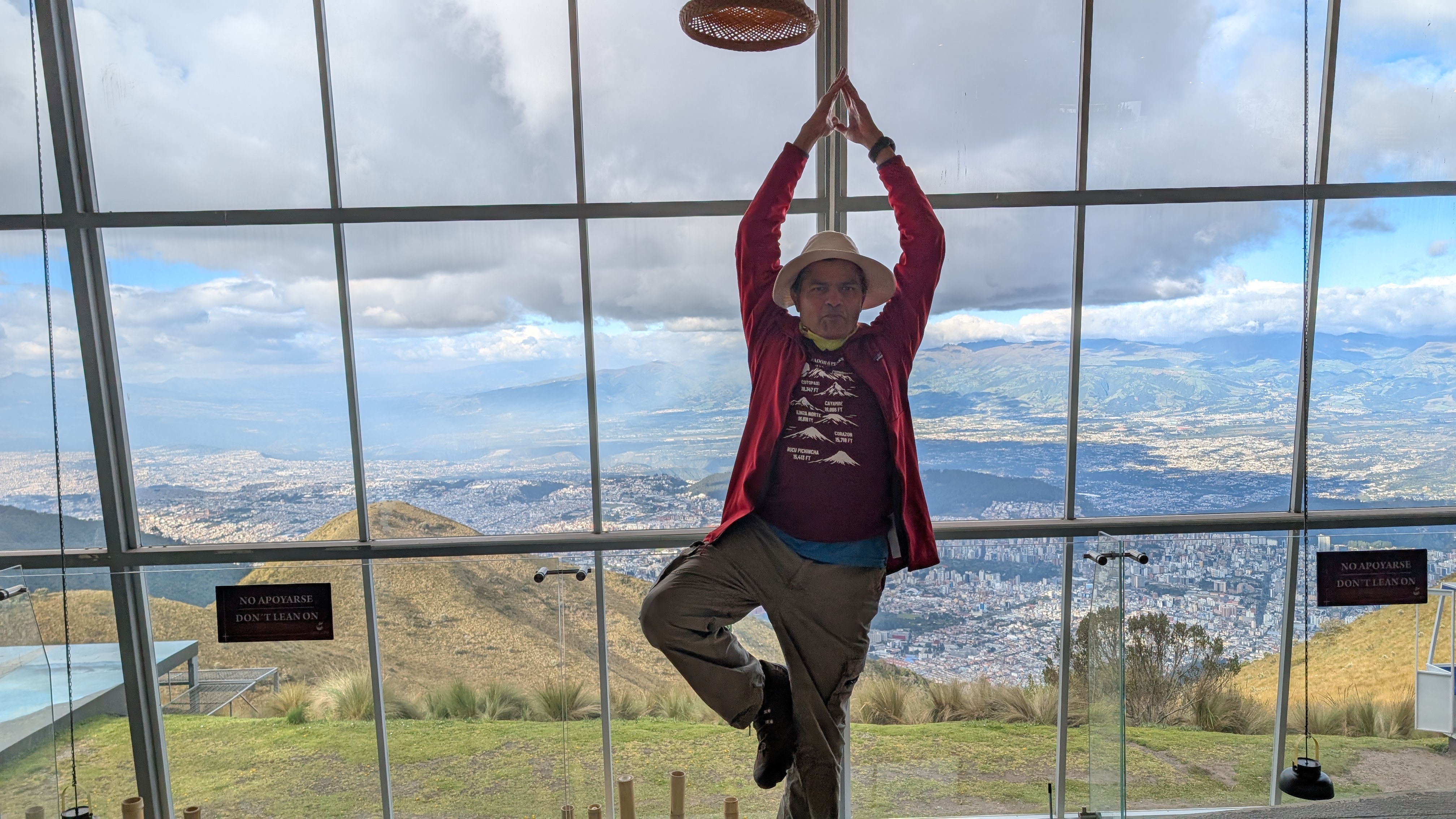
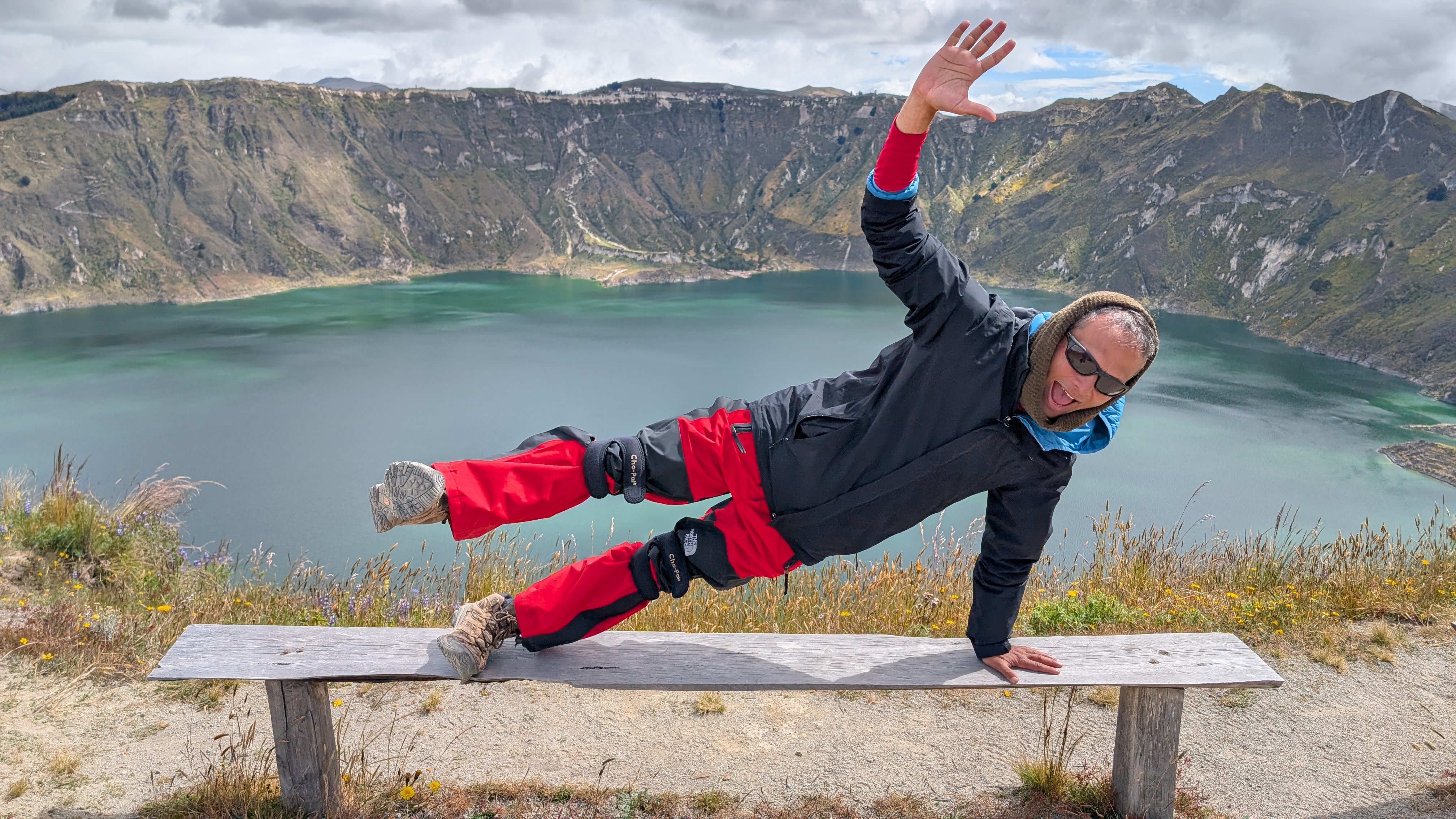
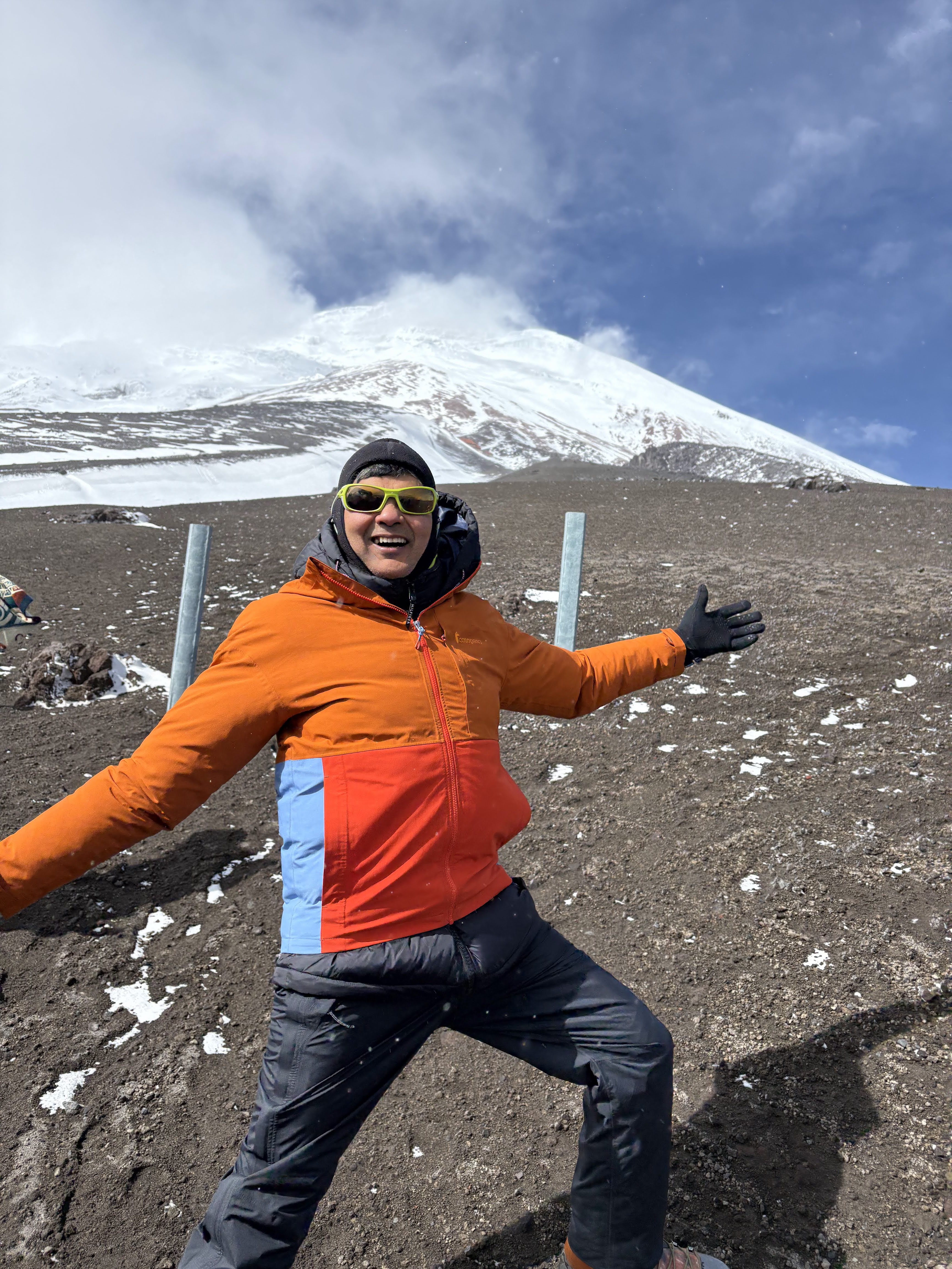
Fun Fotos
Here’s a compilation of some fun photos from the trek
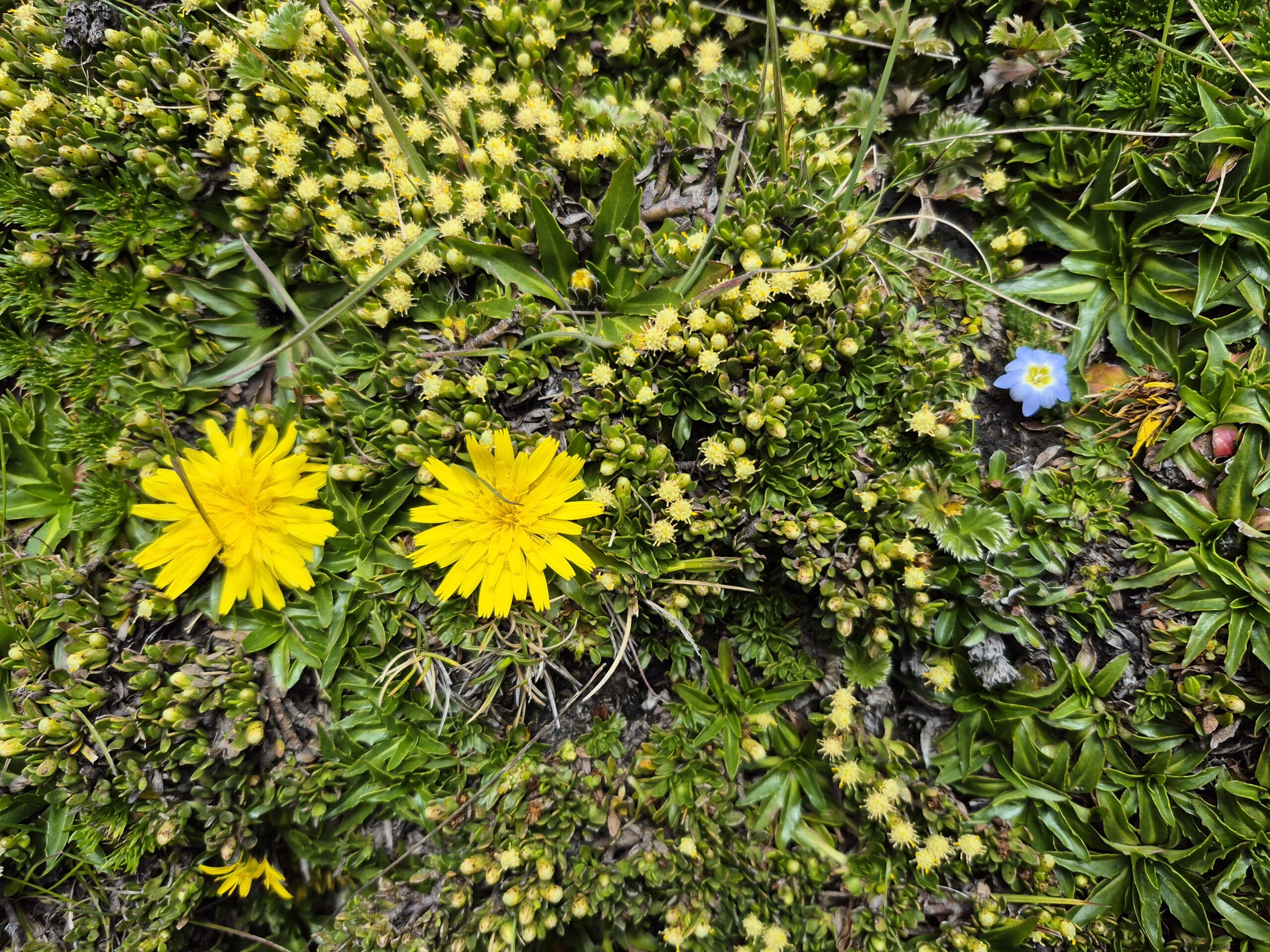
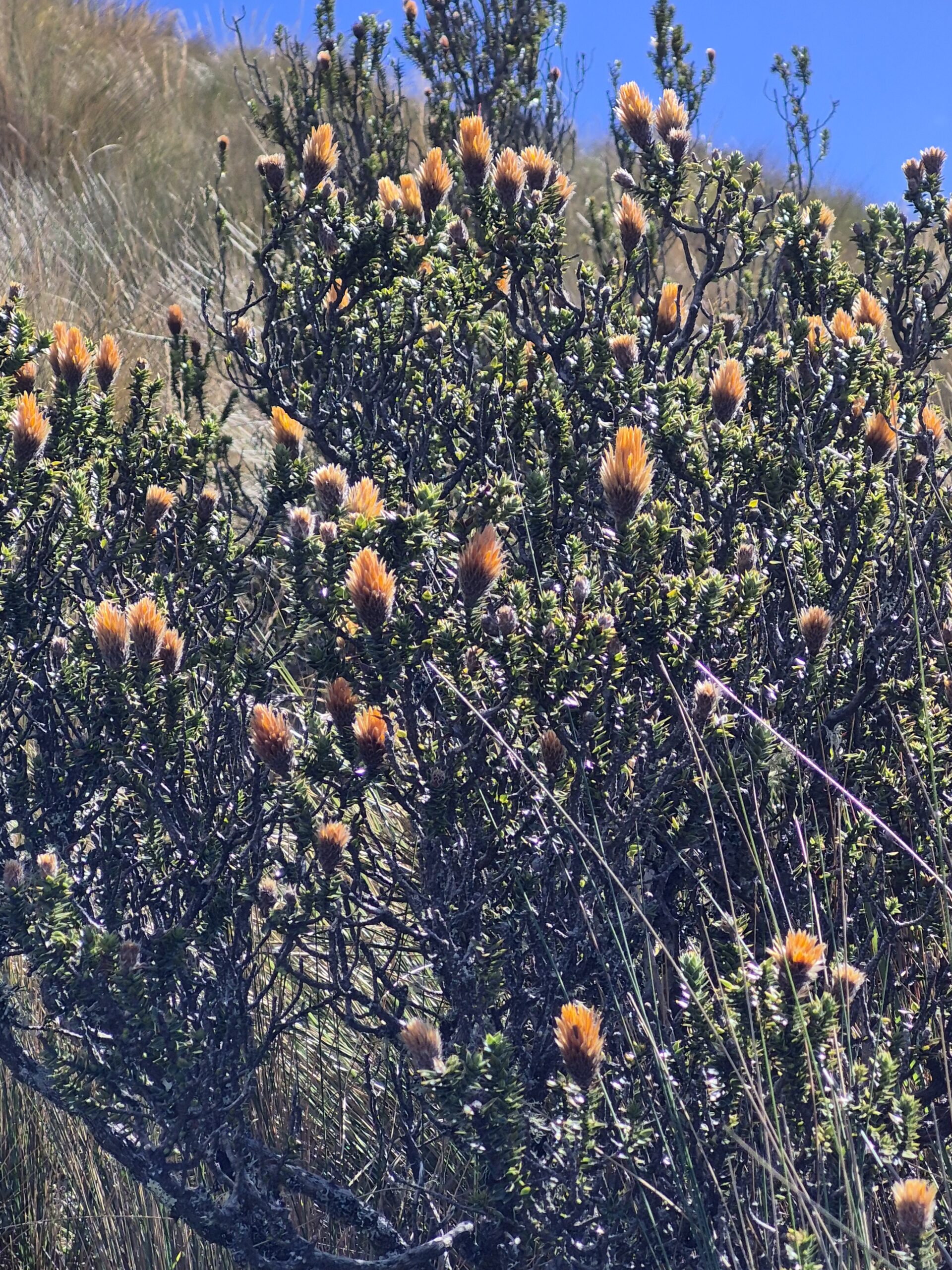
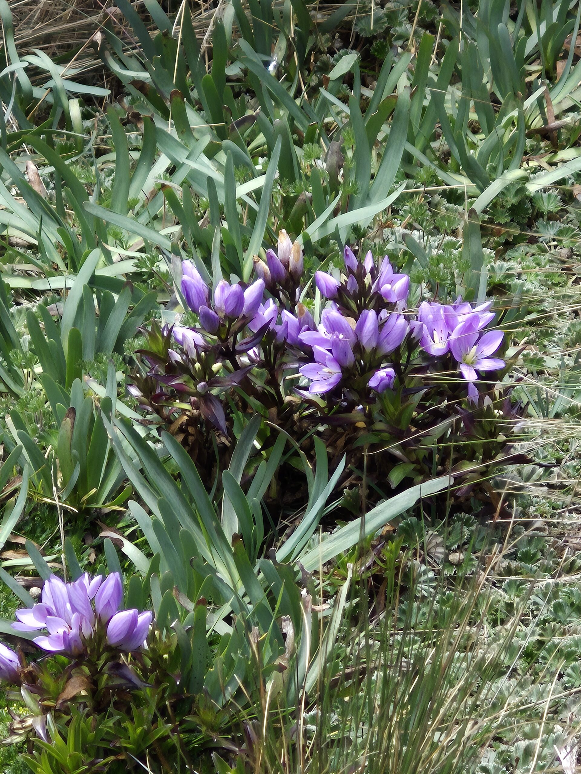
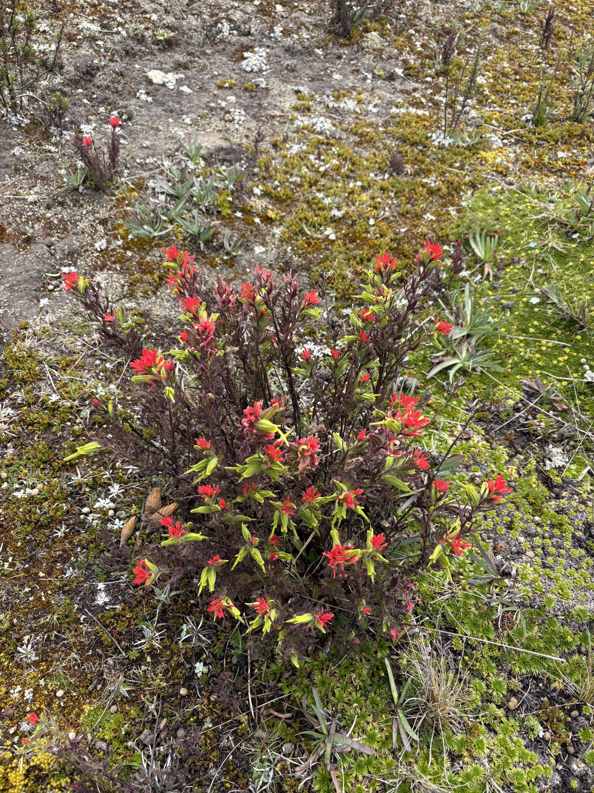
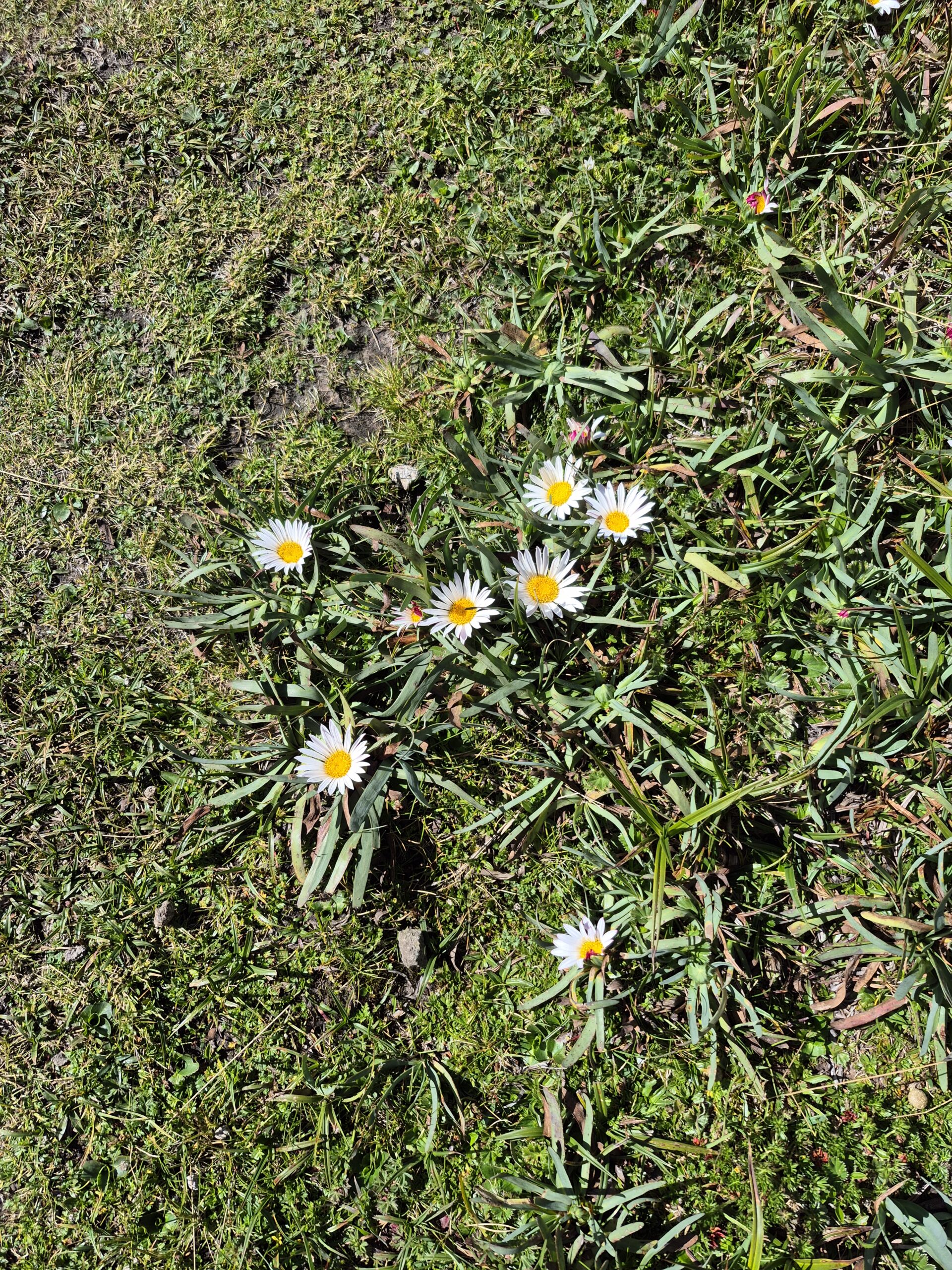
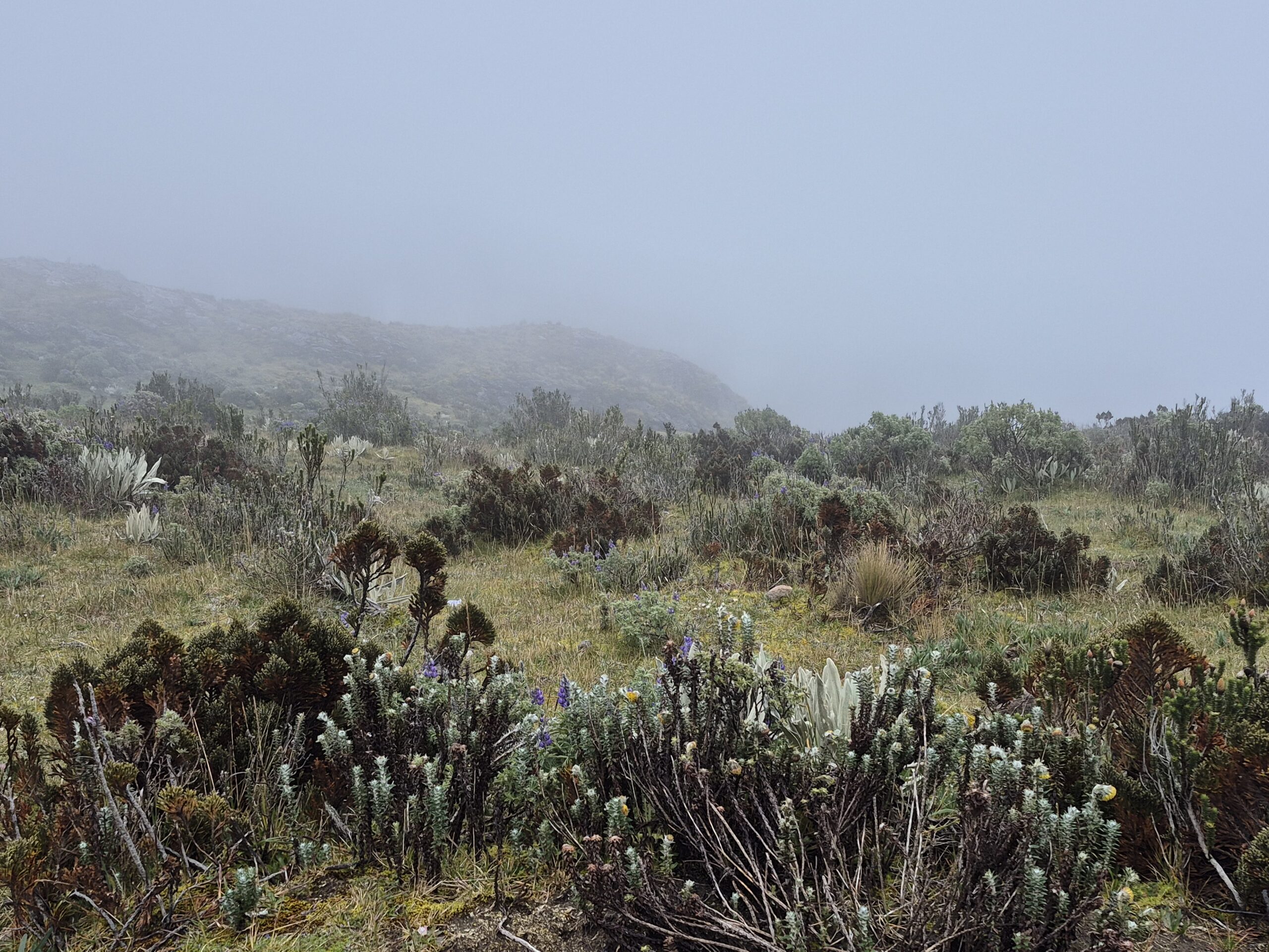
Flower Fotos
Most of the trails we did (except Cotopaxi of course), were full of wildflowers. Here are some photos we captured of the flora. I am absolutely terrible at recognizing plants and flowers and have no idea of the names of these flowers. I don’t have the time or motivation to Google it either. If you know the names, please message me and I will amend the post and credit you 🙂
Hope you enjoyed reading the blog. Would love to read your comments.


")
 – Summary : Aug 11-30, 2021")
